
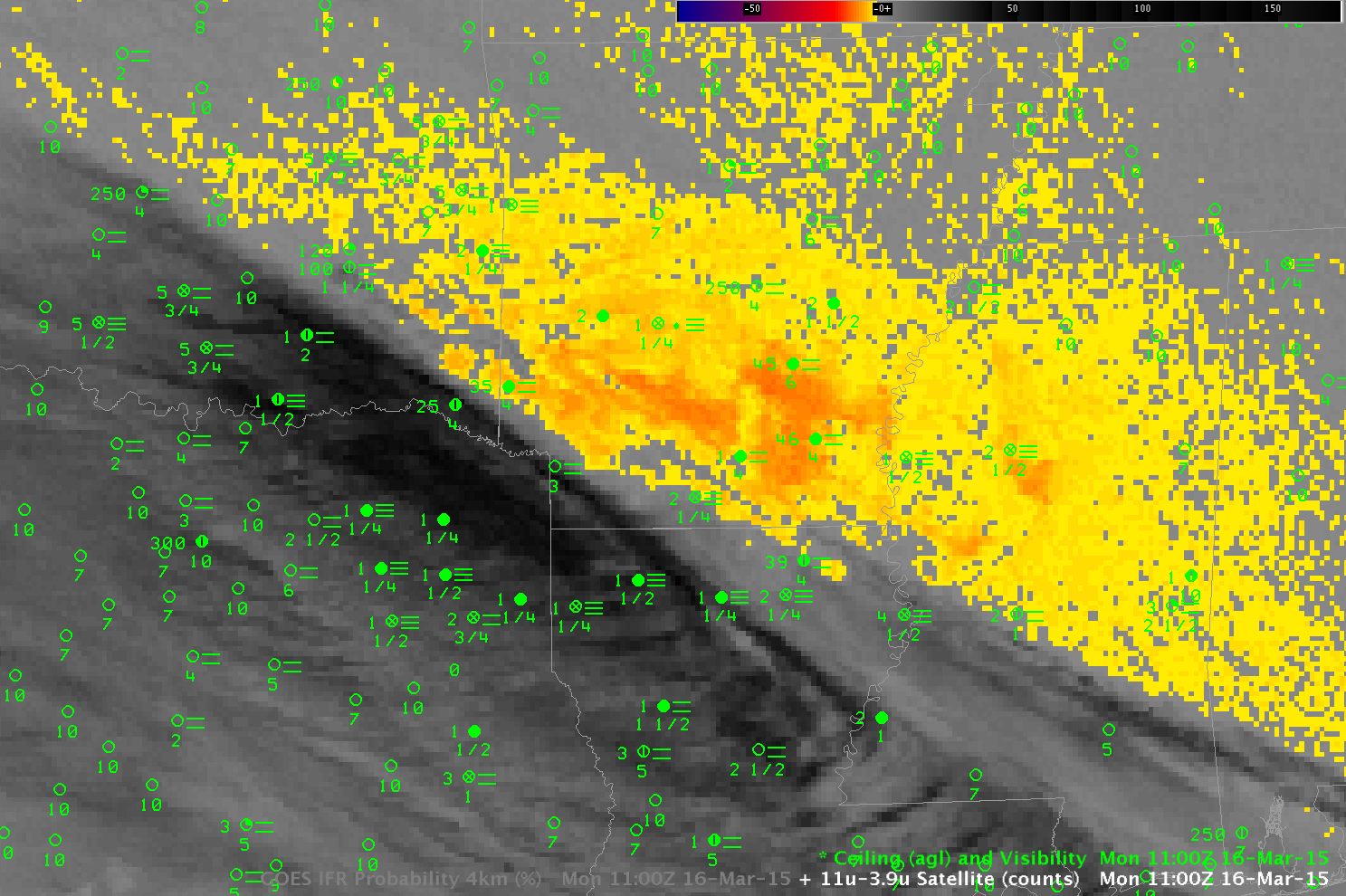
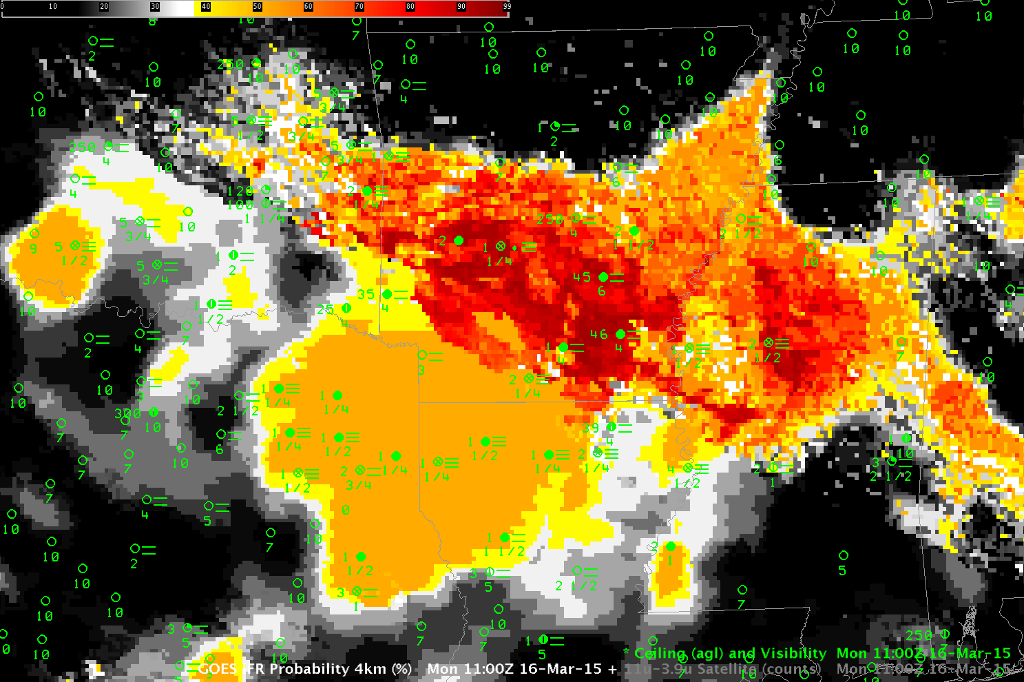
Early morning March 16 2016 had another fine example of the importance of using fused information to detect regions of low clouds and fog. The animation above shows the Brightness Temperature Difference (10.7µm – 3.9µm) and IFR Probability fields from 1100 UTC 16 March 2016. A cirrus canopy over Texas and Louisiana prevents the satellite from detecting radiation emitted from lower clouds. In this region, the IFR Probability field can suggest the presence of fog/low stratus and IFR Conditions because of low-level saturation that is present in the Rapid Refresh Model. Fusing this information together allows for a better depiction of where IFR Conditions are present. Cirrus clouds are not present over Arkansas; there, both satellite and model can be used to compute IFR Probabilities. When both satellite and model suggest fog is present, IFR Probabilities are higher (over Arkansas) than when only model (over Louisiana), or only satellite, suggest fog is present.