
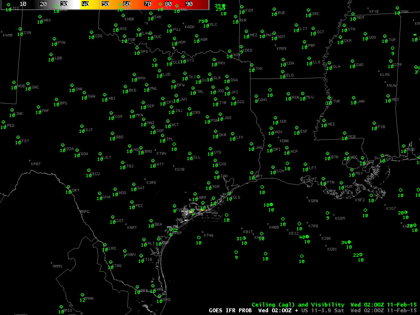
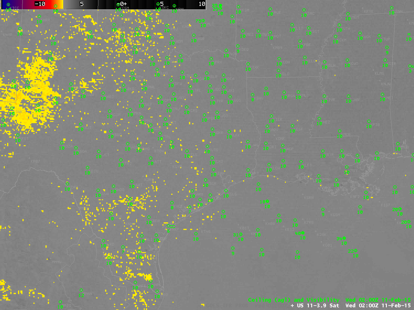
GOES-R IFR Probabilities and GOES-East Brightness Temperature Difference fields (10.7µm – 3.9µm) at 0200 UTC on 11 February 2015 (Click to enlarge)
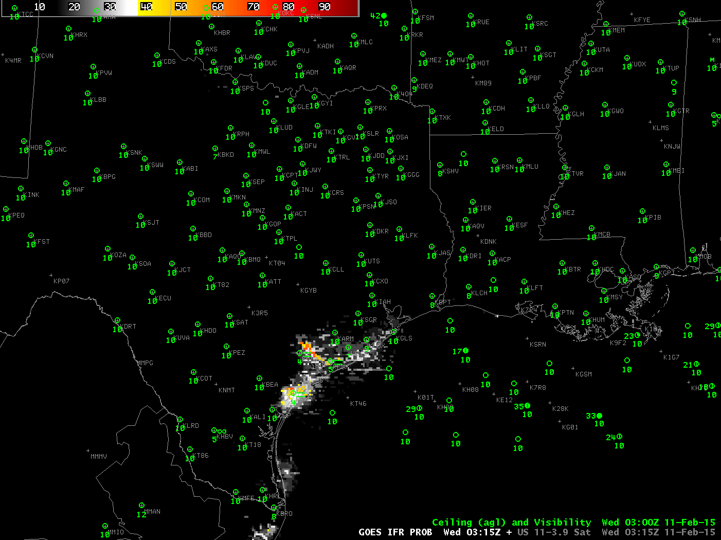
GOES-R IFR Probabilities and GOES-East Brightness Temperature Difference fields (10.7µm – 3.9µm) at 0315 UTC on 11 February 2015 (Click to enlarge)
Dense fog developed along the Texas Gulf Coast late on 10 February and early on 11 February. GOES-R IFR Probabilities gave an advance warning of the fog development, as shown above. Toggles between the GOES-R IFR Probability and the Brightness Temperature Difference Product (a heritage method of fog detection) show a IFR Probability signal at 0200 UTC; that signal steadily increased until 0315 UTC when a signal started to become apparent in the Brightness Temperature Difference Field. In this case, IFR Probabilities gave extra lead time to alert the forecaster to the development of fog. (This has happened before) Note also how the IFR Probability fields screen out false positive signals of fog over West Texas.
Hourly animations for GOES-R IFR Probability and GOES-13 Brightness Temperature Difference fields are below. The IFR Probability fields neatly overlap regions with IFR or near-IFR conditions. Note the impact of the high clouds that move over coastal south Texas after 1200 UTC; the brightness temperature difference field and the GOES-R IFR Probability fields both are affected.
GOES-R IFR Probability hourly from 0200 through 1300 UTC 11 February 2015 (Click to enlarge)
GOES-13 Brightness Temperature Difference (10.7µm – 3.9µm) hourly from 0200 through 1300 UTC 11 February 2015 (Click to enlarge)