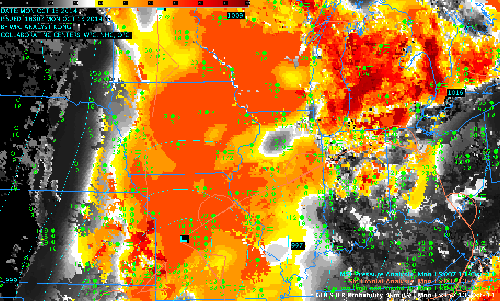
GOES-R IFR Probabilities over the upper Midwest, 1515 UTC on 13 October 2014, along with surface reports of Ceilings and Visibilities, and HPC Frontal / Pressure analyses (Click to enlarge)
Strong low pressure systems can cause IFR conditions over large areas, but the multiple cloud layers that accompany extratropical cyclogenesis make difficult the observation of low stratus, because higher cloud decks are invariably in the way of the satellite’s view. For such systems, inclusion of Rapid Refresh Data as a way of detecting low-level saturation is a must. In the imagery above, note that the highest IFR Probabilities are between the warm front (that emerges from the low in Missouri and stretches into Illinois and Indiana) and the trough that extends north of the low in Missouri.
A zoomed-in view of the above image, below, centered over Iowa, does show good spatial correlation between observed IFR conditions and high IFR Probabilities. This suggests that the Rapid Refresh Model is accurately simulating the evolution of the strong storm in Missouri.
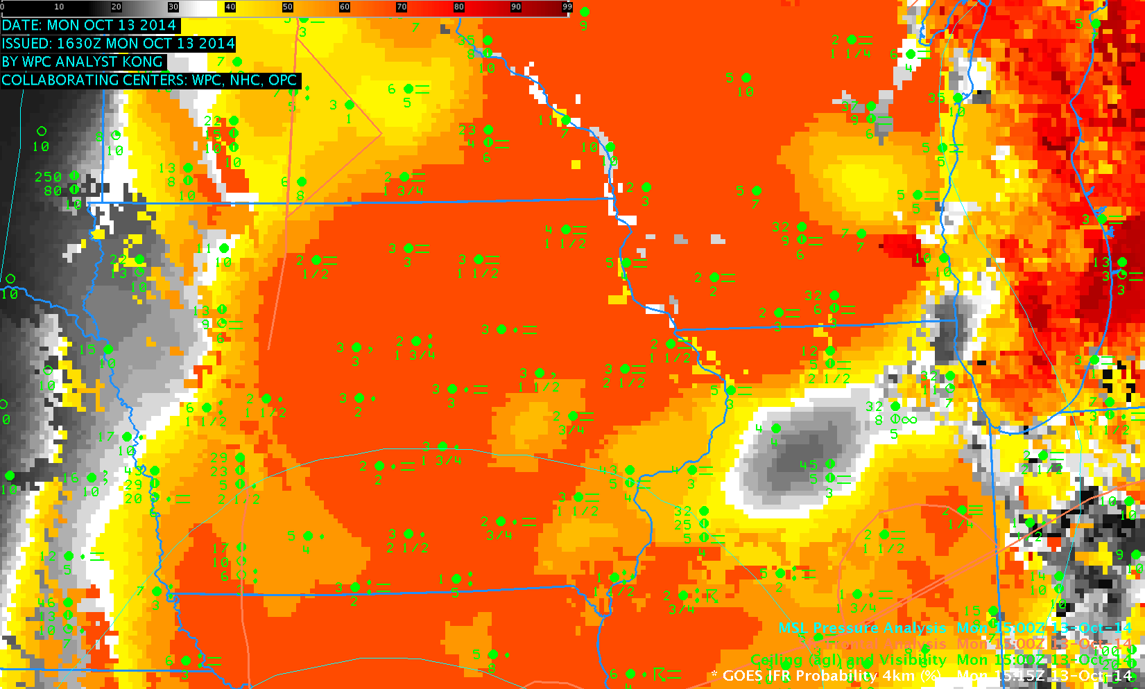
As above, but zoomed in over Iowa (Click to enlarge)