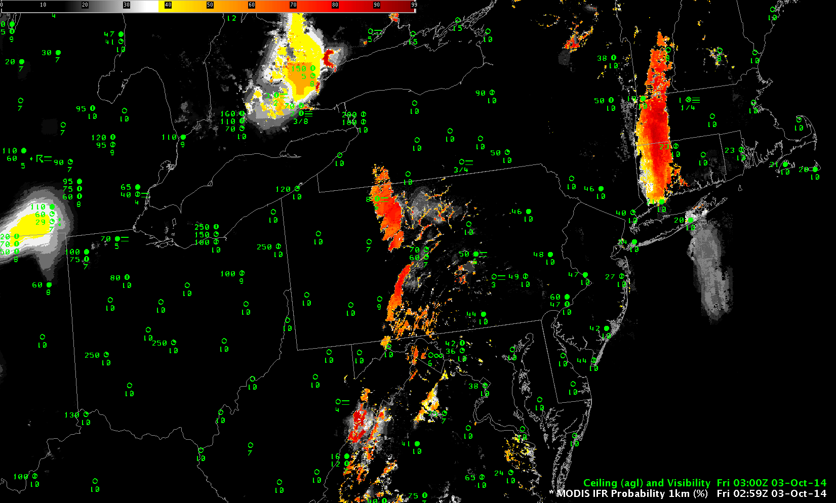
MODIS-based and GOES-based IFR Probability fields at ~0300 UTC on 03 October 2014 (click to enlarge)
A great benefit of a polar-orbiting satellite, such as Terra, or Aqua, or Suomi NPP, is that they provide very high-resolution imagery. The toggle above shows the early development of overnight fog over the mountainous terrain of Pennsylvania. The MODIS IFR Probability resolves with clarity the small river valleys of north-central Pennsylvania. Both MODIS and GOES suggest higher probabilities over the elevated terrain (the Laurel Highlands near Johnstown and regions around Bradford). A later overpass, below, just after 0700 UTC, shows the expansion of the regions of high probability has occurred in both MODIS and GOES-based products, but the MODIS-based product continues better to resolve the river valleys, such that Probabilities are higher over River Valleys (over the Pine Creek basin of north-central Pennsylvania, for example).
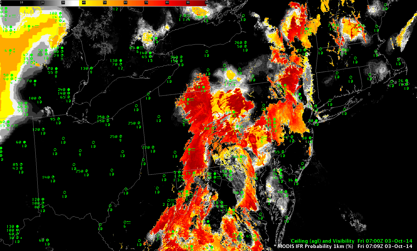
MODIS-based and GOES-based IFR Probability fields at ~0700 UTC on 03 October 2014 (click to enlarge)
Suomi NPP also provides high-resolution imagery, and sometimes orbital geometry allows two consecutive orbits – about 90 minutes apart — to view the same region, as below over Pennsylvania. This also shows the general increase in fog/low stratus over the eastern two-thirds of the state. (IFR Probability algorithms do not yet include Suomi NPP data).
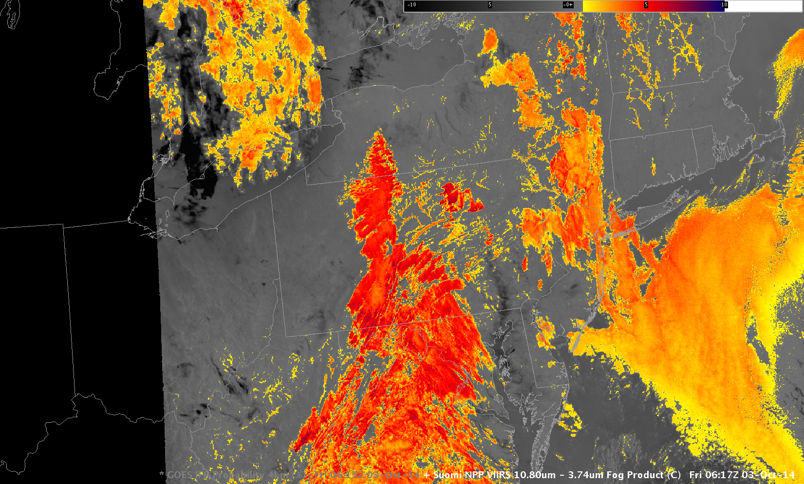
Suomi NPP Brightness Temperature Difference (11.35µm – 3.74µm) Fields at 0617 and 0756 UTC 03 October 2014 (click to enlarge)
Polar orbiters lack good routine temporal resolution, a shortcoming that can be a significant drawback. For example, none of the satellites are overhead just before sunrise, a time when the start of the morning commute might demand information. For that, GOES data (with its 15-minute temporal resolution) is essential. The 1145 UTC image, below, shows IFR Probabilities over the region at that time, and GOES data are routinely used to monitor the evolution of IFR Probability fields over the course of the night.

GOES-based IFR Probability fields at 1145 UTC on 03 October 2014 (click to enlarge)