Brightness temperature difference fields over the Pacific Ocean offshore of southern California showed a solid field of clouds overnight. How can this information about the top of the cloud be used to predict where low clouds and fog (IFR conditions) might exist? If you blend the satellite predictors with predictors from the Rapid Refresh model, you have information about the presence of clouds (the satellite predictors) and about the likelihood of saturation in the lowest kilometer of the model atmosphere. Consider the example below from 0400 UTC on 25 March 2014.
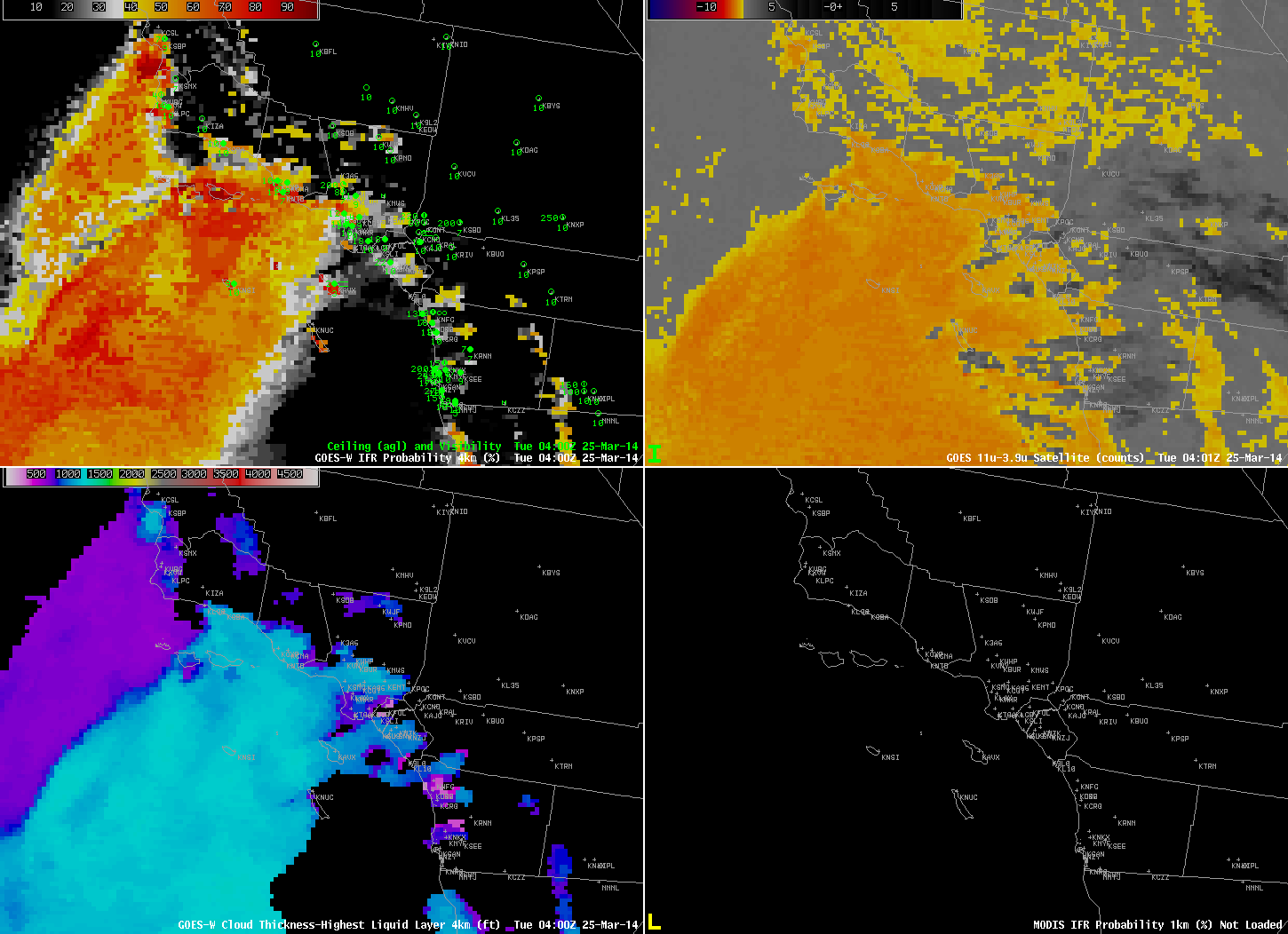
GOES-R IFR Probabilities computed from GOES-15 (Upper Left), GOES-West Brightness Temperature Differences (10.7 µm – 3.9 µm) (Upper Right), GOES-R Cloud Thickness (Lower Left), GOES-R IFR Probabilities computed from MODIS (Lower Right), all near 0400 UTC on 25 March 2014 (click to enlarge)
Brightness temperature differences suggest a deck of stratus over most of the Gulf of Santa Catalina (and over the Channel Islands as well). The IFR Probability field, however, suggests that the stratus just offshore of southern California, between the mainland and the Islands, is not reducing surface visibilities, and IFR conditions do not exist right along the coast of the mainland. The station reporting IFR conditions, KAVX, Catalina Airport on Catalina Island, is 1600′ above sea level.
By 1000 UTC, below, visibilities have lowered (and IFR Probabilities have increased) near Vandenberg AFB north of Point Conception. IFR conditions persist over Catalina Island (demonstrating the importance of knowing the elevation of the stations!).
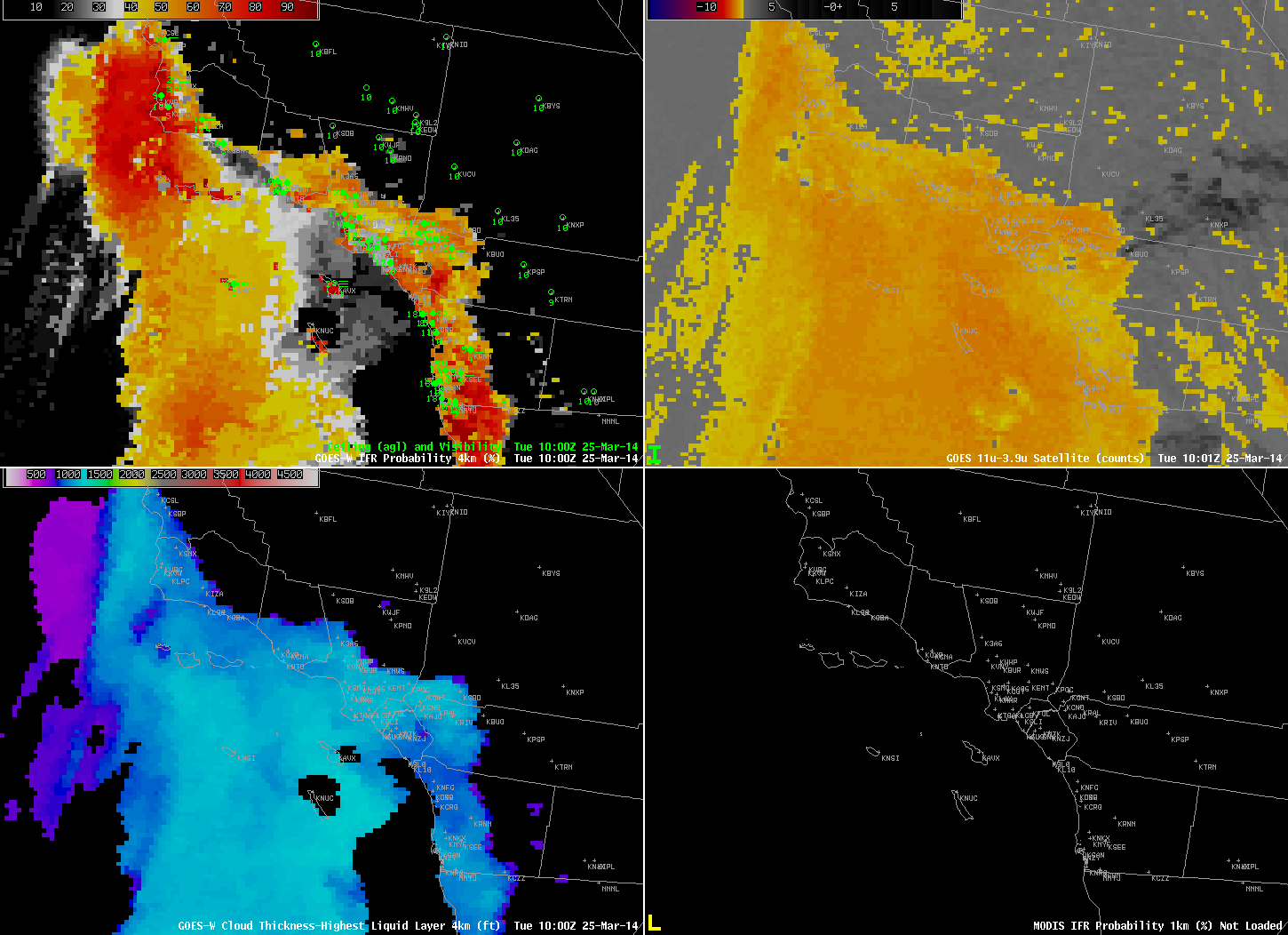
As above, but at 1000 UTC on 25 March 2014 (click to enlarge)