 |
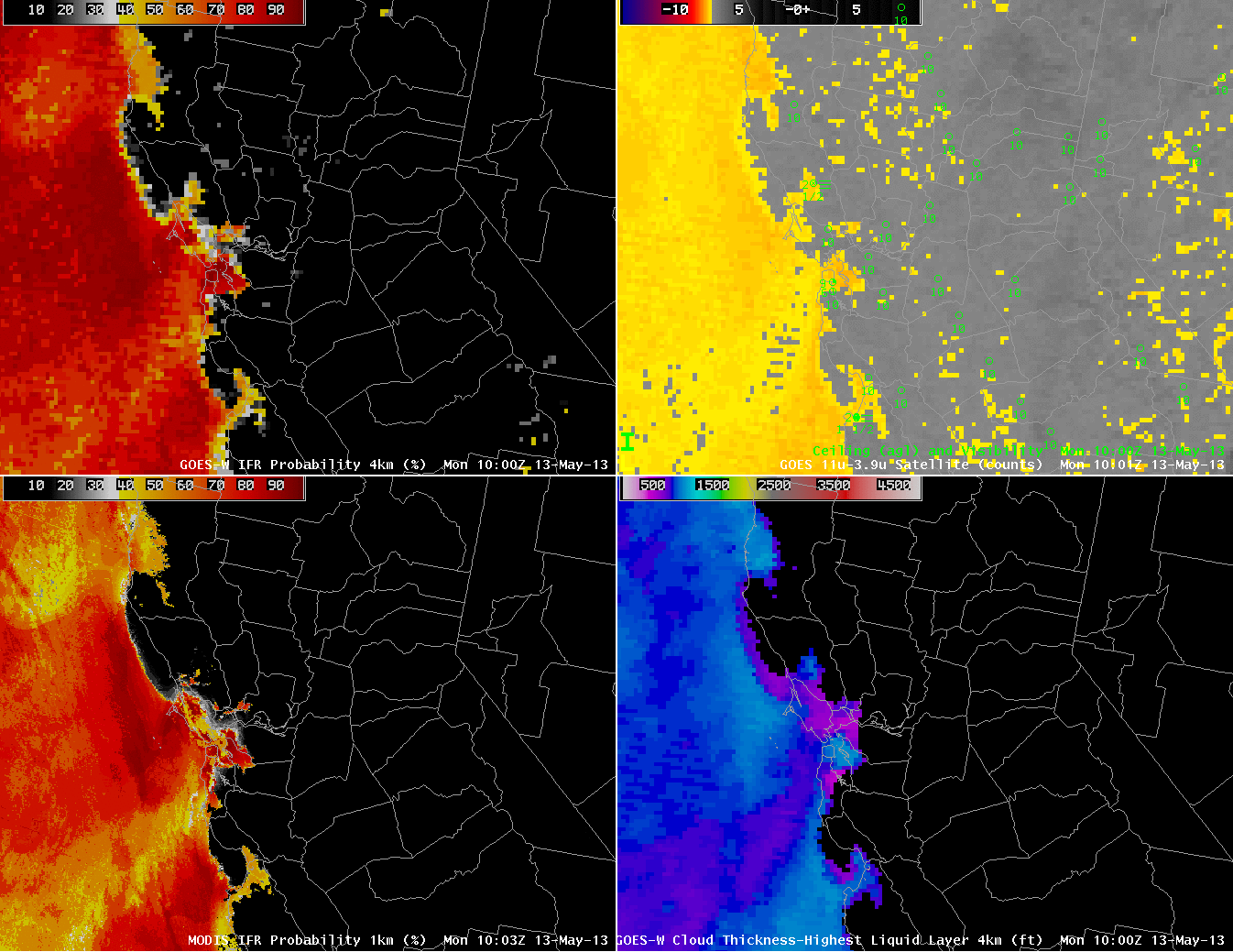
| GOES-R IFR Probabilities computed from GOES-West data (Upper Left), GOES-West Brightness Temperature Difference (10.7 – 3.9 ) (Upper Right), GOES-R IFR Probabilities computed from MODIS data (Lower Left), Toggle between GOES-R Cloud Thickness computed with GOES-West data and with MODIS data, all imagery around 1000 UTC on 13 May 2013 |
The high spatial resolution on MODIS allows a much more detailed description of IFR probability fields, and cloud thickness fields, than from the GOES-West Imager instrument. Note in the IFR probability fields on the left, and in the toggle of the Cloud Thickness fields, how the MODIS fields show crisper edges to the fog. The IFR probability is also — correctly — screening out brightness temperature difference signal in regions where fog and low stratus are not present (in central California and over Nevada). Note how the three stations reporting IFR conditions all sit within the region where the brightness temperature difference field has a strong signal, and where the IFR Probability is high.
GOES-R Resolution will be between MODIS and present GOES; that is, nominal pixel size in the GOES-R era will be 2 km.