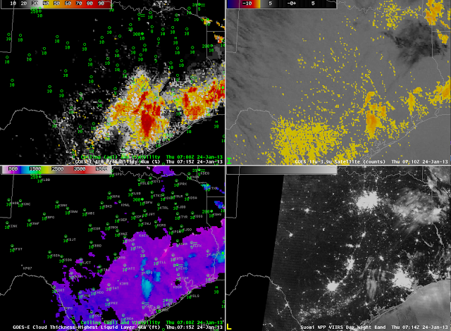
Clear skies and light winds again allowed for the development of radiation fog over southeast Texas. How did the development, and the detection of fog, differ for this event from the event 1 night previous (as discussed here). The 0615 UTC imagery, above, shows a separation between where the Brightness Temperature Difference (the heritage fog detection product) and where the GOES-R IFR probabilities are suggesting fog is present. The Heritage Fog Product is focused on the Rio Grande Valley whereas the GOES-R IFR Probability is focused (correctly, as it turns out) on southeast Texas. Note also that the Brightness Temperature Difference product has a signal representative of higher clouds (the dark region) over northeast Texas.
 |
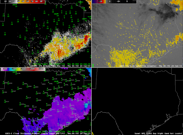
| As above, but at ~0715 UTC |
At 0715 UTC, IFR probabilities are increasing over southeast Texas between Houston and San Antonio. Suomi/NPP Day/Night band imagery at that time shows evidence of clouds in the region of highest IFR probabilities. The traditional brightness temperature difference product continues to highlight a region near the Rio Grande Valley.
 |
| As above, but at ~0845 UTC |
At 0845 UTC, IFR probabilities continue to increase over southeast Texas in the region surrounding Houston and a region near San Antonio. The Day/Night band detects the cloudiness present in those regions. High clouds persist over northeast Texas.
 |
| As above, but at 1315 UTC |
Shortly before sunrise, fog is widespread over southeast Texas. IFR probabilities are highest where both model and satellite predictors can be used. Over northeast Texas, where cirrus clouds are present and where the brightness temperature difference product can therefore not provide guidance, the Rapid Refresh data are suggesting that fog is present (as observed), but IFR probabilities are lower because the satellite predictor is not used.

