 |
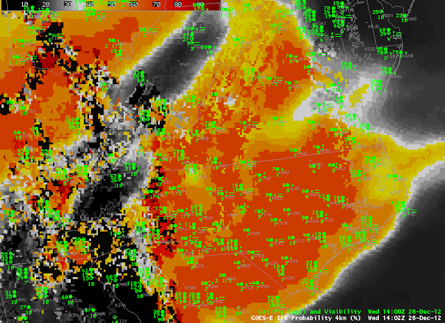
| GOES-R IFR Probabilities computed from GOES-East and the Rapid Refresh, 1400 UTC 26 December 2012, and surface observations of ceilings and visibilities. |
Large winter-time extratropical storms generate multiple cloud layers, and those many layers make difficult the detection of IFR conditions at the surface, caused by fog and low stratus. The winter storm moving up the East Coast on December 26th, 2012, is typical of the type of storm that causes these conditions (although its abnormal production of tornadoes is very atypical). In the figure above, IFR probabilities are high over eastern North Carolina, and those high probabilities are generated solely from Model Data. Satellite information from GOES-East there is not useful because of multiple cloud layers. There are regions over western North Carolina — where the GOES-R IFR probability field is less smooth and more pixelated — where GOES data indicate low-level clouds only and both satellite data and model data contribute to the IFR Probability fields.
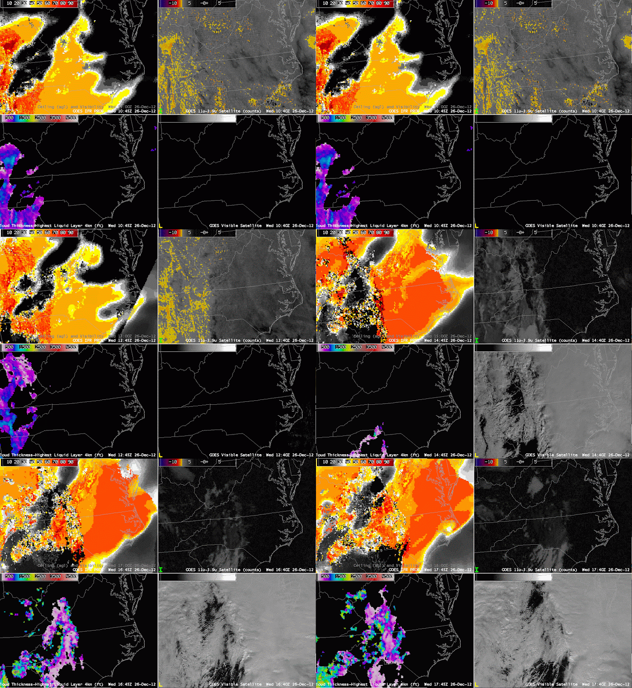
The hourly animation of GOES-R IFR probabilities, Traditional Brightness Temperature Difference, GOES-R Cloud Thickness and Visible Imagery, above, is instructive on several points. The Traditional Brightness Temperature Difference, because of the abundant high clouds (likely associated with the warm conveyor belt of the extratropical storm), yields little information about low-level conditions. Note also how Cloud Thickness field is computed in one region: the region where multiple cloud layers do not exist, and where twilight conditions are not present. There are also differences in the GOES-R IFR Probability field between day and night that reflect the different predictors (and different predictor weights) that are used during those two times.

