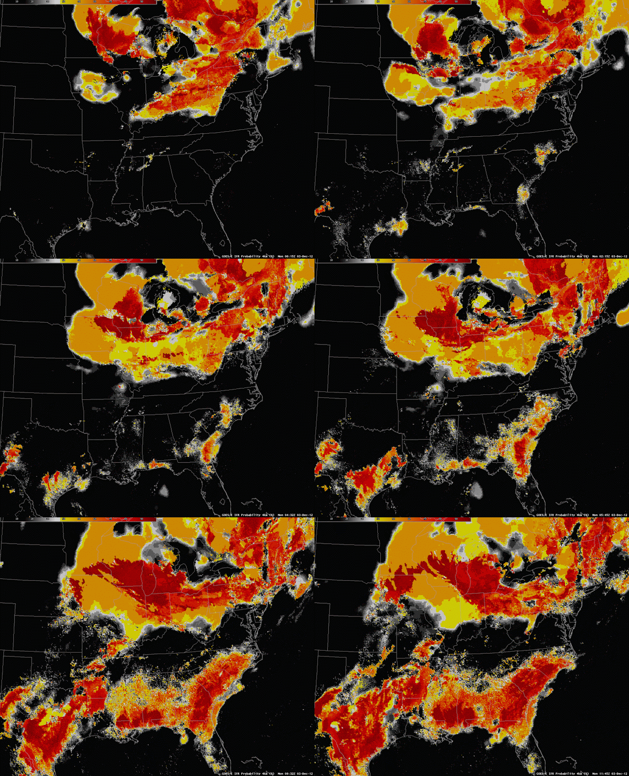
It is always possible to reconstruct the GOES-R IFR Products and to re-inject them into AWIPS for case studies. For example, Columbia, SC, notified us of a fog event there on the morning of December 3rd, 2012 (See here). The imagery below was created on 19 December and shows the development of the GOES-R IFR probabilities over the entire southeast during this event.
 |
| GOES-R IFR Probabilities from 3 December 2012 |
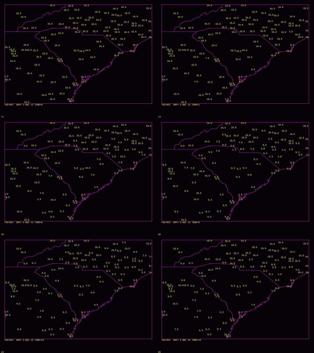
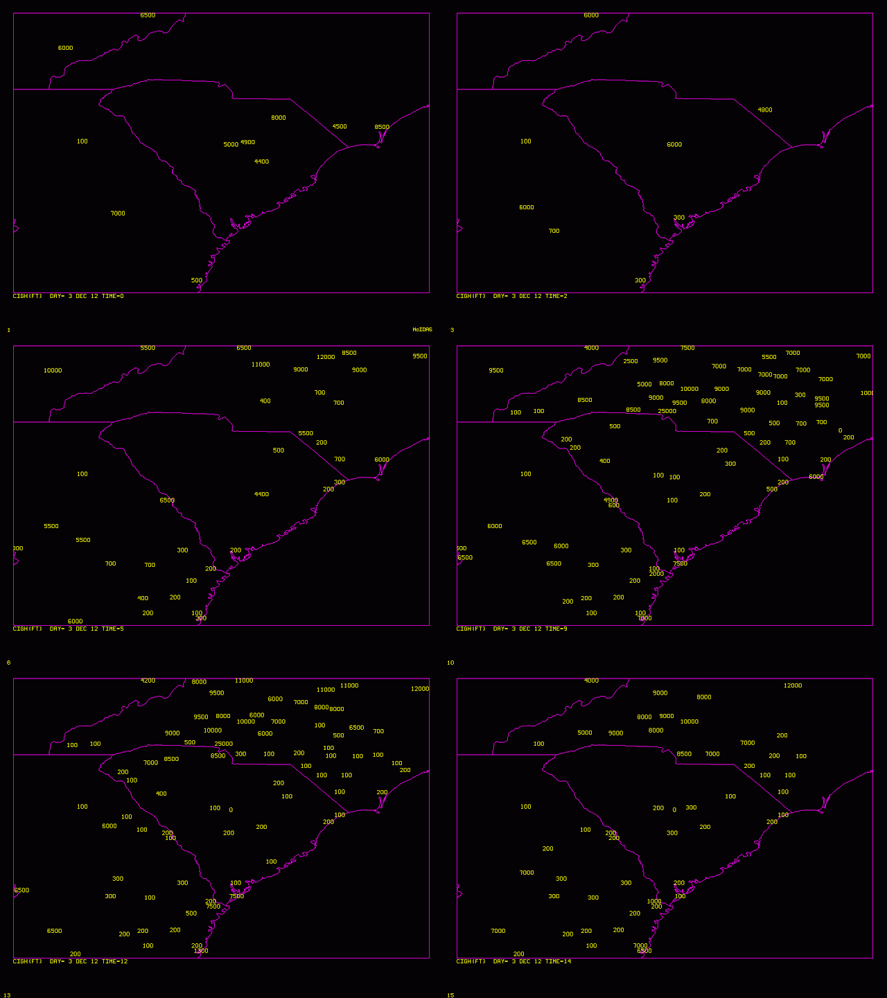
IFR probabilities increase first along coastal South Carolina and Georgia and then increase inland. The animations below show the hourly changes in visibility (top) and ceiling (bottom) from 0000 UTC to 1400 UTC on 3 December.
 |
| Visibility (Statute Miles) from 0000 UTC to 1400 UTC on 3 December |
 |
| Ceiling Height (feet) from 0000 UTC to 1400 UTC on 3 December 2012 |
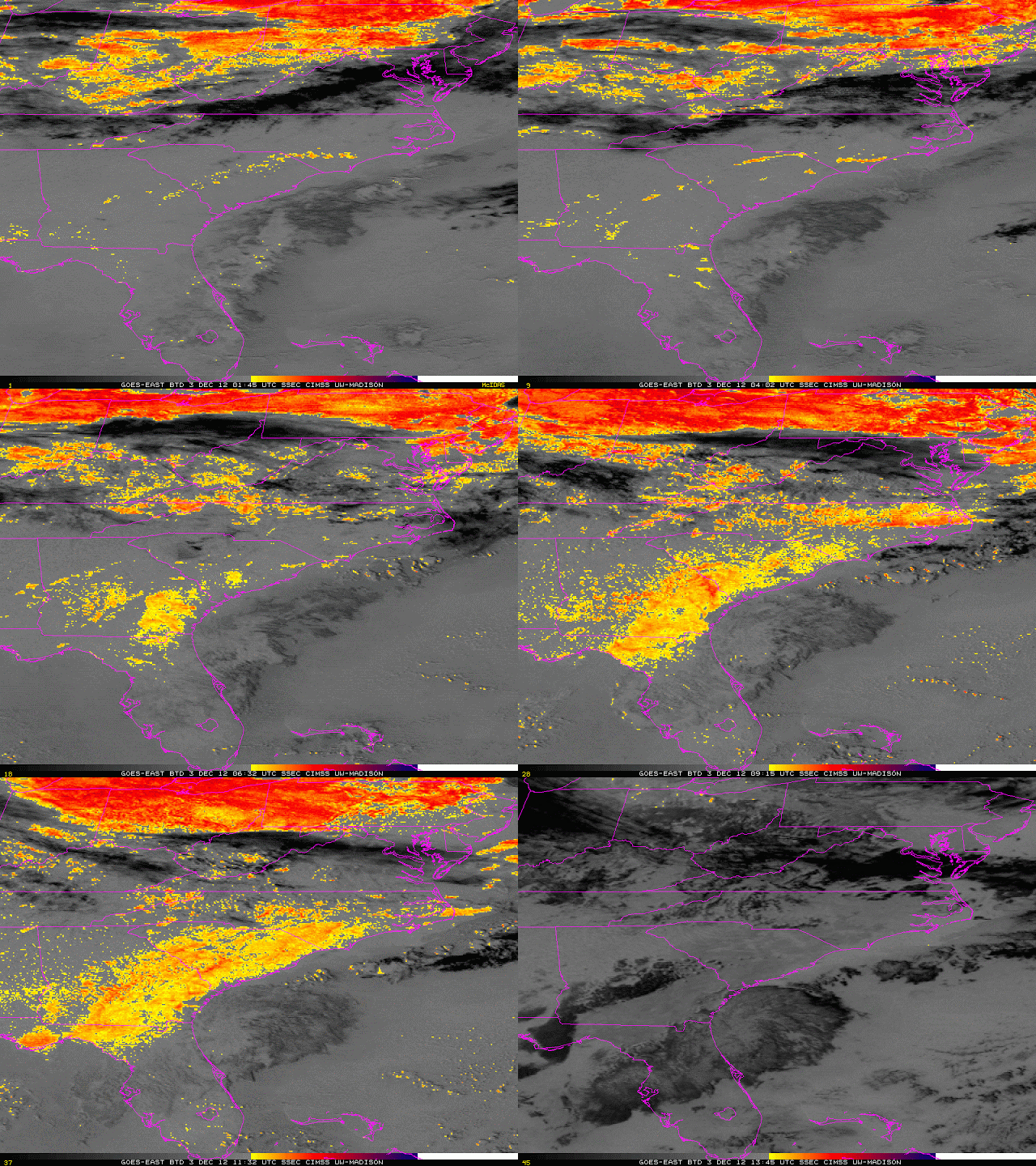
The brightness temperature difference animation, below, from 0145 UTC through 1345 UTC, shows the development of the low stratus over coastal South Carolina and Georgia. The Brightness temperature difference field loses its signal at sunrise, however, even though observations show fog and low stratus persisting.
 |
| Brightness Temperature Difference (BTD) (10.7 µm – 3.9 µm) from 0145 UTC through 1345 UTC, from GOES-East |
