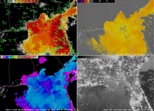
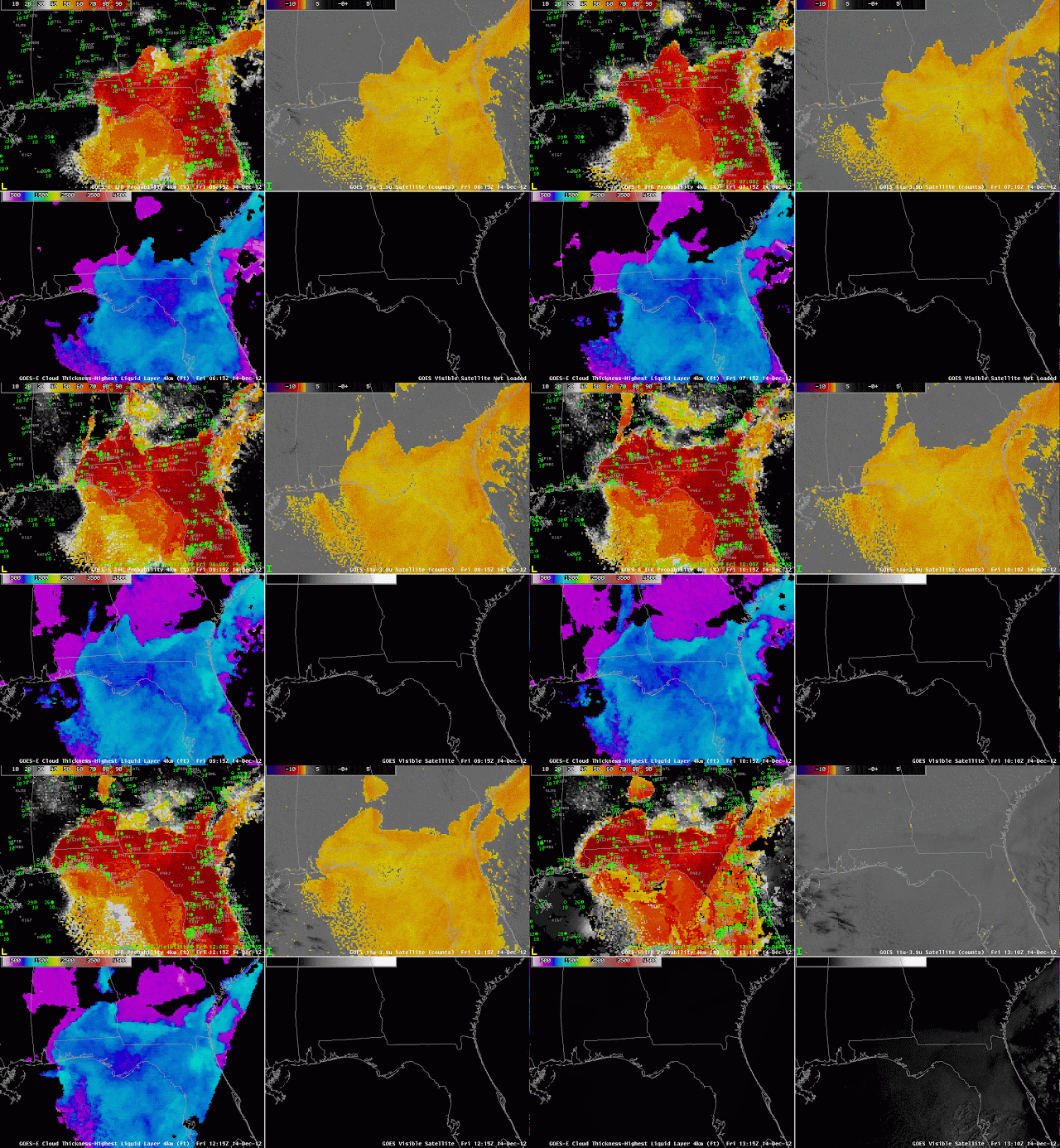
Light north winds over Florida over night were accompanied by the development of low stratus and fog that were captured well by the traditional fog detection product, the brightness temperature difference between 10.7 µm and 3.9 µm that occurs because of emissivity differences in water clouds at the two wavelengths. Because of the strong satellite signal (upper right), the GOES-R IFR Probabilities over Florida were quite high. When mid-level and high clouds are absent, IFR probabilities in regions of fog development can easily exceed 90%, as shown above.
Note, however, what happens at sunrise. The increase in reflected 3.9 µm solar radiation causes the brightness temperature signal to vanish. (At later times, the sign of the brightness temperature difference will flip). The GOES-R IFR probability product maintains a coherent signal through sunrise, although values shift somewhat, as can be seen by the southwest to northeast boundary in the final image of the loop over Florida and extreme southeast Georgia.
Cloud thickness, bottom left, can be used to estimate when radiation-induced stratus or fog will ‘burn off’ — thicker clouds will take longer to dissipate.
Note in this loop that the eastern coastline of Mobile Bay shows a signal in the Brightness Temperature Difference. This signal is likely an artifact of poor co-registration between Bands 2 and 4 (the 3.9 µm and 10.7 µm channels, respectively) on GOES-13. NESDIS scientists and engineers are working to mitigate this time-dependent error.
The Fog/Low Stratus products can be compared to data from Suomi/NPP. The VIIRS instrument includes a day/night band that uses reflected moonlight as a light source (below). Unfortunately, because the moon was new on December 13th, 2012, very little reflected light is available. Nevertheless, smearing of city lights over Florida does suggest the presence of fog.
 |
| As above, but with Day/Night band from VIIRS on Suomi/NPP instead of GOES-13 0.63 µm visible imagery. Images from ~0630 UTC on 14 December. |

