 |
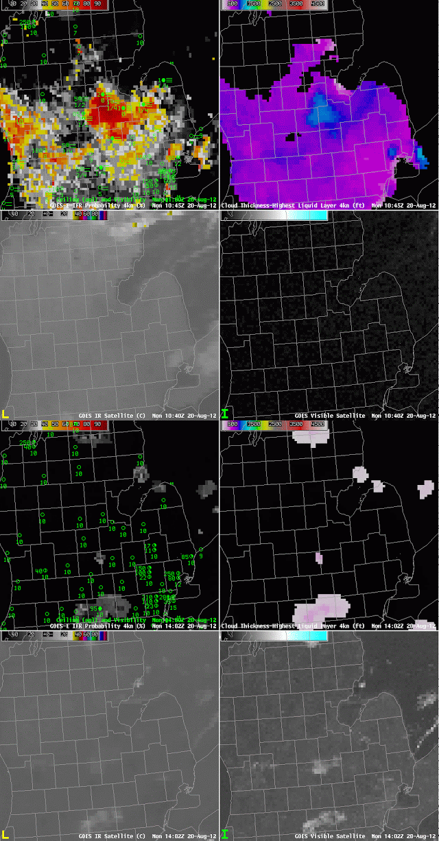
| GOES-R IFR Probabilities (Upper Left), GOES-R Cloud Thickness (Upper Right), GOES-East 10.7 µm imagery (Lower Left) and GOES-East 0.63 µm (Visible) imagery (Lower Right)m at 1045 and 1402 UTC |
Radiation fog occurred over central Lower Michigan near Saginaw overnight into the morning of the 20th of August, and the thickest fog is indicated at 1045 UTC — just before sunrise — to be just shy of 1000 feet thick. This fog bank slowly shifted southward, and dissipated shortly after 1400 UTC, one county south of its location at 1045 UTC. That dissipation time neatly fits in with the graph of fog thickness vs. dissipation time shown here.
