 |
|
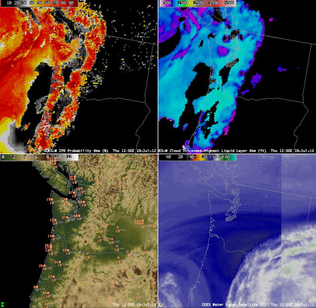
| GOES-R IFR Probabilities (Upper left), GOES-R Cloud Thickness (Upper right), Terrain with surface plots of Ceiling (above MSL) and visibility (lower left) and the GOES-15/GOES-13 Water vapor imagery |
When terrain rises up into the clouds, IFR conditions occur, and the GOES-R IFR product shows that effect. These images from ~1200 UTC on 19 July 2012 show two regions of IFR conditions over the Pacific Northwest — along the spine of the coastal range from the Olympic Mountains south to the Oregon Coast Range and along the Cascades from east of Seattle southward to Oregon. The observations shown in the lower left (with ceilings above mean sea level, plotted over topography) are consistent with the IFR probabilities: Low probability over the region between the coastal range and the Cascades, and high probability in regions over the Cascades where the height exceeds the observed ceilings over, say, Seattle and Portland, and high probabilities along the Coastal Range where heights exceed the observed ceilings along the coast.
