 |
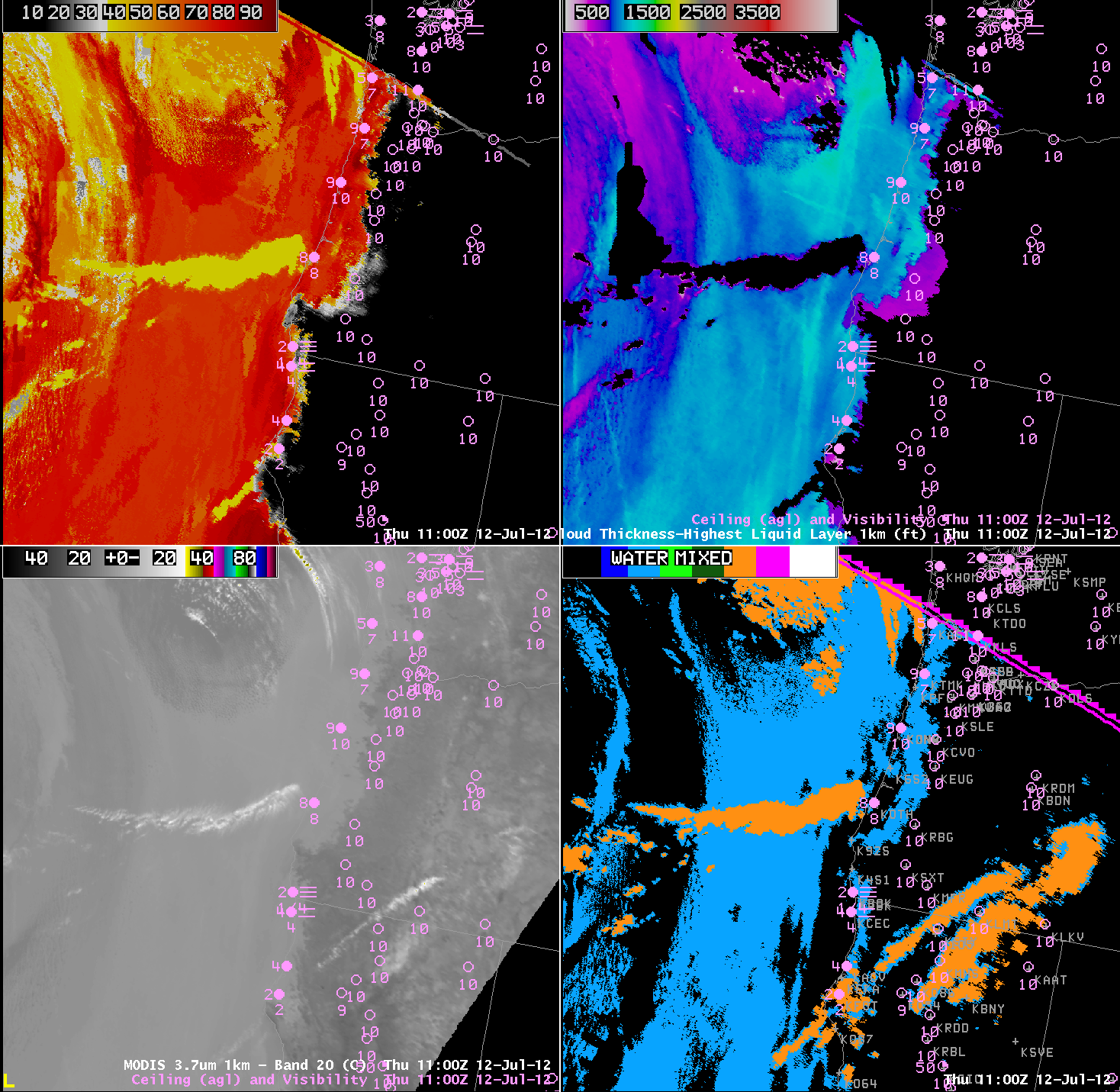
| MODIS-based IFR Probabilities (Upper Left), Cloud Thickness of the Highest Liquid Layer (Upper Right), 3.7 micron brightness temperatures (Lower Left) and MODIS Cloud Phase (Lower Right) from 1100 UTC on 12 July 2012. |
A benefit of the GOES-R Fog/Low Stratus product is that it provides a signal even in the presence of higher clouds that make fog detection via brightness temperature difference methods impossible. In this case from 1100 UTC on 12 July, a thin cirrus shield off the coast of Oregon (the bright white wisp in the 3.7 micron imagery in the bottom left) shows up (correctly) as an ice cloud in the cloud phase field (bottom right). Note that low cloud thickness is not computed when higher clouds overlay the low cloud field — so data are available underneath the cirrus deck, although you might infer the thickness from the surrounding fields. The GOES-R IFR probabilities show values exceeding 50% underneath the cirrus deck, in a region where the brightness temperature difference gives no information.
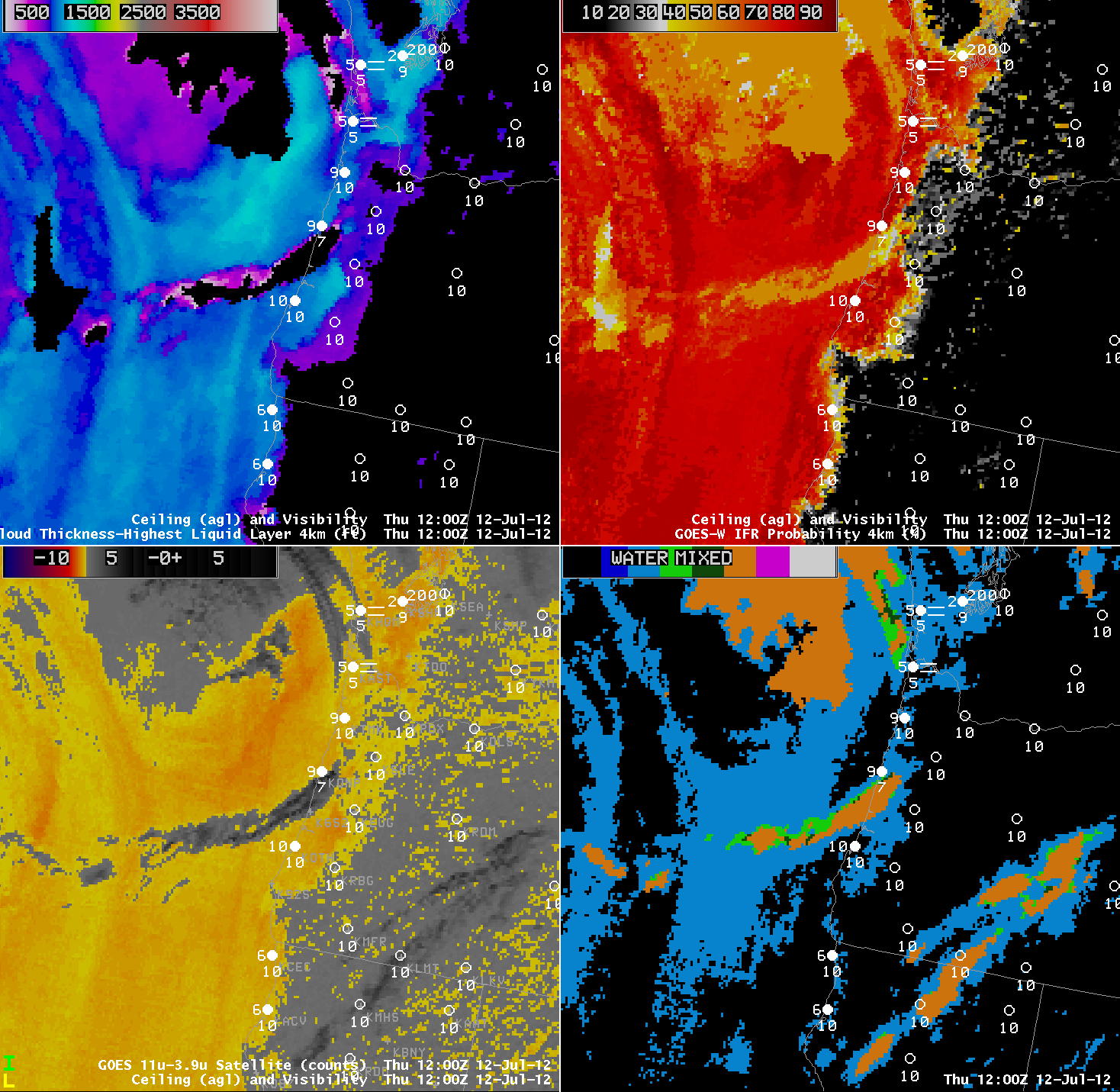
This effect is also seen in GOES-based imagery, below, from 1200 UTC. The Cirrus cloud has moved onshore just south of KONP (Newport, OR) where IFR conditions exist. The IFR probabilities suggest fog/low clouds are likely present in a region where the brightness temperature difference field gives no information because of cirrus clouds. Although this cirrus shield is small, it should be easy to envision a larger cirrus shield and what that impact might be.
Note also the number of false positives in the brightness temperature difference field that do not show up in the IFR Probabilities.
 |
|
| GOES-West-based Cloud Thickness of the Highest Liquid Layer (Upper Left), IFR Probabilities (Upper Right), 11 micrometer – 3.9 micrometer brightness temperature difference (Bottom Left) and Cloud Phase (Bottom right) |