 |
| GOES-R IFR Probabilities, and Surface Visibility/Ceilings, from 0432 UTC through 1432 UTC on 22 August 2012 |
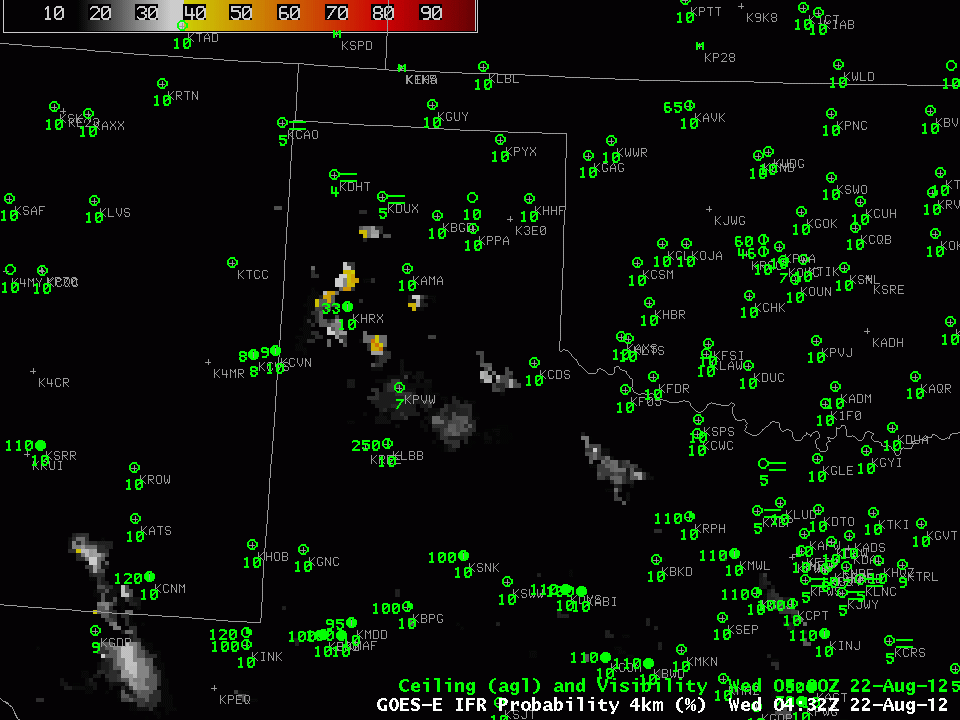
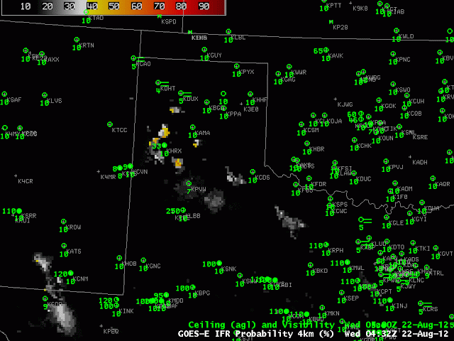
GOES-R IFR Probabilities showed good spatial correlation with observed IFR conditions early in the morning on 22 August 2012. The spatial characteristics of the field suggest that model-only predictions of the presence of fog/low stratus occurred in regions over west Texas that were overlain by higher clouds. The Traditional brightness temperature difference product at 1101 UTC, for example, below, shows the characteristic signal of high clouds over parts of west Texas. There is also a significant region of returns over north central OK/south central Kansas that is not associated with IFR conditions. The GOES-R IFR product in that region correctly shows low probabilities.
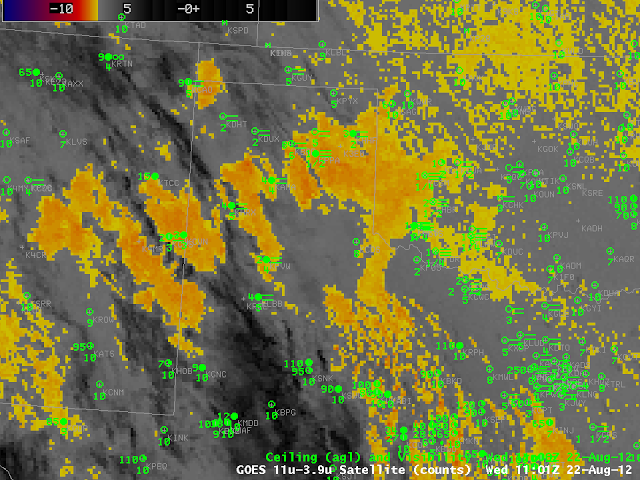 |
| Brightness Temperature Difference from GOES (10.7 – 3.9) at 1101 UTC 22 August. |
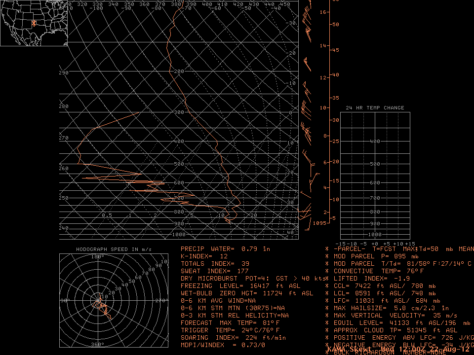
The upper-air sounding from Amarillo from 1200 UTC confirms the presence of saturated conditions only in the boundary layer.
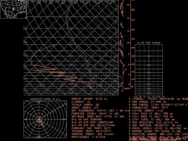 |
| Skew-T/Ln P Thermodynamic diagram frmo 1200 UTC 22 August 2012 at Amarillo TX |