 |
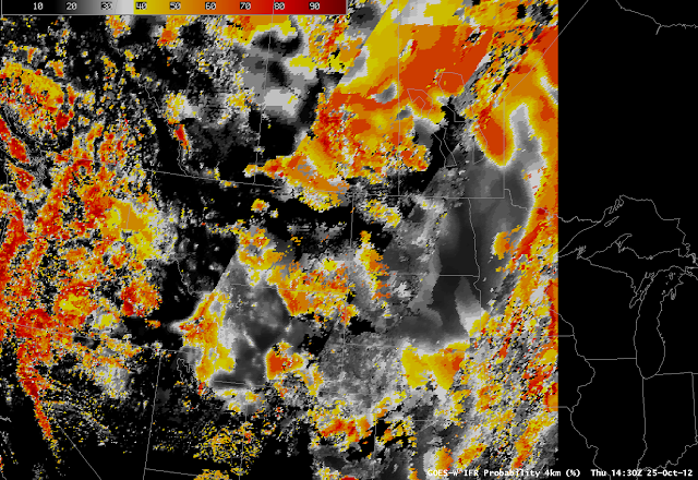
| GOES-R IFR Probability, 1430 UTC on 25 October 2012 |
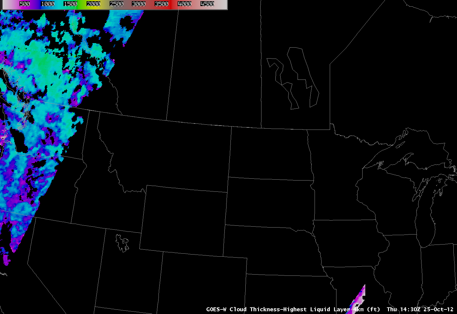
The predictors used by the GOES-R IFR Probability algorithms change as night turns to day and vice versa. For example, the daytime predictors include the visible satellite imagery. The change in predictors occurs when the solar zenith angle is less than 85 degrees (that is, when the sun is just rising). For solar angles between 85-90 degrees, temporal continuity has an increased importance and therefore the IFR probabilities look very similar to the previous temporal images. When the solar zenith angle is between 80-85 degrees temporal metrics are used combined with current visible channel data (only if certain tests are passed that prove the data is of good quality). The cloud mask sometimes has difficulty detecting low clouds in this region so it still is not fully utilized until the solar zenith angle drops to below 80 degrees, where the cloud mask and the full array of daytime predictors are used. This leads to discernible changes in the probability fields, as shown above. Two boundaries, extending southwest to northeast (roughly parallel to the terminator) are apparent, one from extreme northwest Utah through central Montana and into Canada (where the solar angle is around 85 degrees) and one from northwest Colorado through northwest South Dakota into Manitoba (where the solar angle increases above 80 degrees). This transition zone is less noticeable in the Summer because of the Earth-Sun geometry. It is very difficult to create the GOES-R Cloud Thickness product when the solar zenith angles are between 75-90 degrees so the product is currently not available in this region. This is why the Cloud Thicknesses cut off over eastern Oregon and show back up over central Missouri.
 |
| GOES-R Cloud Thickness for 1430 UTC, 25 October 2012 |