 |
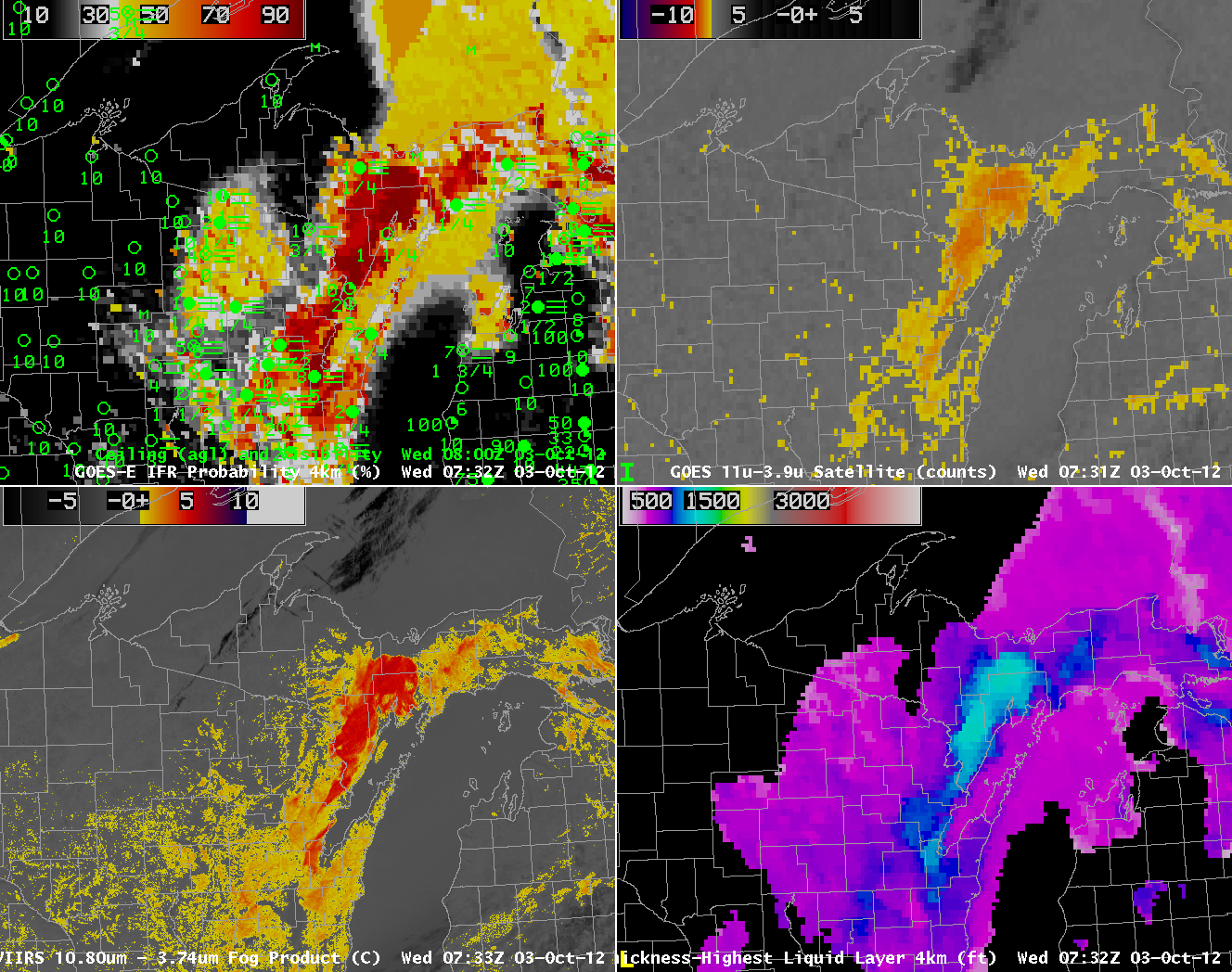
| 0730 UTC GOES-R IFR Probabilities computed from GOES-14 (Upper left), Traditional Brightness Temperature difference (10.7 µm – 3.9 µm) from GOES-14 (Upper Right), Brightness Temperature Difference (11.35 µm – 3.74 µm) from VIIRS on Suomi/NPP (Lower left), Thickness of highest Liquid Water Cloud Layer (Lower Right) |
Low cloud formation over northern and northeastern Wisconsin early in the morning of October 3rd 2012 demonstrated some strengths of the fused GOES-R Fog/Low Stratus product. Note that the 0732 UTC GOES-R IFR Probability has a pocket of higher probabilityes over north-central Wisconsin (near Vilas and Oneida Counties) in a region where the traditional brightness temperature difference has a weak signal, and in a region where surface observations indicate fog is present. This region is a good example of how the model RH data can amplify weak satellite signals where fog/low clouds are present but the satellite signal alone may not be strong enough to detect it.
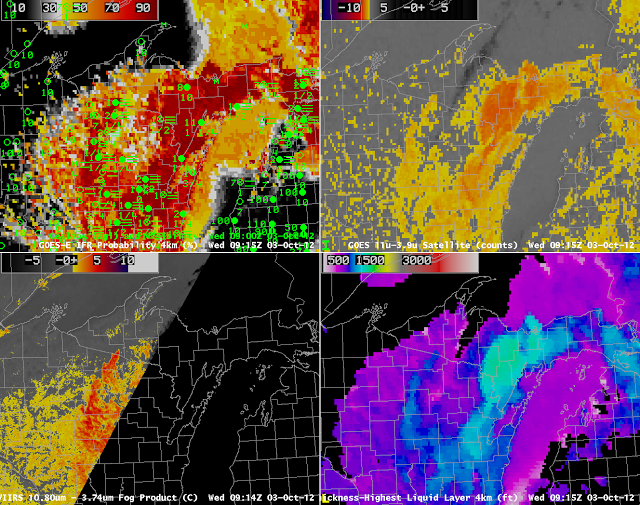 |
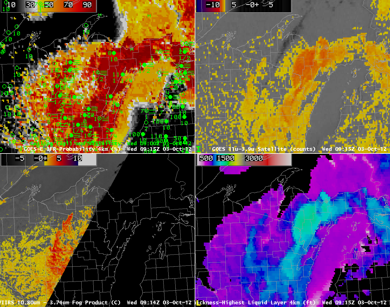
| 0915 UTC GOES-R IFR Probabilities computed from GOES-14 (Upper left), Traditional Brightness Temperature difference (10.7 µm – 3.9 µm) from GOES-14 (Upper Right), Brightness Temperature Difference (11.35 µm – 3.74 µm) from VIIRS on Suomi/NPP (Lower left), Thickness Of highest Liquid Water Cloud Layer (Lower Right) |
At 0915 UTC, the region of IFR conditions in north-central Wisconsin persists. At this time, however, the satellite signal also increases showing a signature consistent with low clouds/fog, and therefore GOES-R IFR probabilities significantly increase. Two things should be clear. First, the GOES-R IFR probability predicted the presence of Fog/Low Stratus before satellite signal was strong enough to detect it alone (a benefit of using a fused data product) and could be used better to nowcast the evolving boundary layer. Second, GOES-R IFR Probabilities when the model signal (in this case, the Rapid Refresh) is strong and the satellite signal is weak are lower than when both model and satellite signals are strong. This is always the case.
 |
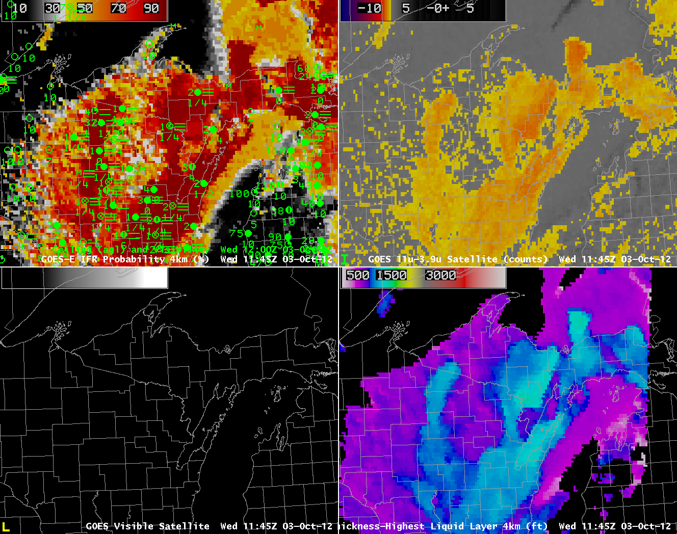
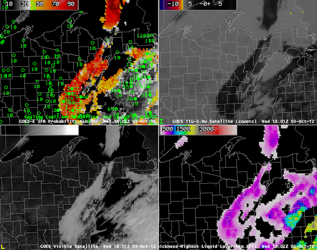
| 1145 UTC GOES-R IFR Probabilities computed from GOES-14 (Upper left), Traditional Brightness Temperature difference (10.7 µm – 3.9 µm) from GOES-14 (Upper Right), Visible Imagery (0.62 µm) from GOES-14 (Lower left), Thickness Of highest Liquid Water Cloud Layer (Lower Right) |
The 1145 UTC shows the last pre-dawn estimate of Cloud Thickness over north-central Wisconsin (the terminator is apparent, running north-south through the Straits of Mackinac). Estimated cloud thickesses over Vilas and Oneida counties are between 1000 and 1150 feet, vs. 1250 feet over Green Bay and more than 1300 feet over southern Upper Michigan. Predictably, then, the fog/low stratus over north-central Wisconsin dissipates before the fog/low stratus over northeast Wisconsin and eastern Upper Michigan (see below).
 |
| 1602 UTC GOES-R IFR Probabilities computed from GOES-14 (Upper left), Traditional Brightness Temperature difference (10.7 µm – 3.9 µm) from GOES-14 (Upper Right), Visible Imagery (0.62 µm) from GOES-14 (Lower left), Thickness Of highest Liquid Water Cloud Layer (Lower Right) |