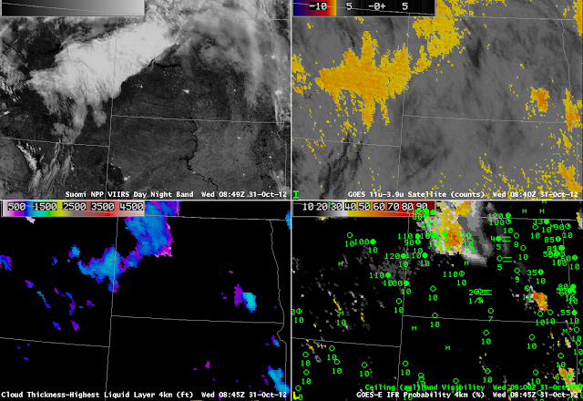
Both the nighttime visible image from the Suomi/NPP VIIRS instrument (which uses moonlight as an illumination source) and the traditional brightness temperature difference product suggest the presence of water-based clouds over eastern Montana and northwest North Dakota on the morning of 31 October 2012. However, there are no reports in Montana of IFR conditions. GOES-R IFR Probabilities overlapping the cloud deck are very low. It is likely that this cloud feature is elevated stratus, and that saturation is not occuring in the lowest levels of the model. Fusing both model and satellite data yields a product that can be greater than the sum of the two. Note, however, the IFR conditions that do exist in Bismarck, where IFR probabilities are very low and satellite information shows no fog signal. This is likely very small scale river fog in the Missouri River Valley that is both too small to be resolved in the model or detected by the satellite. In addition, very thin cirrus is interfering with the detection of low-level water clouds in much of central North Dakota.
Stratus vs. Fog in Montana/North Dakota
Leave a reply

