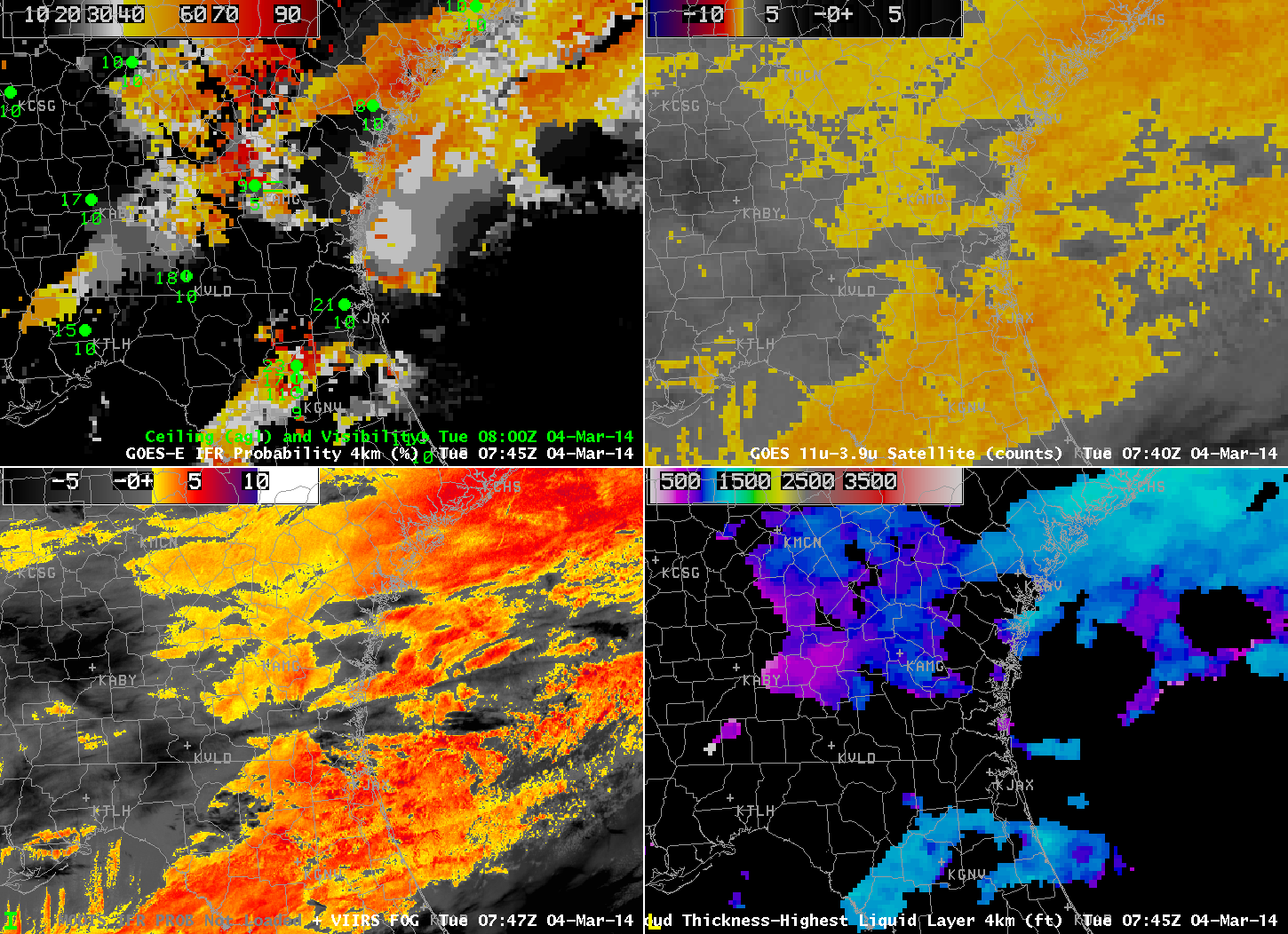
GOES-R IFR Probabilities computed from GOES-13 (Upper left); GOES-East Brightness Temperature Differences (10.7 µm – 3.9 µm) (Upper Right); MODIS-based IFR Probabilities or VIIRS-based Brightness Temperature Difference (11.35 µm – 3.74 µm) (Lower Left); GOES-R Cloud Thickness computed from GOES-East (Lower Right) (click to play animation)
Cold air has swept down the east coast into northern Florida, and the leading edge of that cold air, marked by a shift to northeasterly winds and low clouds, shows up well in the GOES-R IFR Probability fields, displayed above, because the airmass with the northeasterly winds also included low clouds/fog. Note in the animation how IFR conditions develop in Jacksonville as the higher IFR probabilities slide southward. Similarly, IFR conditions diminish over Savannah as IFR Probabilities drop.
This is a case for which the heritage method of detecting fog had difficulties because multiple cloud layers existed. For example, a stratus deck over central Florida shows up very well in the brightness temperature difference field from both GOES and VIIRS, but IFR conditions are not initially seen there (and GOES-R IFR Probabilities are small). The GOES-R Cloud Thickness is not computed in regions with multiple cloud layers, typically, because it shows the thickness of the highest water-based cloud layer. If any overlaying cloud layer at high levels contains ice, the field is not computed.
