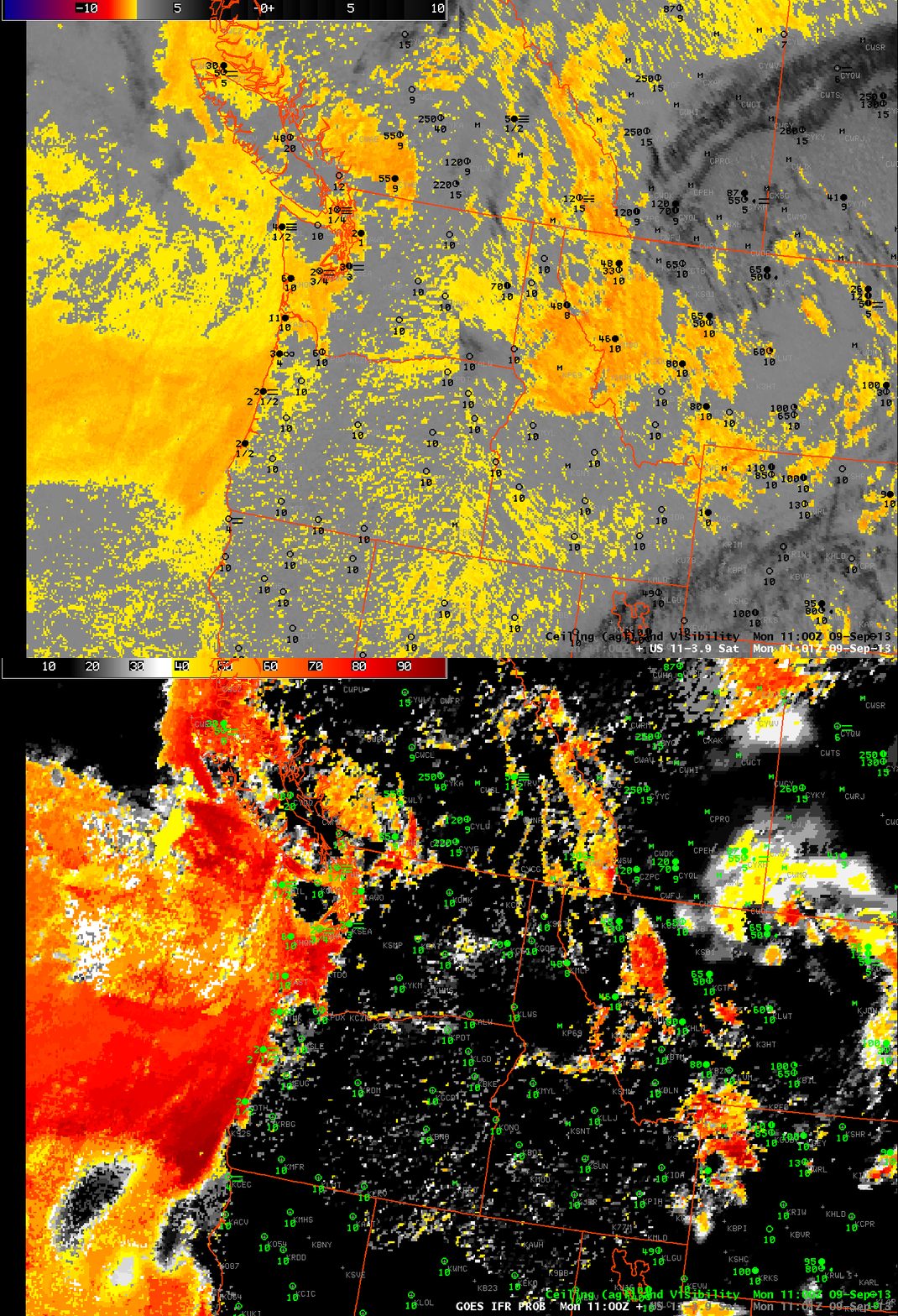
Brightness Temperature Difference from GOES-W and GOES-R IFR Probability computed from GOES-West and Rapid Refresh data, both images at 1100 UTC 9 September (click image to enlarge)
Fog and low clouds off the coast of Washington and in Montana are instructive in describing some strengths of the GOES-R IFR Probability algorithm. A general statement is that the IFR Probability improves — sometimes greatly — the approximation of where fog and low clouds are present. In the example above, the brightness temperature difference shows a positive signal — suggestive of low clouds — along the Washington and Oregon coasts (where IFR conditions are reported within the marine layer of stratus/fog). The brightness temperature difference also has a strong signal over Montana; there is a scattershot signal as well over Nevada, Idaho and western Oregon/Washington. These are regions where the GOES-R IFR Probability field is correctly minimizing the probability of fog/low clouds. Over Montana, the Brightness Temperature Difference signal is driven by an elevated stratus deck. The positive signal in arid Nevada, Idaho, Oregon and Washington arises from soil emissivity variability. The IFR Probability field maintains a strong signal where IFR conditions are reported, and reduces the strong signal in regions where fog/low stratus likely do not exist.

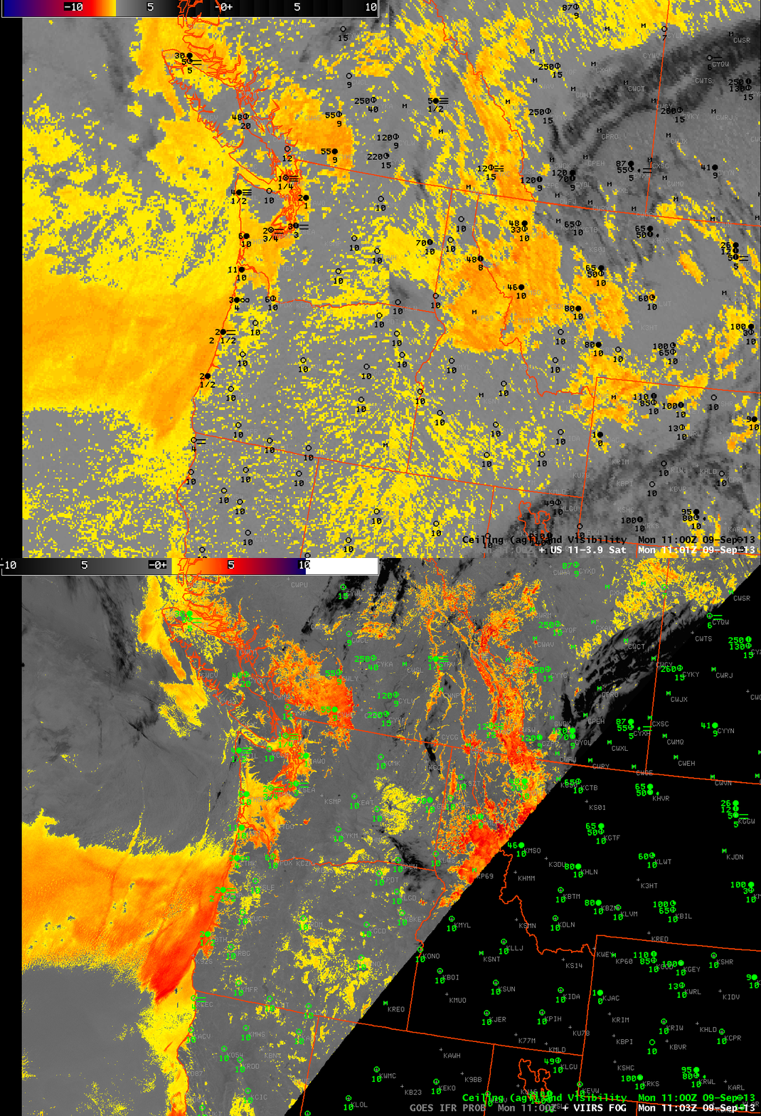
Brightness Temperature Difference from GOES-W and and from Suomi/NPP, both images at ~1100 UTC 9 September (click image to enlarge)
Suomi/NPP was passing over the Pacific NW at 1100 UTC, the times of the imagery above, and it provided a higher-resolution look. Suomi/NPP data allows for better definition of the — apparently — thickest stratus/fog layer right along the Washington and Oregon coast. The superior resolution also allows for a better approximate of the dendritic nature of river valley clouds, as demonstrated over southern British Columbia. However, the brightness temperature difference here is also unable to distinguish between fog on the ground and stratus that at mid levels.

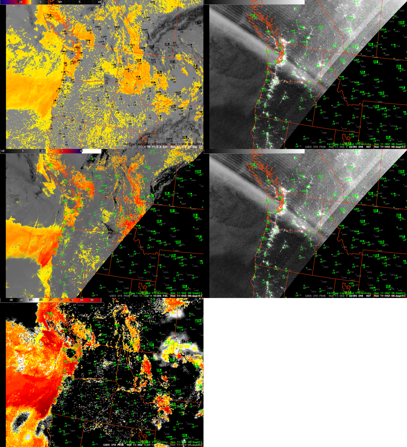
Brightness Temperature Difference from GOES-W, Day/Night Band, Brightness Temperature Difference from Suomi/NPP, Day/Night Band, GOES-based GOES-R IFR Probabilities, all at ~1100 UTC 9 September (click image to enlarge)
The animation above loops through the GOES-Based Brightness temperature difference, the Suomi-NPP Brightness temperature difference, the Suomi-NPP Day/Night band, and the GOES-R IFR Probability field computed with GOES-W and Rapid Refresh data.
