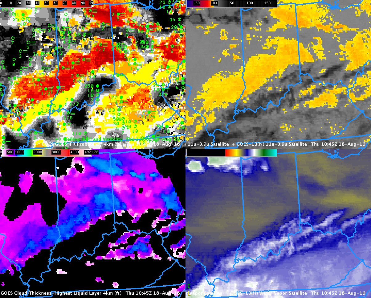
GOES-R IFR Probability Fields (Upper left), GOES-East Brightness Temperature Difference (3.9 – 10.7) (Upper Right), GOES-R Cloud Thickness (Lower Left) and GOES-East Water Vapor imagery (Lower Right), all at 1045 UTC on 18 August 2016. Surface observations of ceilings and visibilities at 1100 UTC are included in the upper right (Click to enlarge)
Dense Fog developed over southern Indiana on the morning of August 18 (and advisories were hoisted). The single image above demonstrates an advantage of GOES-R IFR Probability fields in determining the areal extent of fog: the traditional method of night-time fog detection from satellite fails in regions where cirrus clouds obscure the view of low clouds. That was the case over the Ohio River Valley where IFR conditions were occurring. GOES-R IFR Probability fields have a signal where high clouds exist in regions where Rapid Refresh model output shows low-level saturation, as over southwestern Indiana. Because satellite data cannot be used there to compute IFR Probabilities, the magnitude of the probability is smaller. Tailor your interpretation of the IFR Values based on the presence of high clouds. The presence of high clouds changes the character of the IFR Probability field, from a pixelated field where satellite data are present to a flatter field where only model data can be used.
GOES-R Cloud Thickness can be used to estimate fog dissipation time (using this scatterplot, where the thickness values are from the last pre-sunrise scene). That field, however, is only produced where the satellite has an unimpeded view of the low clouds (therefore, where cirrus clouds are present, as over the Ohio River Valley, Cloud Thickness is not produced). Note the line parallel to the terminator over eastern Ohio: GOES-R Cloud Thickness is not produced during twilight times around sunrise or sunset. This 1045 UTC image is the final one over Indiana before sunrise. Maximum thickness values are just over 1000 feet over southwest Indiana, suggesting a dissipation time of about three hours, that is, around 1345 UTC.