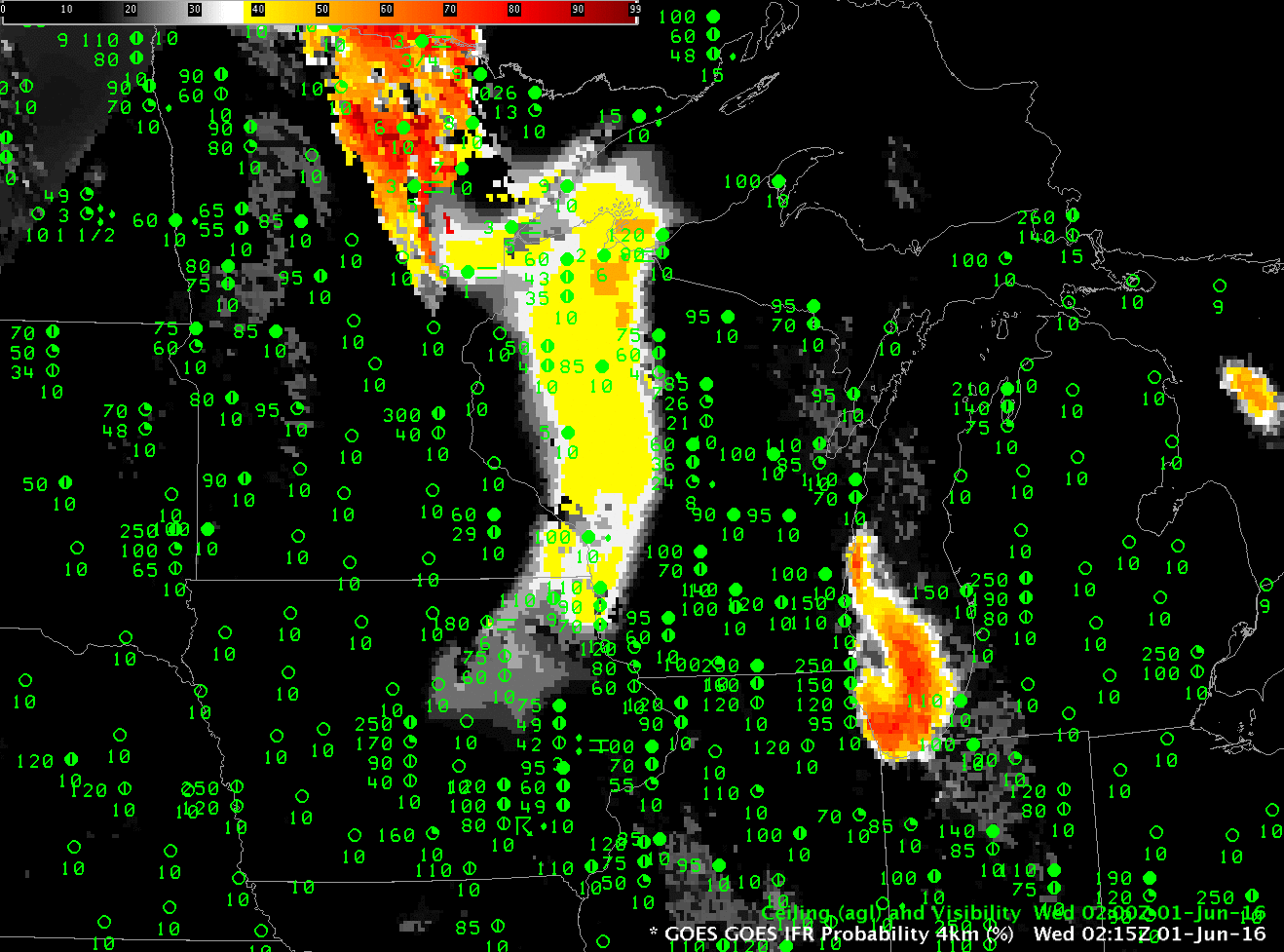
GOES-R IFR Probability Fields, computed from GOES-13 and Rapid Refresh output, 0215-1115 UTC on 1 June 2016 (Click to enlarge)
Dense Fog Advisories were issued over parts of Iowa and Minnesota early on 1 June 2016 (see map below). The fog developed over wet ground left in the wake of convection that moved through the region late in the day on 30 May/early on 1 June (Precipitation totals available here). GOES-R IFR Probability fields, above, show the two areas of dense fog developing. The region over Minnesota was characterized a lack of high clouds — the satellite could view the developing fog, and satellite parameters were included in the computation of IFR Probability. Consequently, the IFR Probability values were larger.
Fog over Iowa initially developed under mid-level clouds behind departing convection. IFR Probability fields in that case show a flatter distribution because horizontal variability is controlled mostly by model fields that are smooth; additionally, IFR Probability values are somewhat reduced because satellite predictors cannot be used. By 0815 UTC, however, mid- and high-level clouds have dissipated, and the satellite has a unobstructed view of the fog/stratus. Satellite predictors could then be used and IFR Probabilities increased, and the field itself shows more horizontal variability as might be expected from the use of nominal 4-km resolution satellite pixels.
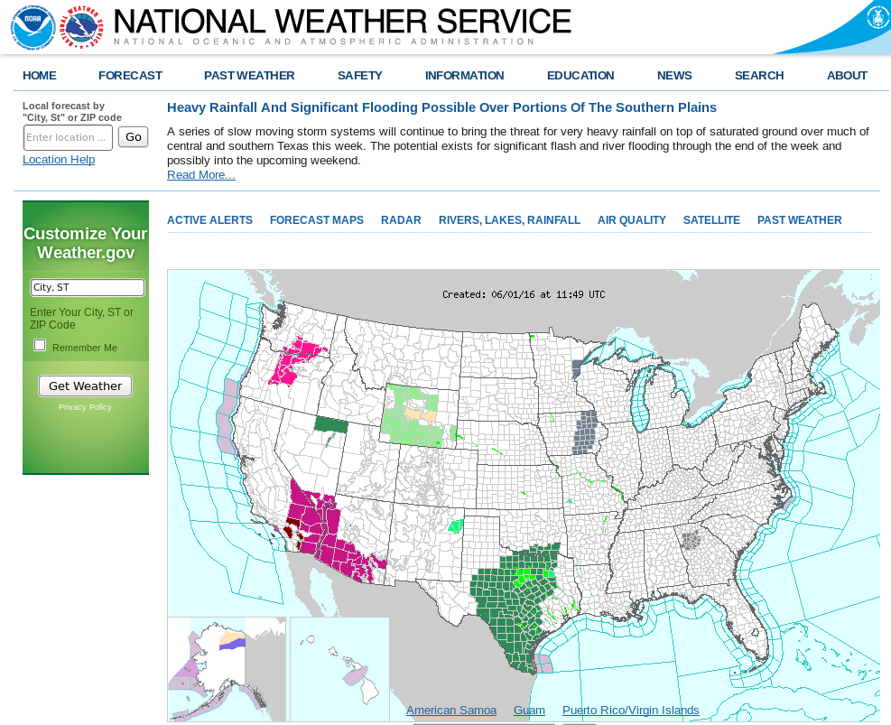
Screen Capture of weather.gov website at 1129 UTC on 1 June. Dense Fog Advisories are indicated over eastern Iowa and northeast Minnesota (click to enlarge)