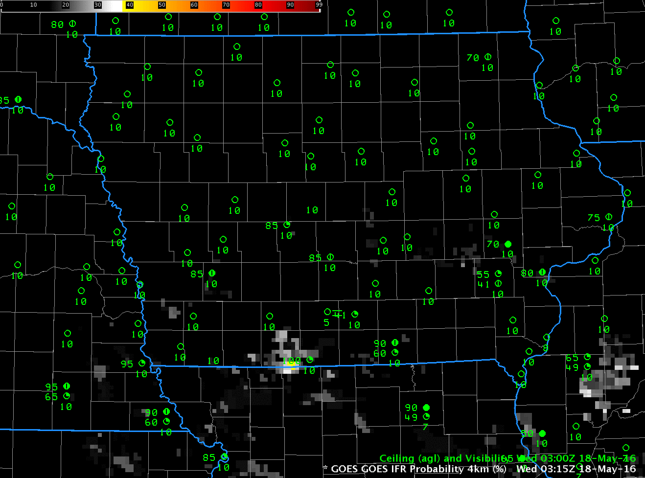
GOES-R IFR Probability Fields, hourly from 0315 through 1215 UTC on 18 May 2016 (Click to animate)
Dense Fog Advisories were issued by the Des Moines Forecast Office on 18 May as fog developed across southern Iowa. The IFR Probability Field animation, above, articulates where the fog is developing — most of the stations reporting IFR (or near-IFR) conditions are within the region of enhanced IFR Probability, and regions where IFR conditions did not develop show persistent low values of IFR Probability.
Compare the 1015 UTC image of GOES-R IFR Probability and the GOES-13 Brightness Temperature Difference (a traditional way of detecting the presence of low clouds/fog at night), below. Because the IFR Probability fields incorporate information from the Rapid Refresh Model about low-level saturation, IFR Probability screens out the region in central and northern Iowa where the Brightness Temperature Difference field suggests clouds might be forming (but where surface observations show scant evidence of cloud).
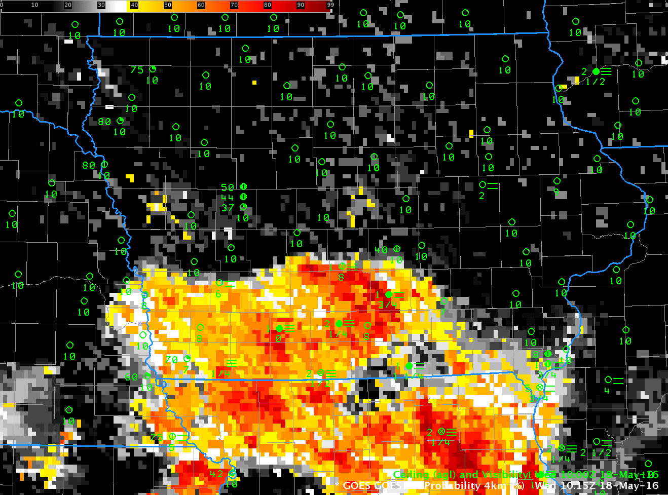
GOES-R IFR Probability and GOES-13 Brightness Temperature Difference (10.7 µm – 3.9 µm) fields, 1015 UTC on 18 May 2016 (Click to enlarge)
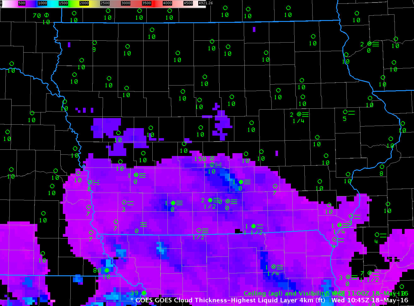
The fog that developed over Iowa was fairly thin and should dissipate quickly under a strong May sun. The GOES-R Cloud Thickness field from 1045 UTC, the last complete field before twilight conditions, below, shows values mostly less than 700 feet with a few pockets of 800-900 feet. The toggle below shows the GOES-R Cloud Thickness at 1045 UTC and the IFR Probability field 90 minutes later. Regions with the thickest fog at 1045 UTC do show a persistent signal in the IFR Probability field 90 minutes later.