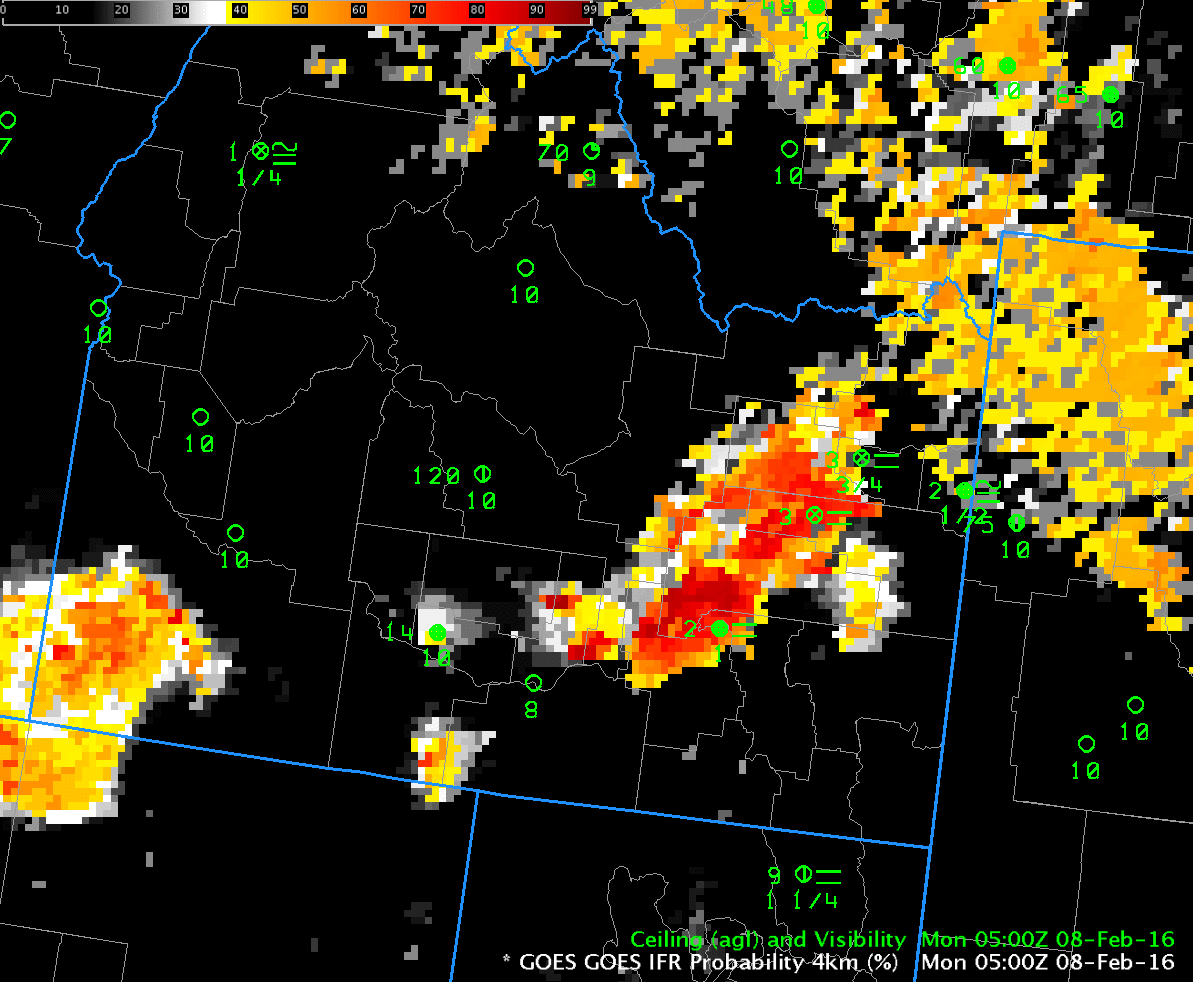
GOES-R IFR Probability, hourly from 0500 through 1500 on 8 February 2016 (Click to enlarge)
River Valleys will be prone to fog when they are capped by strong High Pressure, as occurred early in the morning on 8 February 2016 over Idaho. The animations, above and below, show GOES-R IFR Probability fields and GOES Brightness Temperature Difference Fields, respectively. GOES-R IFR Probability fields include information from the Rapid Refresh about near-surface saturation. Compare IFR Probabilities at Burley Municipal Airport (KBYI) in Cassia County with those at Jerome County Airport (KJER) between 0800 and 1100 UTC, when visibilities and ceilings at the two airports vary. IFR Probabilities in general are higher when reported ceilings and visibilities are consistent with IFR conditions, and they are lower when IFR conditions are not reported.
Extensive mid-level stratus over the eastern portions of northern Idaho and western Montana have reduced values of IFR Probabilities (compared to the Snake River Valley where IFR Probabilities are large). This is a benefit of a fused product: Information from two sources combined is more powerful than either of the two sources individually. IFR Probability fields also have superior results when mid-level or higher clouds overspread an area. This occurs around 1200-1300 UTC over the northeastern portion of the Snake River Canyon around Rexburg and Idaho Falls, locations that maintain IFR (or near-IFR) conditions although the brightness temperature difference field has little signal. IFR Probabilities remain enhanced in the region, however, with a signal — a less pixelated, flatter field — that suggests only Rapid Refresh Data are being used as predictors of IFR.
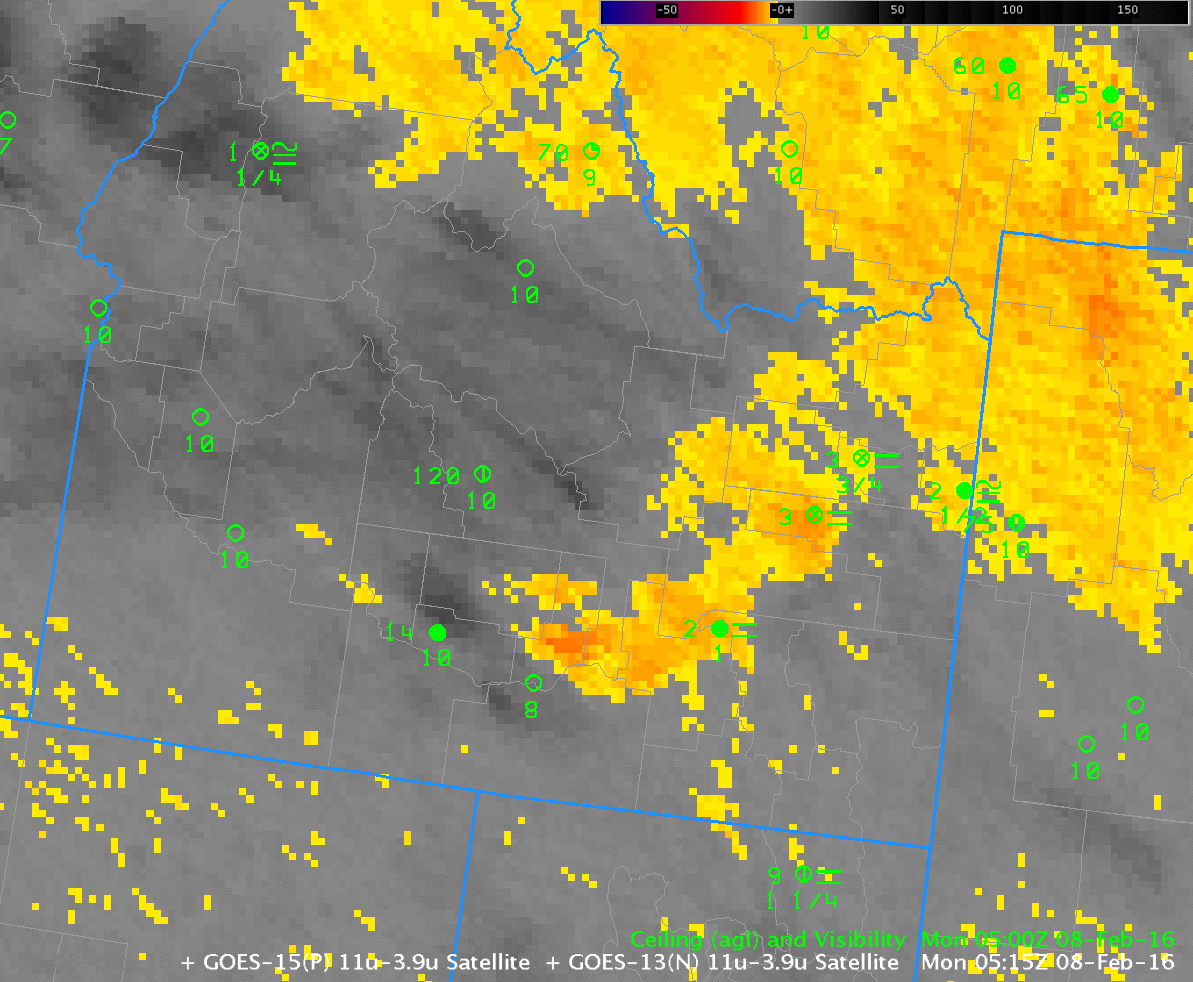
GOES Brightness Temperature Difference (10.7µm – 3.9µm), hourly from 0500 through 1500 on 8 February 2016 (Click to enlarge)