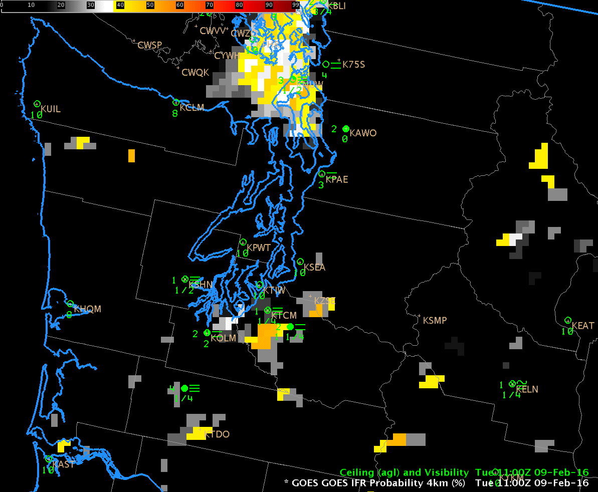
GOES-R IFR Probabilities computed with GOES-15 and Rapid Refresh Data, 1100-2200 UTC on 9 February 2016 (Click to enlarge)
GOES-R IFR probabilities on Tuesday 9 February captured the development of a small-scale fog event in/around the southern part of Puget Sound in Washington State. The animation above shows high IFR Probabilities developing shortly before sunrise and persisting through most of the day in a region including Shelton, Olympia, Tacoma and Seattle.
MODIS visible data, below, from the Terra Satellite overpass shortly after 1800 UTC, below, shows the fogbank over the most of Puget Sound, extending inland only over the southern part of the sound.
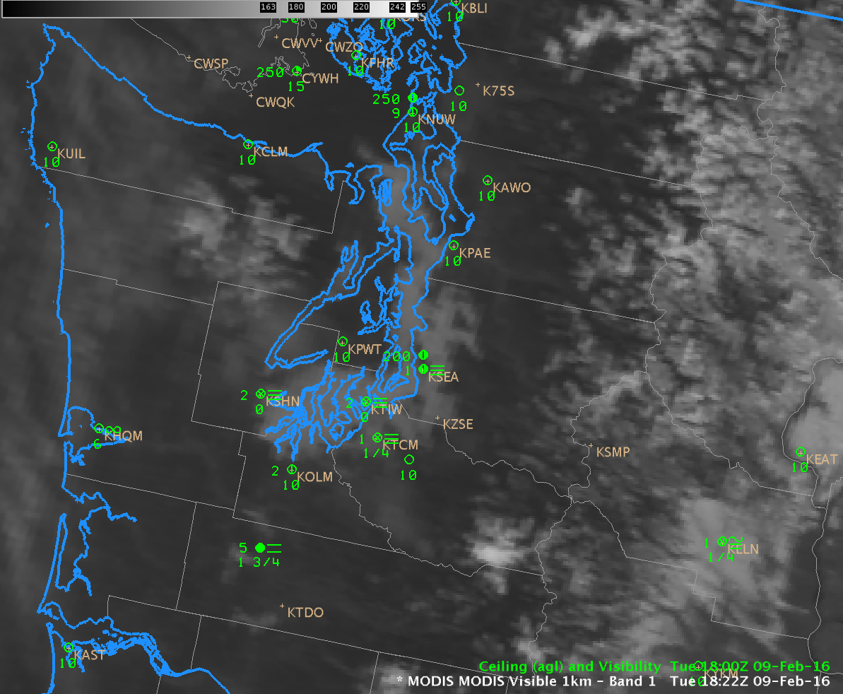
MODIS Visible Imagery (0.65 µm), 1822 UTC on 9 February (Click to enlarge)
Suomi NPP viewed Puget Sound on two consecutive overpasses on 9 February, and visible imagery from those passes, just before 2000 UTC and near 2130 UTC, are shown below. Fog Dissipation is apparent in the later image, which is consistent with the animation of IFR Probability at the top of this post, which animation shows IFR Probabilities declining in value after 2100 UTC.
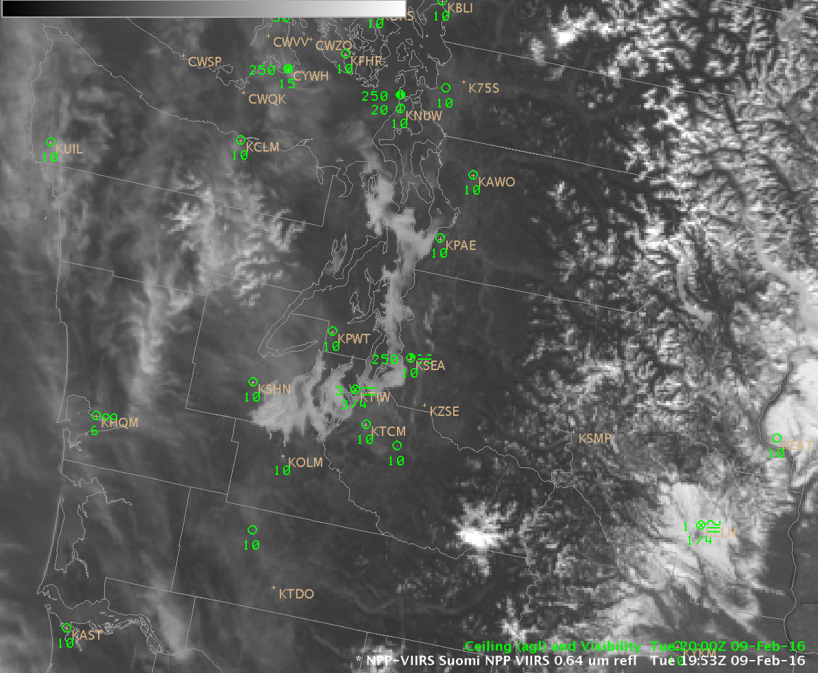
Suomi NPP Visible Imagery (0.64 µm), 1953 and 2122 UTC on 9 February (Click to enlarge)