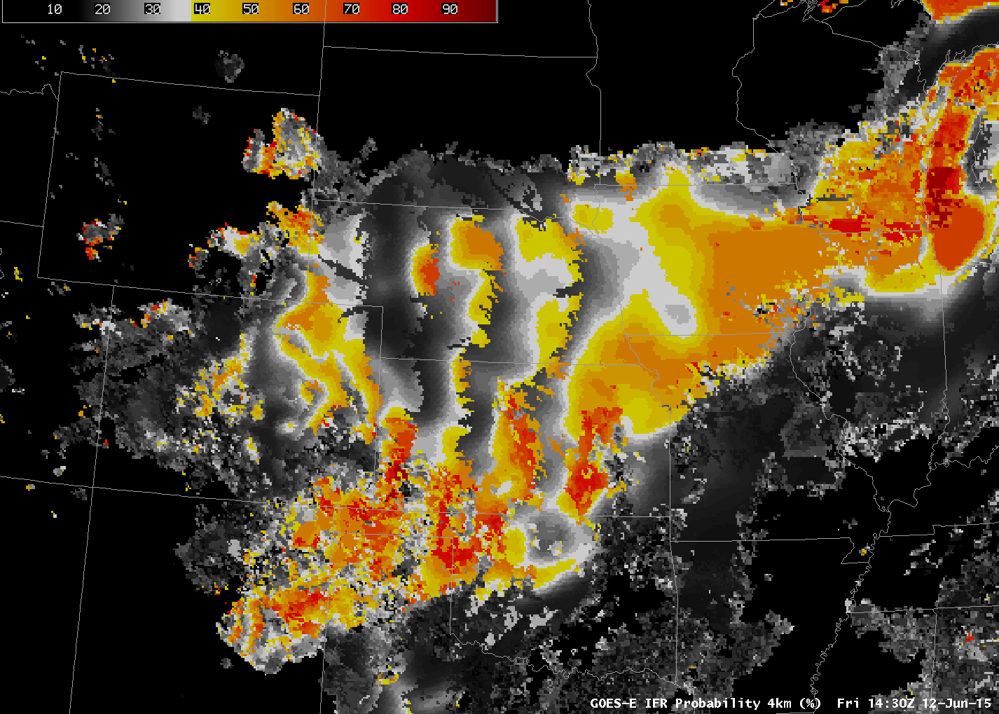
GOES-R IFR Probabilities over the Great Plains. Notice the north-south lines/artifacts in the field over Kansas and Nebraska (Click to enlarge)
GOES-R IFR Probability fields over the Plains can sometimes include structures as shown above. These are related to the sloped topography of the Great Plains. They occur because of interpolation between model layers and the lowest 1000 feet that are examined for saturation. In a sloping region, quick changes in saturation amount can occur where changing topography changes which model levels are used in the examination of those lowest 1000 feet.
In other words, satellite pixels that are very close horizontally may nevertheless have different surface elevations that cause different profile levels to be analyzed for the maximum relative humidity (RH). If the RH drastically changes at the bottom or top of the profile being analyzed then differences will emerge as shown above. Extra interpolation before the profile is analyzed may mitigate this issue and could be incorporated into the algorithm in the future.