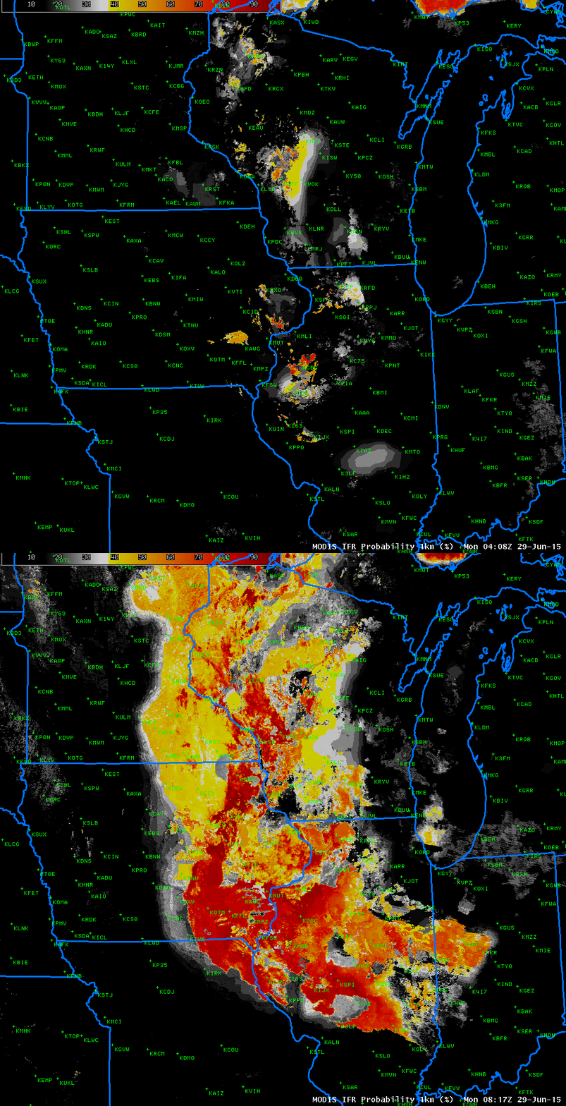
Front page of the National Weather Service in the Quad Cities, Monday morning 29 June 2015 (Click to enlarge)
Dense fog developed over the mid-Mississippi Valley early on Monday, 29 June 2015, and Dense Fog Advisories were hoisted by the DVN WFO, as shown above. How did the GOES-IFR Probabilities (and other products) capture this event? The animation below shows the evolution of surface visibilities at 0600, 0800 and 1000 UTC. IFR Conditions have developed by 0600 UTC and they subsequently expand.
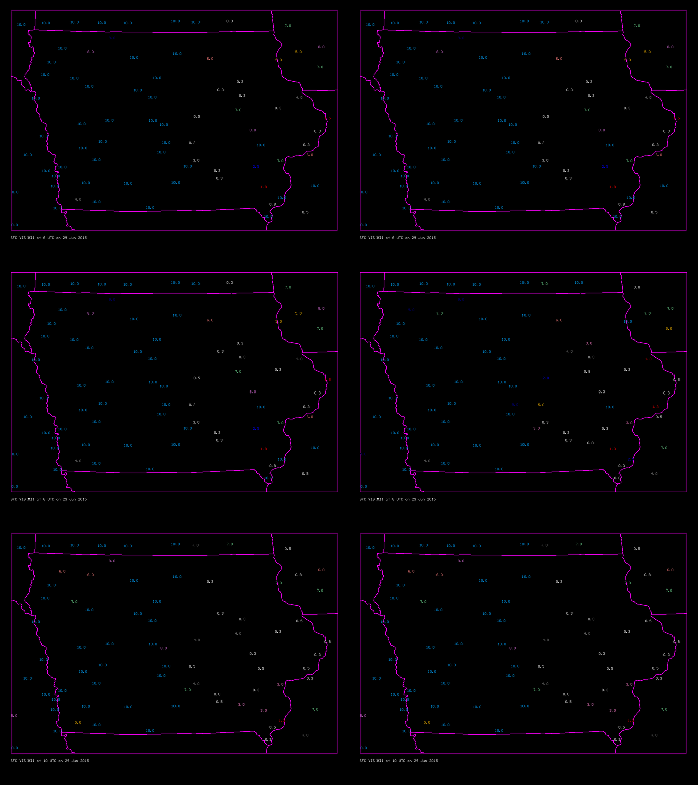
Surface Visibilities (Statute Miles) over Iowa, 0600, 0800 and 1000 UTC, 29 June 2015. IFR Conditions are highlighted in white (Click to enlarge)
The Day Night band suggests clouds are present over parts of Iowa at 0707 UTC, but the waxing gibbous moon has set by 0848 UTC (below), and the lack of reflected moonlight at the later time precludes cloud detection. The brightness temperature difference (11.45µm – 3.74µm) from Suomi NPP can detect the tops water-based low clouds and it does confirm that the clouds have not vanished at 0848 UTC despite the lack of signal in the Day Night band. The brightness temperature difference field includes signals (black in the enhancement used) that suggest the presence of cirrus clouds.
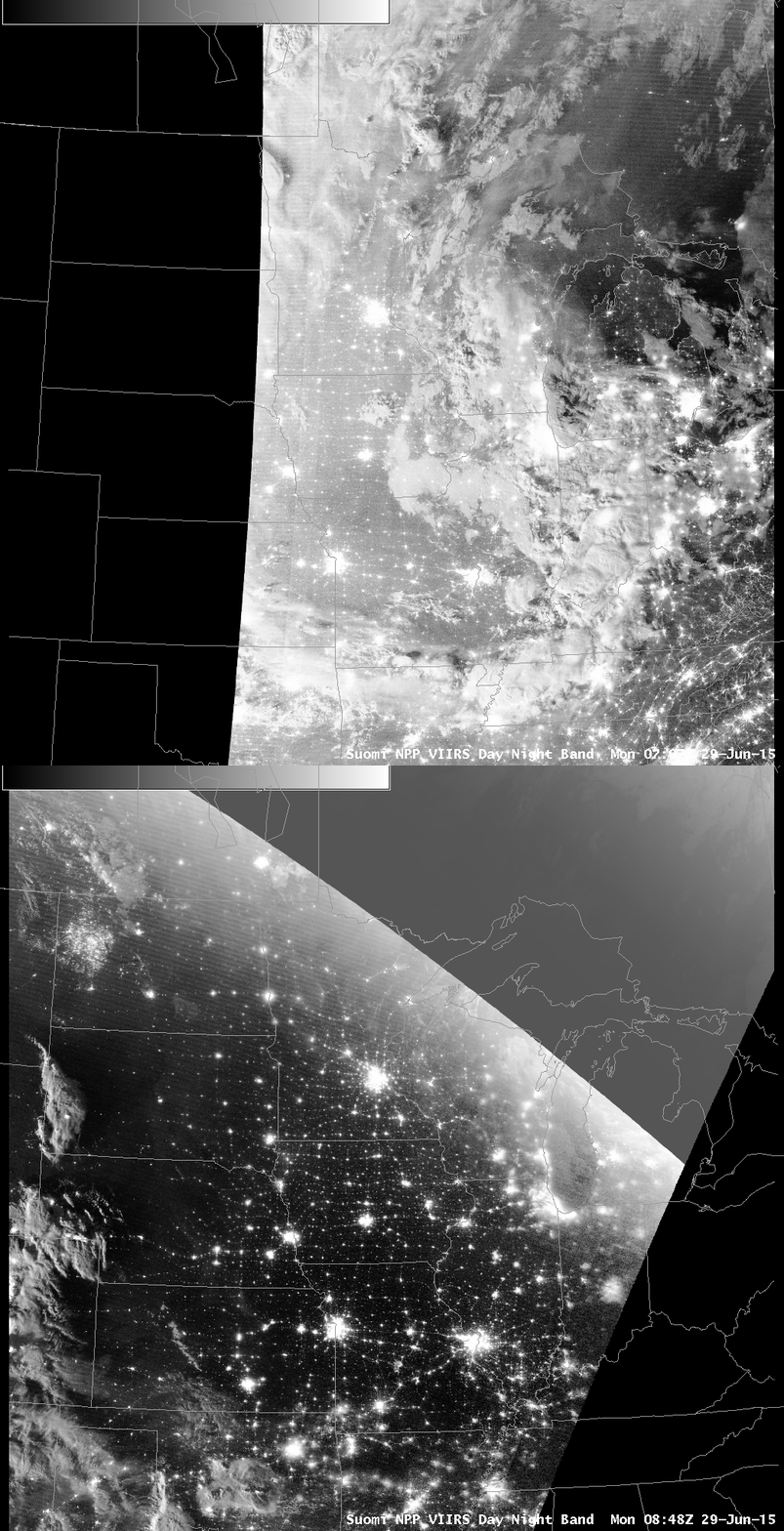
Visible Imagery from the Suomi NPP Day Night Band, 0707 and 0848 UTC on 29 June 2015 (Click to enlarge)
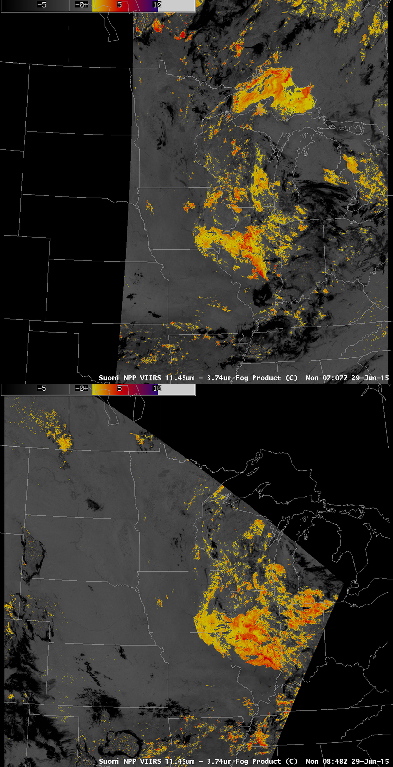
Suomi NPP Brightness Temperature Difference (11.45µm – 3.74µm) at 0707 UTC and 0848 UTC (Click to enlarge)
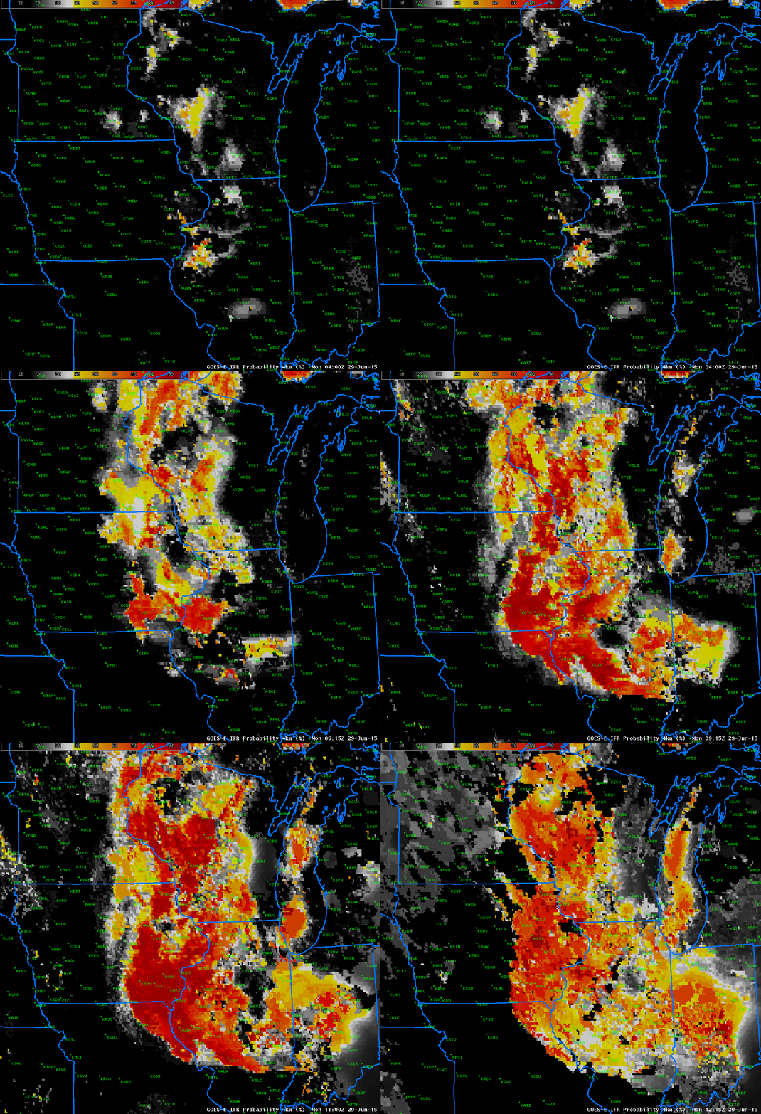
MODIS data can be used to compute IFR Probability fields. These fields are not available frequently, although they do present a high-resolution view of events when available. Two overpasses, at 0408 (Terra) and 0817 (Aqua), provided imagery early on 29 June. The MODIS data suggests the development of a large area of fog. What does GOES data show? Click here for a comparison of MODIS and GOES at 0408 UTC, and here for a comparison of MODIS and GOES at 0817 UTC). The chief difference between MODIS and GOES is somewhat higher values at the earlier time, and sharper edges (as might be expected given the resolution differences) at both times.
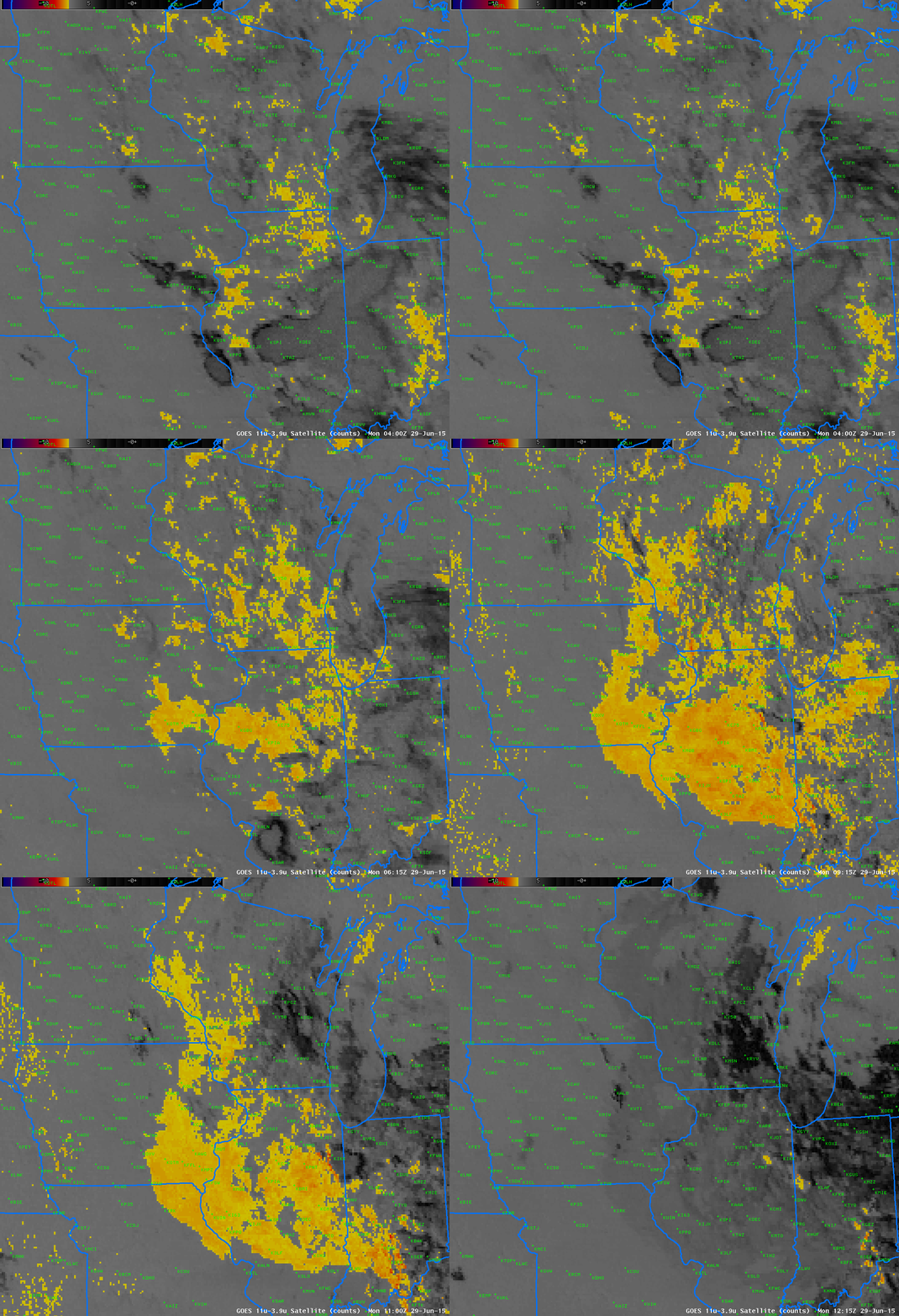
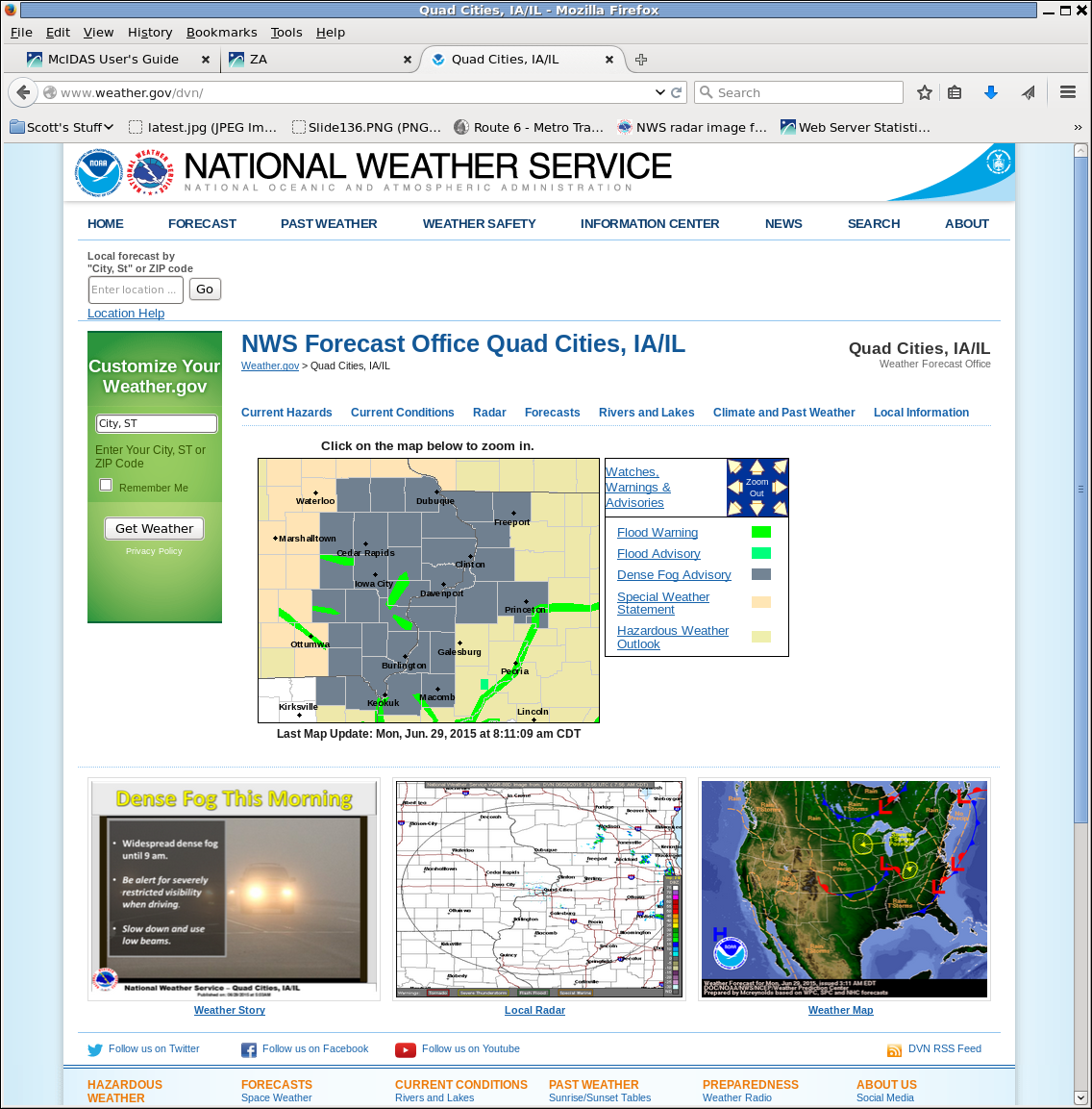
GOES-R IFR Probabilities computed from GOES-13 have a temporal resolution that allows for monitoring of fog development, and values increase rapidly after 0500 UTC over eastern Iowa, in accord with the development of IFR observations shown above. Brightness Temperature Difference fields (bottom) also suggest the development of low clouds over Iowa. However, there are places where high clouds prevent a signal and the rising sun (and its 3.9 µm radiation) mean the signal is reduced at the end of the animation. GOES-R IFR Probabilities maintain a coherent signal through sunrise.

