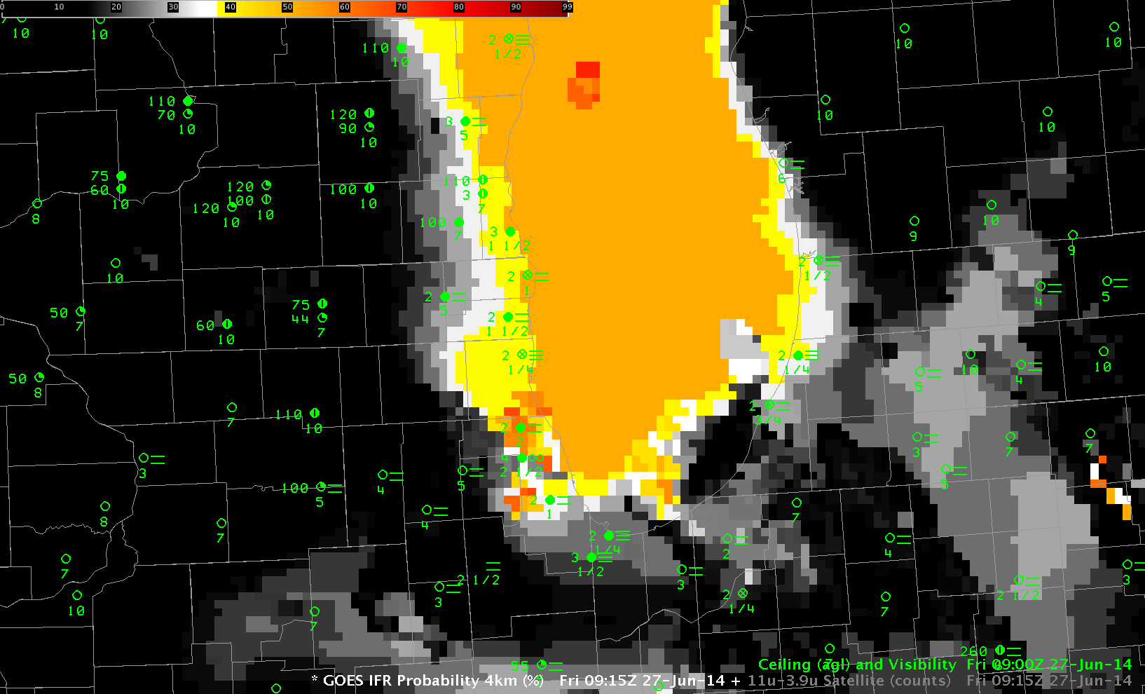
GOES-R IFR Probability and GOES-13 Brightness Temperature Difference, 0915 UTC on 27 June (Click to enlarge)
A cold winter and cool Spring have caused Lake Michigan to be much cooler than normal (Linked-to Figure is on this page). Colder-than-normal lake temperatures and warm summer dewpoints are a recipe for fog, and that fog has persisted over and near Lake Michigan this month. (Click here for a video of fog moving over Chicago on 26 June). The imagery above shows the GOES-R IFR Probability toggling with the GOES-13 Brightness Temperature Difference field (10.7µm – 3.9µm) at 0915 UTC. Abundant high clouds (cirrus from convection over the Plains) makes the brightness temperature difference method of detecting low clouds problematic. Because IFR Probability computation includes surface information, however, a useful signal near Lake Michigan that captures the extent of the fog is produced.
When high clouds prevent satellite predictors from being used, the IFR Probability field is typically fairly smooth. That is the case over most of Lake Michigan. Breaks in the high clouds at 0915 UTC over Chicago allow for satellite predictors to be used. Where that happens, IFR probabilities are larger, and the IFR Probability field is more pixelated.
Click here for a blog entry at the Washington Post on the fog.