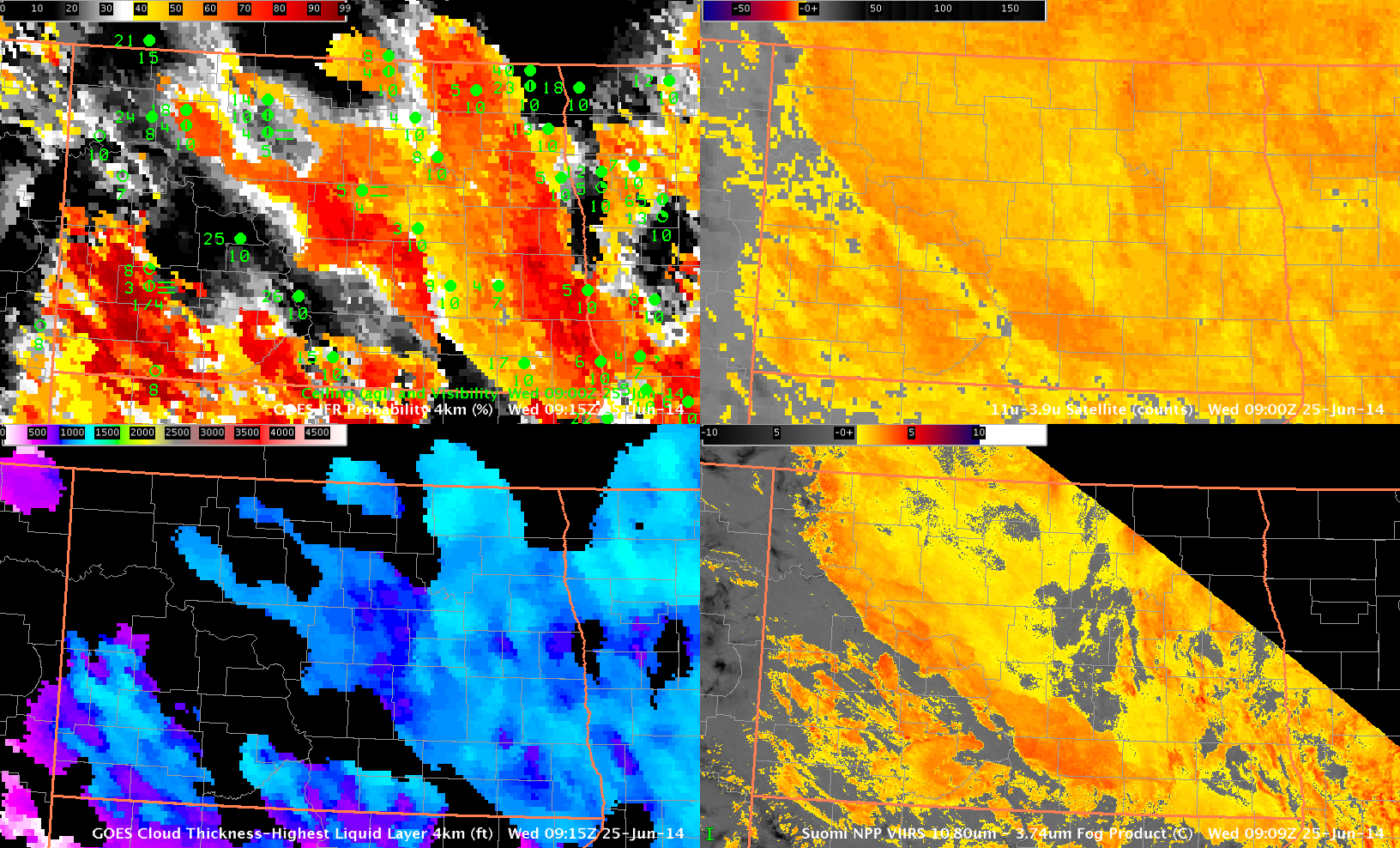
GOES-based GOES-R IFR Probabilities (Upper Left), GOES-13 Brightness Temperature Difference (10.7µm – 3.9µm) (Upper Right), GOES-R Cloud Thickness (Lower Left), Suomi/NPP Brightness Temperature Difference (11.35µm – 3.74µm) (Lower Right), all times as indicated (Click to enlarge)
A strength of the GOES-R IFR Probability field is that it highlights regions where IFR conditions are occurring and downplays regions where stratus is elevated off the surface, insignificant from an aviation point of view. In the image above, note how stations in the Missouri River valley of central North Dakota (Bismarck, Mercer County) are under a thick stratus deck that is highlighted in the brightness temperature difference fields, but surface ceilings and visibilities are good. IFR Probabilities there are small because the Rapid Refresh Model data does not suggest low-level saturation. Dickinson and Hettinger, over southwestern North Dakota, in contrast, show restricted visibilities (that worsen before sunrise, see below) in a region of higher IFR Probabilities. IFR Probabilities remain low over central North Dakota where visibilities are not restricted.
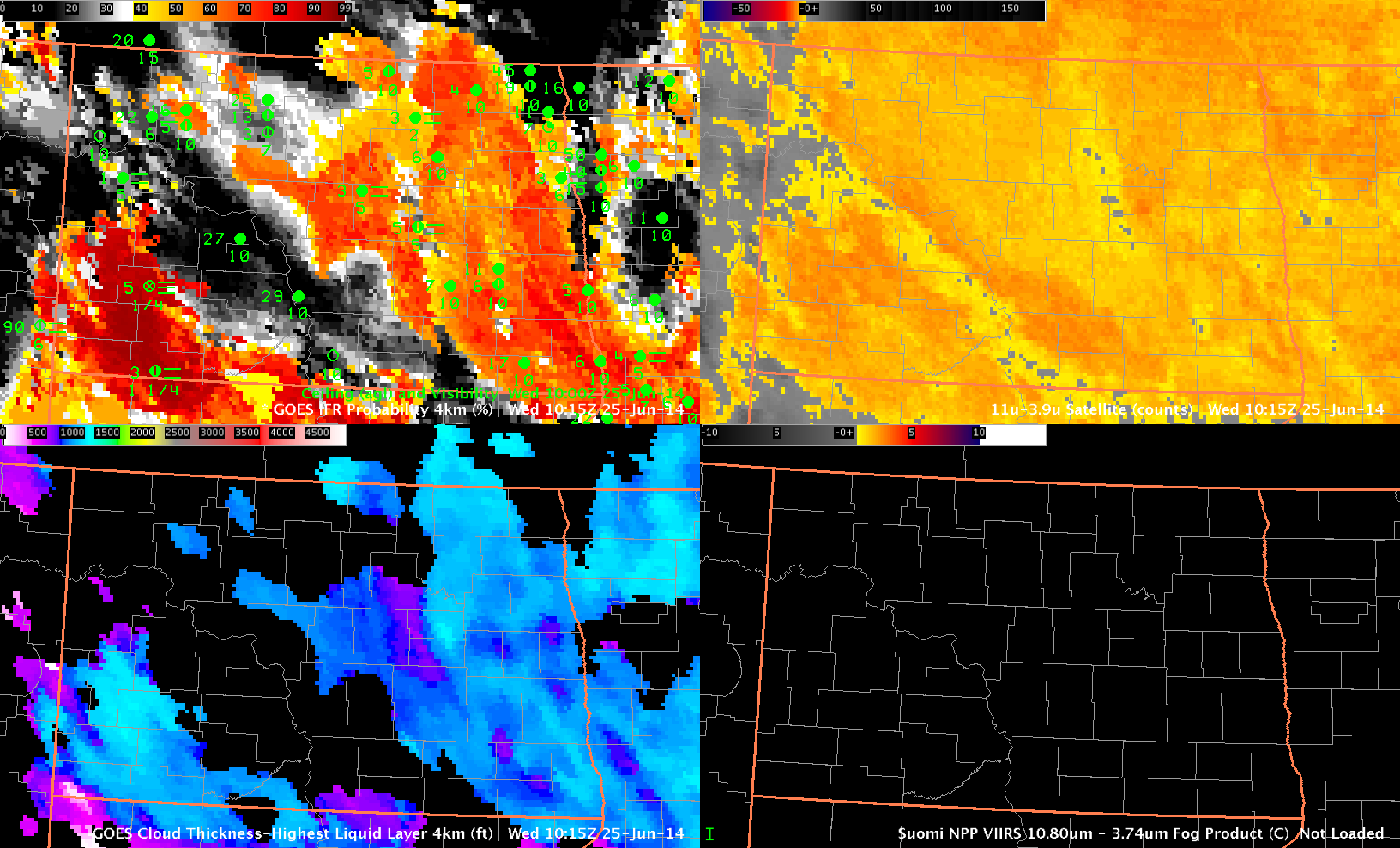
GOES-based GOES-R IFR Probabilities (Upper Left), GOES-13 Brightness Temperature Difference (10.7 – 3.9) (Upper Right), GOES-R Cloud Thickness (Lower Left), Suomi/NPP Brightness Temperature Difference (11.35 – 3.74) (Lower Right), all times as indicated (Click to enlarge)