GOES-R Fog/Low Stratus Products have been available in NWS Forecast Offices since 2012 via an LDM feed. GOES-16 versions for these products over the CONUS domain are now flowing over the Satellite Broadcast Network (SBN), effective 9 September 2020 (Announcement). Responsibility for this data feed is now at NESDIS following an extensive research-to-operations path. Fields distributed include Probability of: Marginal Visual Flight Rules (MVFR), Instrument Flight Rules (IFR) and Low Instrument Flight Rules (LIFR). In addition to these three probabilities (Click here to see an explanation), there is also a Low Cloud Thickness product that can be used to predict the dissipation time of radiation fogs.
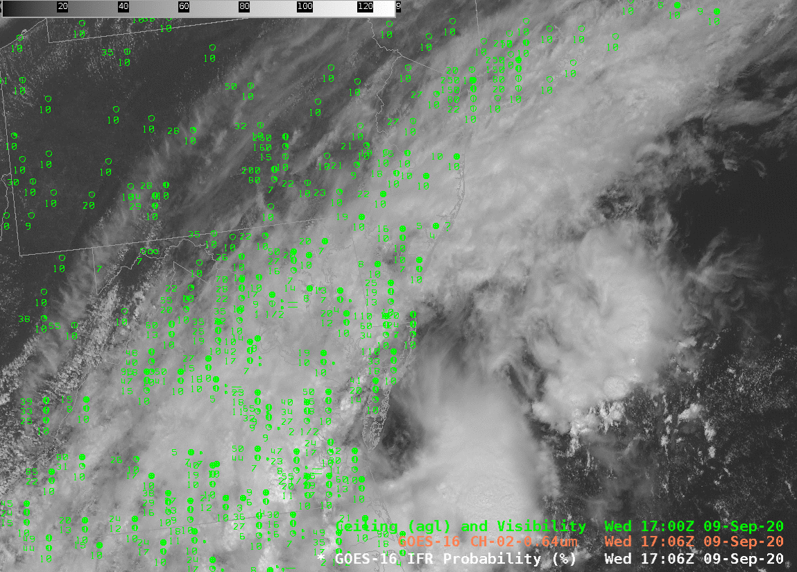
IFR Probabilities, as shown above, are useful because they highlight regions under clouds where visibility restrictions are most likely. Loading it under a visible image and making the visible semi-transparent, as shown above, is a handy way to use the product. A forecaster responsible for transportation concerns can therefore focus their attention where it is needed, as defined by the IFR Probability field: IFR Probability is a good situational awareness tool.
Accessing the Fog/Low Stratus products via the SBN requires TOWR-S RPM v. 19 (It will be baselined in AWIPS v. 21.3.1 in 2021). GOES-17 (and GOES-16) IFR Probabilities are available at this website for the GOES-16 CONUS and GOES-17 PACUS sectors. Work is ongoing to product GOES-17 IFR Probabilities for Alaska.