Monthly Archives: September 2020

IFR Conditions over the southern Plains

Click to enlarge
GOES-16 Night Fog Brightness Temperature Difference (10.3 µm – 3.9 µm), Night TIme Microphysics RGB, and IFR Probability, 1001 UTC on 22 September 2020 (Click to enlarge)

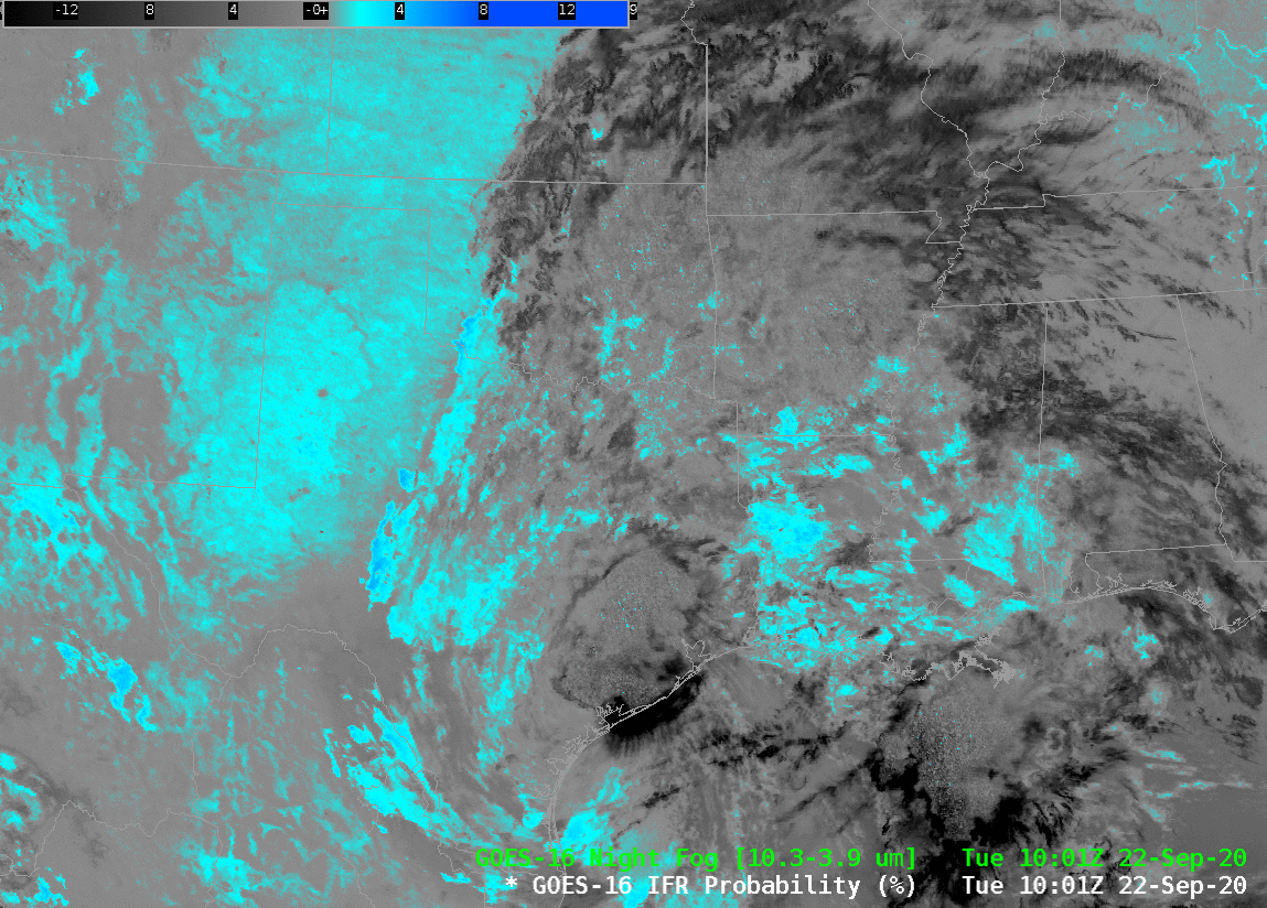
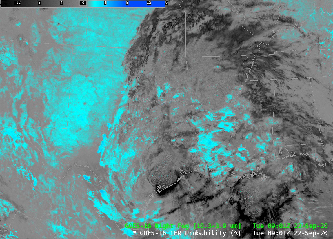
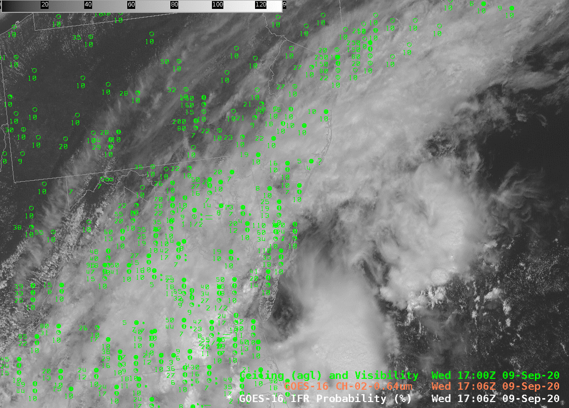
Widespread mid- and upper-level cloudiness over the southern Plains associated with Tropical Storm Beta on 22 September 2020 make it difficult to use satellite data alone to identify where low clouds and fog might exist. This is a day where IFR conditions exist, as shown here, an image from this website. Where would you expect IFR conditions to exist within this field of view? The Night Fog brightness temperature difference, below, (and, by extension, the Nightime Microphysics RGB) shows scant information over eastern Texas/Oklahoma or ArkLaTex. IFR Probability fields, in contrast, have a definite signal of high probability.

The animation of the Night Fog Brightness Temperature Difference field, below, also highlights a challenge in using this product: increasing reflection of solar 3.9 radiation occurs as sunrise progresses, changing the character of the field. Further, soils can have emissivity properties that are similar to clouds, and a positive Night Fog Brightness Temperature difference signal results. (This is especially true in dry regions, such as west Texas; linked-to map from this website).

GOES-16 Night Fog Brightness Temperature Difference (10.3 µm – 3.9 µm), 0901 – 1306 UTC on 22 September 2020 (Click to enlarge)
GOES-16 IFR Probability, 0901-1306 UTC on 22 September 2020 (Click to enlarge)

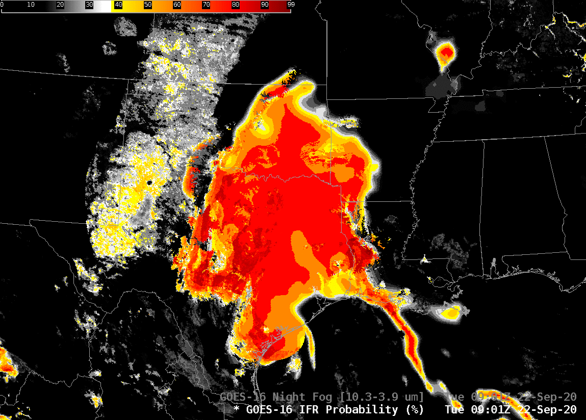
IFR Probability fields for the same time as the Night Fog Brightness Temperature Difference, above, show a consistent region where IFR conditions are most likely. The region over the high Plains of Texas that has a signal in the Brightness Temperature Difference field has low probabilities because in that region, the Rapid Refresh model is not suggesting widespread low-level saturation. In contrast, the Rapid Refresh model over east Texas/Oklahoma, western Louisiana and southwest Arkansas does show saturation.

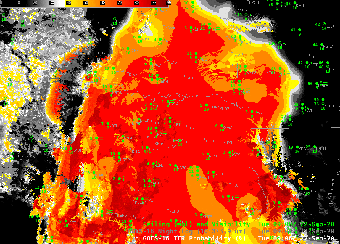
What do observations shows? The hourly observations overlain on the IFR Probability fields, below, show that IFR and near-IFR conditions are widespread within the region of high IFR Probability. Outside that region, IFR conditions are rare.

GOES-R IFR Probability fields, 0906, 1001, 1101, 1201 and 1301 UTC along with observations of ceilings and visibilities (Click to enlarge)

IFR Probability fields are flowing over the SBN to forecast offices. (TOWR-S RPM 19 is needed to display them from that data source). IFR Probability fields are also available via an LDM feed from Regionals if RPM 19 is not installed. They are available online at this website.

GOES-R Fog/Low Stratus Products are now flowing over the SBN

GOES-16 Visible Imagery, 1706 UTC on 9 September, with IFR Probability shown at the same time (with different alpha levels) (Click to enlarge)

GOES-R Fog/Low Stratus Products have been available in NWS Forecast Offices since 2012 via an LDM feed. GOES-16 versions for these products over the CONUS domain are now flowing over the Satellite Broadcast Network (SBN), effective 9 September 2020 (Announcement). Responsibility for this data feed is now at NESDIS following an extensive research-to-operations path. Fields distributed include Probability of: Marginal Visual Flight Rules (MVFR), Instrument Flight Rules (IFR) and Low Instrument Flight Rules (LIFR). In addition to these three probabilities (Click here to see an explanation), there is also a Low Cloud Thickness product that can be used to predict the dissipation time of radiation fogs.

IFR Probabilities, as shown above, are useful because they highlight regions under clouds where visibility restrictions are most likely. Loading it under a visible image and making the visible semi-transparent, as shown above, is a handy way to use the product. A forecaster responsible for transportation concerns can therefore focus their attention where it is needed, as defined by the IFR Probability field: IFR Probability is a good situational awareness tool.

Accessing the Fog/Low Stratus products via the SBN requires TOWR-S RPM v. 19 (It will be baselined in AWIPS v. 21.3.1 in 2021). GOES-17 (and GOES-16) IFR Probabilities are available at this website for the GOES-16 CONUS and GOES-17 PACUS sectors. Work is ongoing to product GOES-17 IFR Probabilities for Alaska.