Monthly Archives: July 2016

Comparing GOES-R IFR Probability Fields and Webcam Observations over Alaska

GOESWIFR_AK_19JUL2016

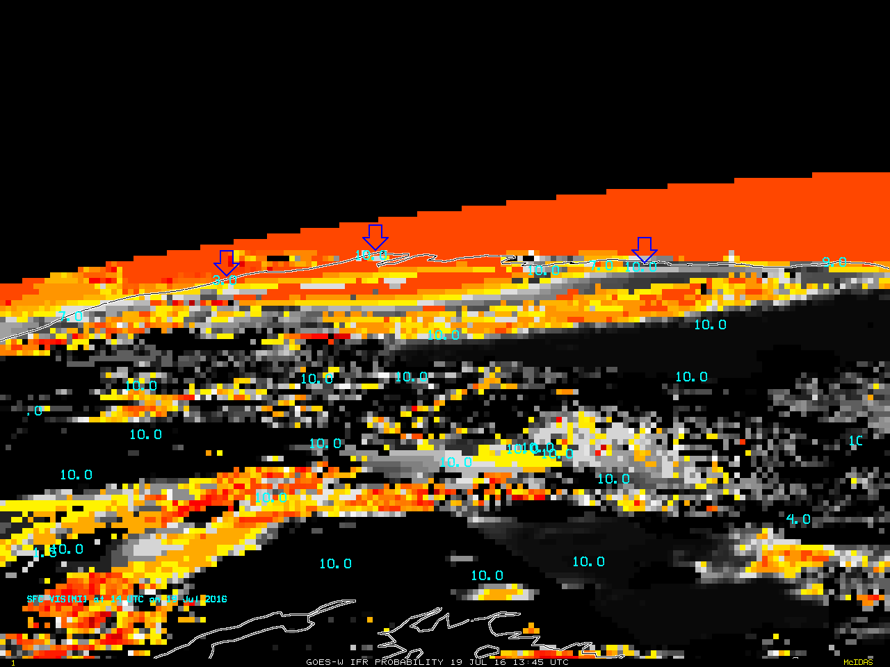
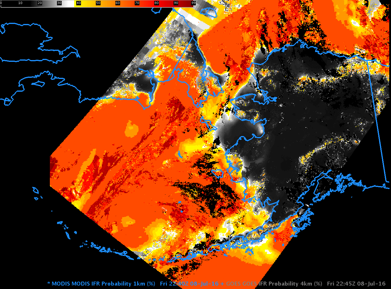
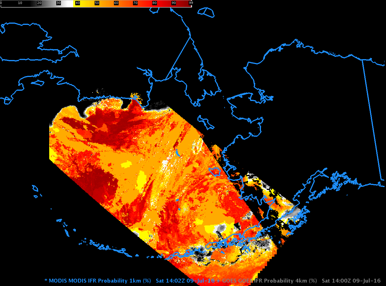
GOES-R IFR Probability, 1345 UTC on 19 July 2016, and 1400 UTC Observations of surface Visibility. Blue arrows point to, from left to right, Wainwright, Barrow, and Deadhorse Alaska (Click to enlarge)

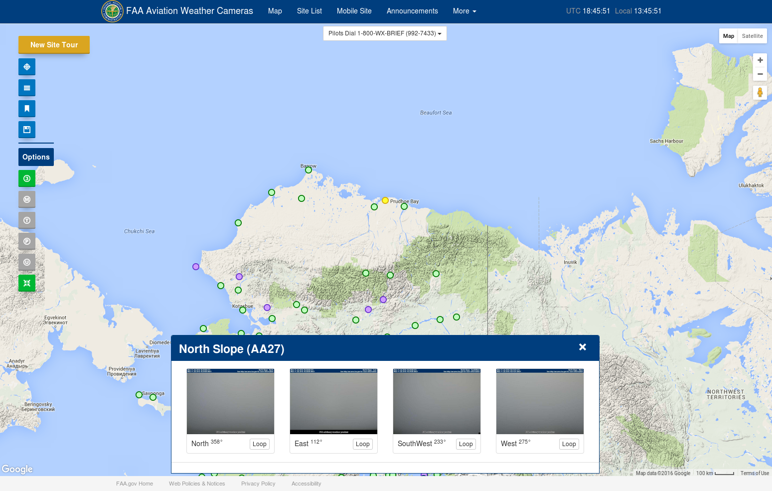
The FAA website that includes webcams over much of Alaska provides a great opportunity to match IFR Probability fields with surface observations. In the image above, Wainwright AK shows a 3-mile visibility, but Barrow and Deadhorse farther east report 10-mile visibilities. All three stations are very near high IFR Probabilities — the red/orange region has IFR Probabilities exceeding 90%. What to the webcams at the three stations show? Screen captures from the three webcams are below. Webcams from both Barrow and Deadhorse show non-IFR conditions. Wainwright shows a dense fog through which the sun is dimly visible. These webcam observations are in general agreement with the GOES-based IFR Probability fields: only Wainwright is in a region where IFR Probabilities are consistently high.

WainWright_1413_19July2016

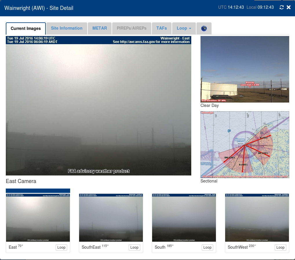
Wainwright AK webcams at 1413 UTC on 19 July 2016 (Click to enlarge)

Barrow_1414_19July2016

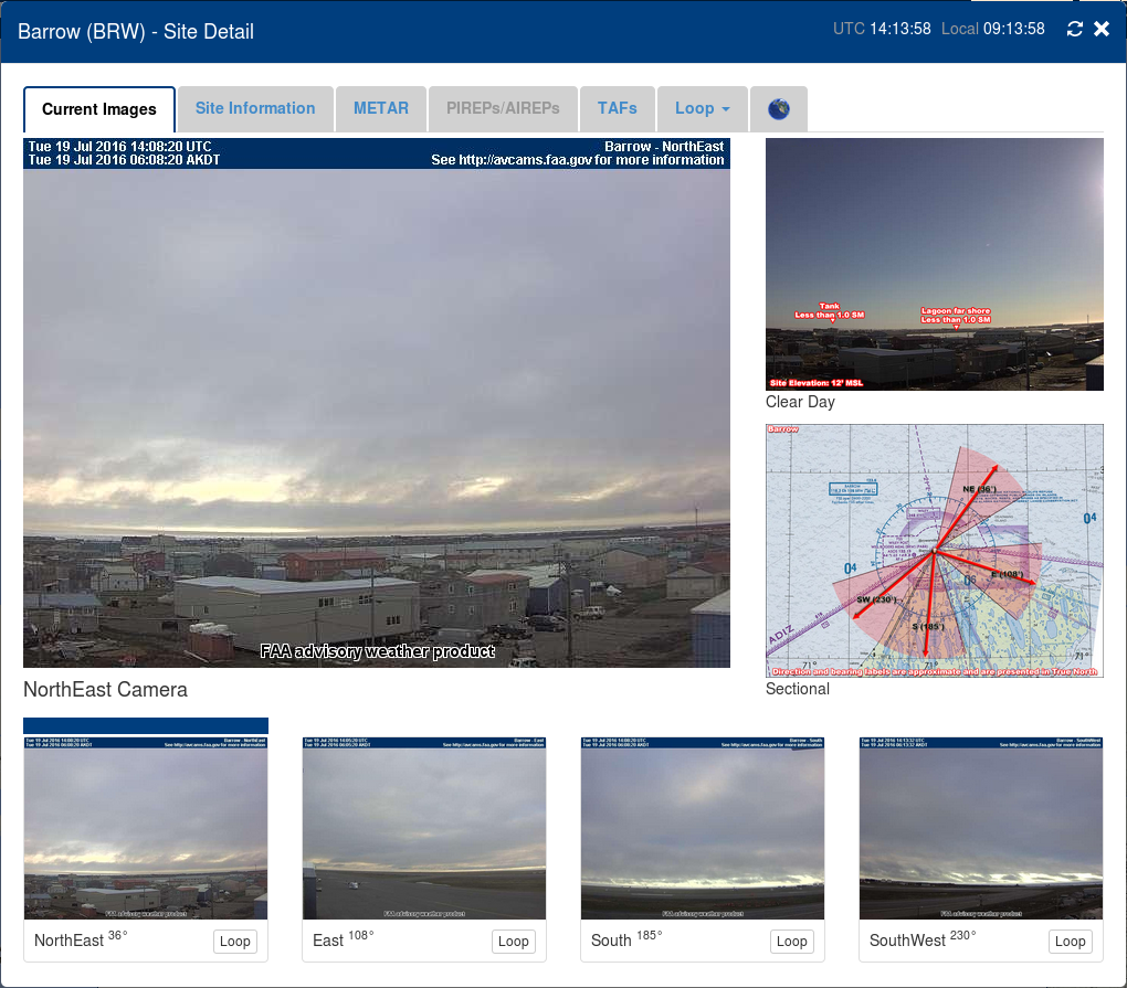
Barrow AK webcams at 1413 UTC on 19 July 2016 (Click to enlarge)

Deadhorse_1415_19July2016

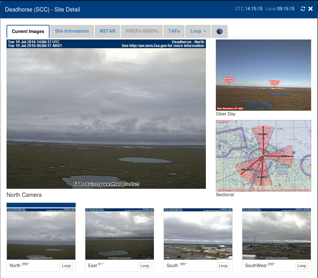
Deadhorse AK webcams at 1413 UTC on 19 July 2016 (Click to enlarge)


==============================================================================

GOES_IFR_1645_19July2016

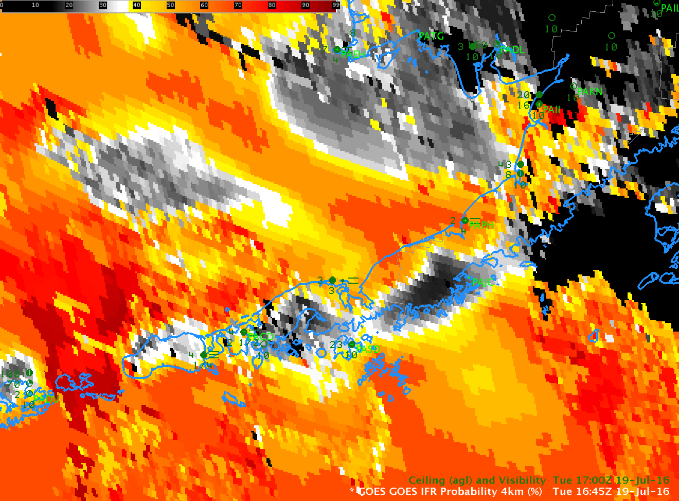
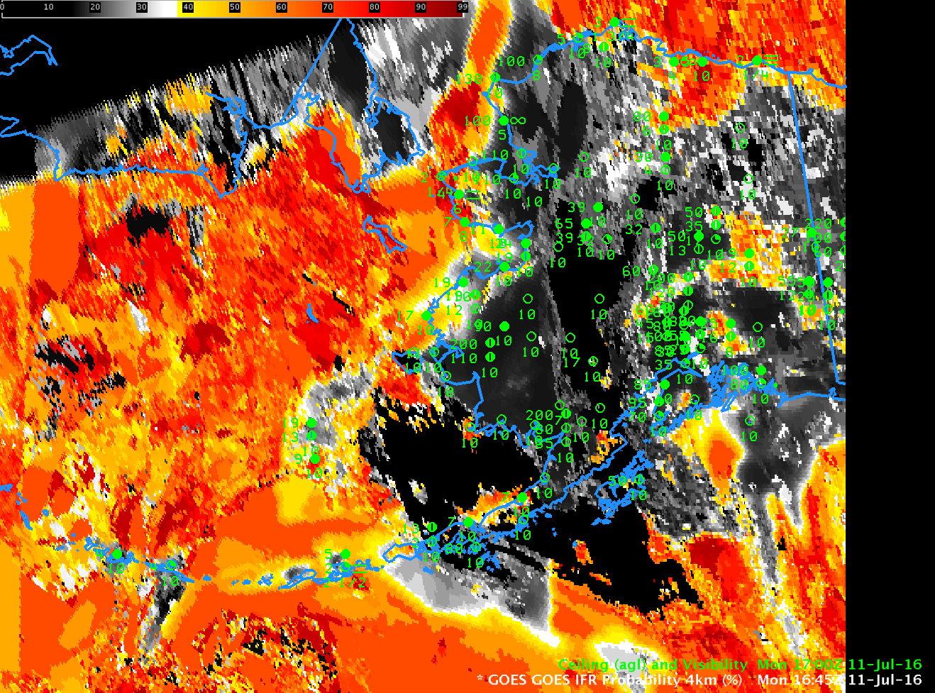
GOES-R IFR Probabilities, 1645 UTC on 19 July 2016, and 1700 UTC Observations of Ceilings/Visibilities (Click to enlarge)

The image above is of GOES-R IFR Probabilities over the Aleutians, along with surface observations of ceilings and visibilities.  In general, IFR Probabilities are a bit higher on the northern side of the Aleutians (False Pass, Cold Bay, Nelson Lagoon, Port Heiden, Pilot Point) than the southern side (Perryville, King Cove).  That is confirmed with the screen captures of webcam imagery, seen below.  The webcam scenes are aligned from west to east, starting at False Pass AK and ending at Pilot Point.

FalsePass_1653_19July2016

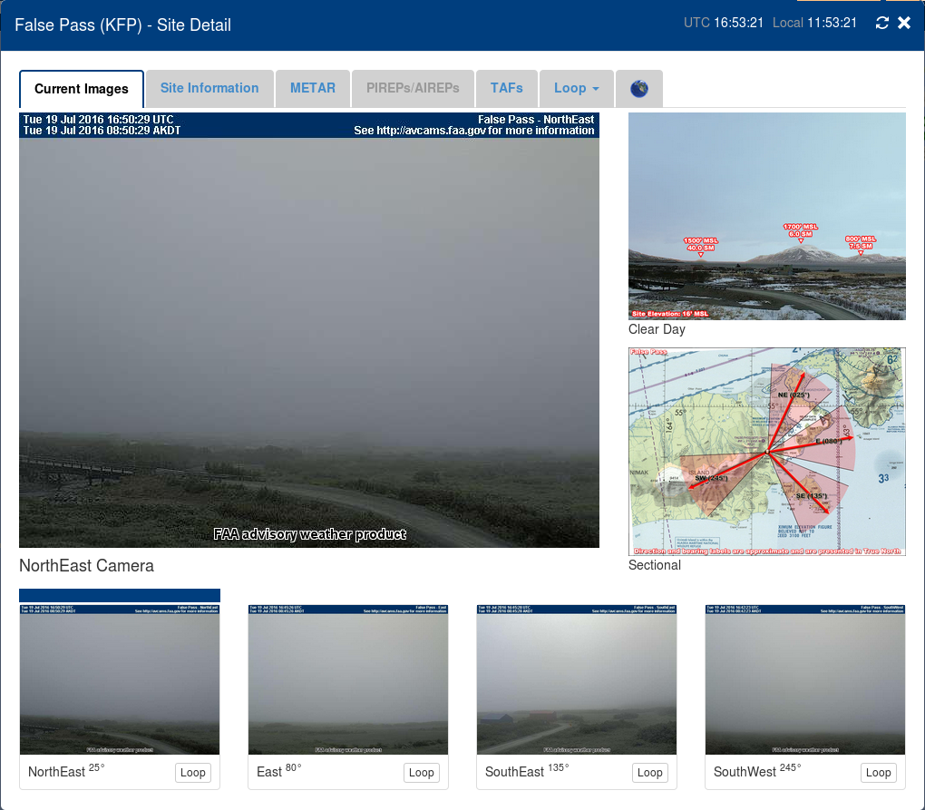
Webcam imagery from False Pass AK (PAKF) at 1653 UTC, 19 July 2016 (Click to enlarge)

ColdBay_1654_19July2016

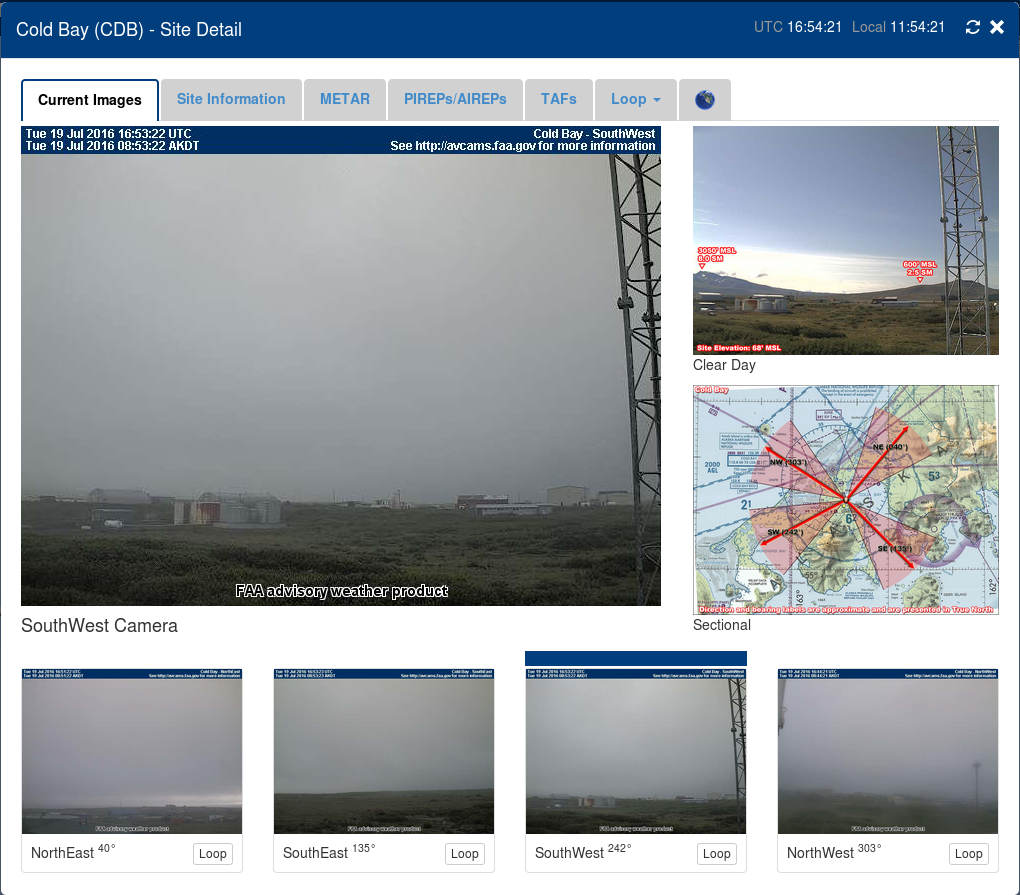
Webcam imagery from Cold Bay, AK (PACD) at 1654 UTC on 19 July 2016 (Click to enlarge)

KingCove_1655_19July2016

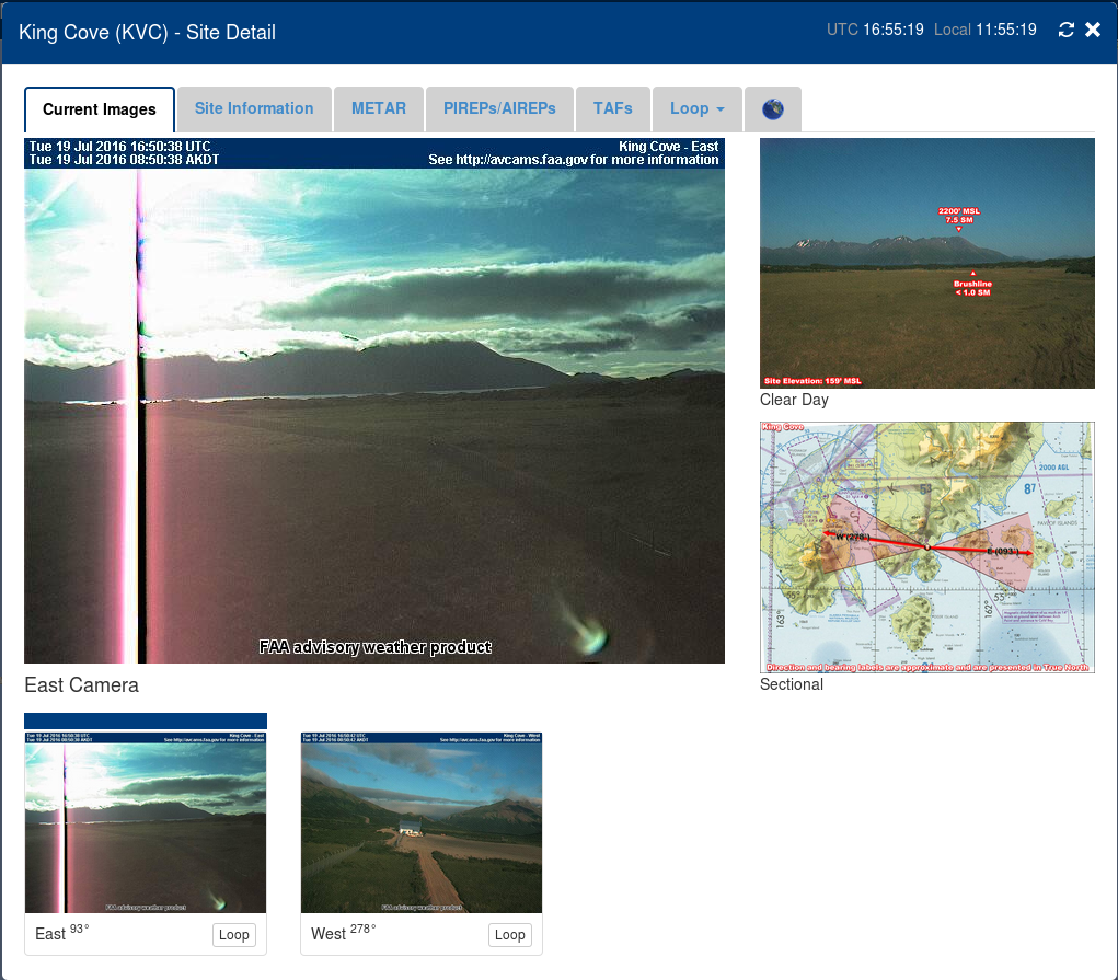
Webcam imagery from King Cove, AK, (PAVC) at 1655 UTC on 19 July 2016 (Click to enlarge)

NelsonLagoon_1656_19July2016

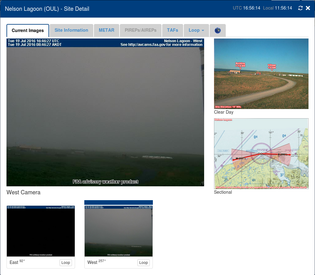
Webcam imagery from Nelson Lagoon, (PAOU) 1656 UTC on 19 July 2016 (Click to enlarge)

Perryville_1659_19July2016

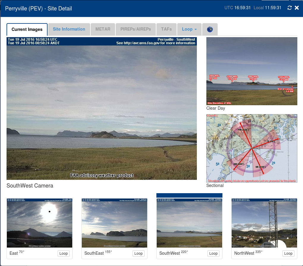
Webcam Imagery from Perryville, AK, 1659 UTC on 19 July 2016 (Click to enlarge)

PortHeiden_1657_19July2016

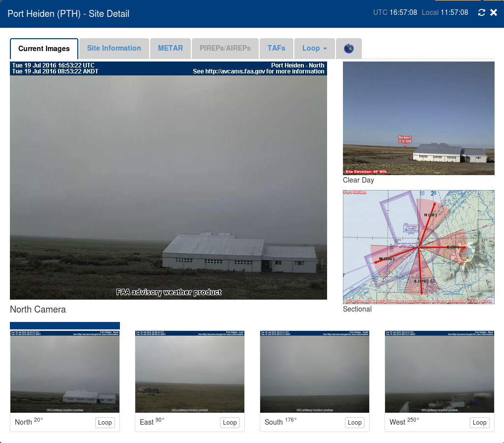
Webcam imagery from Port Heiden, AK, (PAPH) 1657 UTC on 19 July 2016 (Click to enlarge)

PilotPoint_1658_19July2016

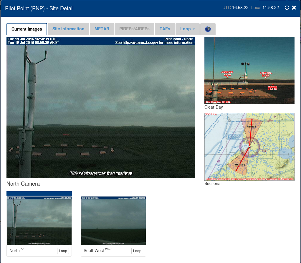
Webcam Imagery from Pilot Point, AK, (PAPN) at 1658 UTC on 19 July 2016 (Click to enlarge)

Fog Detection at Very High Latitudes

Barrow_0930_1230_14July2016

GOES-R IFR Probability Fields, 0930-1230 UTC on 14 July 2016 (Click to enlarge)

The low Sun Angle at very high latitudes during Summer presents a challenge to the GOES-R IFR Probability algorithm. Solar backscatter from clouds in the visible and near-infrared (3.9 µm) channels make traditional fog detection methods (Brightness Temperature Difference between 10.7 µm and 3.9 µm) problematic, but they also are a challenge for GOES-R IFR Probability. At mid-latitudes, when 3.9 µm radiation is changing quickly because of rapid changes associated with a rising (or setting) sun, the ‘satellite’ portion of GOES-R IFR Probability will be frozen for a time step or two. In the GOES-R Algorithm, temporal data (in other words, data from previous times) are used starting at the beginning of the terminator transition periods (that is, when the sun is rising or setting) and it’s used until valid data, either day or night predictors, depending on whether it’s sunrise or sunset, is again available. At mid-latitudes (as seen in the example at the bottom of this post), the transition period is typically less than thirty minutes in length. At high latitudes, however, when the sun lingers near the horizon for hours, the use of temporal data can stretch out for several hours and products will not be updated during that time. This effect happens only in the months surrounding the Summer solstice.

Consider the animation above, of GOES-R IFR Probability north of Alaska, over the Arctic Ocean.  IFR Probabilty varies with each time step over much of the image, especially, for example, near the lower left corner (a region that includes the Brooks Range).  There is a significant region, though, where values do not change over the three hours of the animation — this is because of the low sun angle and the difficulty in relating the 3.9 µm emissivity to a fog property.   (You can detect at the end of the animation changes starting to impinge on the region of a static signal from the west) The three hour animation from 1100-1400 UTC, below, shows changes in the field over much of the domain over the Arctic Ocean.

Barrow Alaska (PABR) develops IFR conditions during this animation as low clouds move south from the ocean.  GOES-R IFR Probability fields suggest that the fog does not penetrate far inland.  Much of northern Alaska had record high temperatures on 13 July (It was 85 in Deadhorse, for example) with light south/southwest winds that would keep the ocean stratus offshore.  Webcam views at Barrow (from this link) confirm the presence of IFR conditions.

Barrow_1100_1400_14July2016

GOES-R IFR Probability fields, 1100-1400 UTC on 14 July 2016 (Click to enlarge)

When GOES-R is flying, data the 8.4 µm channel will be incorporated into the GOES-R IFR Probability algorithm. This channel (Band 11 on the GOES-R ABI) is not so adversely affected by reflected solar radiation as the 3.9 µm channel so the unchanging nature of GOES-R IFR probability fields will be mitigated.

This stationarity in the GOES-R IFR Probability is apparent at mid-latitudes as well. Careful inspection of the animation below, from 1300-1400 UTC on 14 July 2016, shows a region of static IFR Probability fields off the coast of northern Oregon between 1315 and 1345 UTC.

OregonIFR_1300_1400_14July2016anim

GOES-R IFR Probability, 1300-1400 UTC on 14 July 2016 (Click to enlarge)

MODIS and GOES IFR Probabilities over Alaska

GOES-R IFR Probabilities computed using GOES-15 pixels over Alaska suffer from problems inherent in any Geostationary Data Product at high latitudes: Pixel sizes are large. In addition, ‘limb brightening’ — that is, the shift in a brightness temperature towards cooler values because the path length of photon towards the satellite travels through more of the upper (colder) troposphere (a cooling that is also dependent on wavelength being sensed) — affects the brightness temperature difference product that is used to detect water-based clouds. MODIS data from Terra and Aqua has a much higher spatial resolution and a superior view angle. It’s fairly simple to use both MODIS data to get an idea of conditions in and around Alaska, and then use GOES data to approximate the temporal change. Terra and Aqua view Alaska frequently (link) — it’s uncommon to go more than 6 hours without a view.

The toggles below show a series of MODIS IFR Probabilities and corresponding GOES-15 IFR Probabilities from late on 8 July 2016 through mid-day on 9 July 2016. From 2100 UTC to 1400 UTC — 17 hours — there are 7 separate MODIS views of Alaska, and they show similar features. For example, the high terrain of the Brooks Range is apparent: larger values of IFR Probabilities are noted there. The same is true over south central Alaska, over the Alaska Range in between Anchorage and Fairbanks. Interpretation of IFR Probability fields over the State require this background knowledge of Topography.

MODIS_GOES_IFR_2100_08July2016toggle

MODIS-based and GOES-15-based GOES-R IFR Probability fields, 2100 UTC on 8 July 2016 (Click to enlarge)

MODIS_GOES_IFR_2245_08July2016toggle

MODIS-based and GOES-15-based GOES-R IFR Probability fields, 2245 UTC on 8 July 2016 (Click to enlarge)

MODIS_GOES_IFR_2300_08July2016toggle

MODIS-based and GOES-15-based GOES-R IFR Probability fields, 2300 UTC on 8 July 2016 (Click to enlarge)

MODIS_GOES_IFR_0645_09July2016toggle

MODIS-based and GOES-15-based GOES-R IFR Probability fields, 0645 UTC on 9 July 2016 (Click to enlarge)

MODIS_GOES_IFR_0815_09July2016toggle

MODIS-based and GOES-15-based GOES-R IFR Probability fields, 0815 UTC on 9 July 2016 (Click to enlarge)

MODIS_GOES_IFR_1230_09July2016toggle

MODIS-based and GOES-15-based GOES-R IFR Probability fields, 1230 UTC on 9 July 2016 (Click to enlarge)

MODIS_GOES_IFR_1400_09July2016toggle

MODIS-based and GOES-15-based GOES-R IFR Probability fields, 1400 UTC on 9 July 2016 (Click to enlarge)

The scenes above suggest that most IFR Conditions near Alaska are offshore during the early morning of 9 July. On 11 July 2016, some of those regions of reduced visibility crept onshore, as shown in the plot below from this site, where surface stations are color-coded by Flight Rules: Red and Magenta denote IFR and Low IFR conditions.

METARS_1700_11July2016

Surface METARS, 1700 UTC on 11 July 2016 (Click to enlarge)

GOES-15-based IFR Probability fields from near that time show high probabilities along the coastline of Alaska.  Note that the presence of IFR Conditions can also be deduced from this set of webcams! Consider, for example, this webcam site just west of Prudhoe Bay, in a region where GOES-based IFR Probabilities are high.

GOES_IFR_1700_11July2016

GOES-15-based GOES-R IFR probability fields, 1700 UTC on 11 July 2016, along with surface observations of ceilings and visibilities (Click to enlarge)

Dense Fog over Missouri and Illinois

Dense Fog Advisories were issued before sunrise on 5 July 2016 by the National Weather Service Offices in St Louis Missouri and Lincoln Illinois (link).  This post compares GOES-R IFR Probability fields with Brightness Temperature Difference Fields for that event.  At 0500 UTC, the Brightness Temperature Difference Field had a very strong signal over central/northern Illinois.  This region of mid-level stratus was de-emphasized by the GOES-R IFR Probability fields because of a lack of low-level saturation in the Rapid Refresh Model Fields.  At 0500 UTC, IFR Probability Fields show an increase in values over the lower Ohio River Valley.

GOES_BTD_IFRP_0500_05July2016toggle

GOES-13 Brightness Temperature Difference Field (3.9 µm – 10.7 µm) and GOES-R IFR Probability Fields, 0500 UTC on 5 July 2016 (Click to enlarge)

At 0700 UTC, below, an axis of higher probabilities has developed northwest to southeast across central Missouri;  in addition, IFR Probabilities are increasing slowly over central Illinois to the south of the mid-level stratus that persists over east-central parts of Illinois.  IFR Conditions are present at stations over central Illinois  (Springfield — KSPI — and Litchfield — K3LF, for example)

GOES_BTD_IFRP_0700_05July2016toggle

GOES-13 Brightness Temperature Difference Field (3.9 µm – 10.7 µm) and GOES-R IFR Probability Fields, 0700 UTC on 5 July 2016 (Click to enlarge)

By 1000 UTC, below, when Dense Fog Advisories have been issued, a strong brightness temperature difference signal is present over much of northern Missouri, but mid-level clouds over southeast Missouri prevent a strong signal from occurring there where fog is occurring.  IFR Probability Fields’ use of Rapid Refresh information mitigates this lack of satellite observations.    IFR Probability fields at 1000 UTC show a signal over much of southern Illinois where IFR Conditions are widespread.

GOES_BTD_IFRP_1000_05July2016toggle

GOES-13 Brightness Temperature Difference Field (3.9 µm – 10.7 µm) and GOES-R IFR Probability Fields, 1000 UTC on 5 July 2016 (Click to enlarge)

Use IFR Probability fields as a tool to become situationally aware to the development of lowered ceilings and reduced visibilities.  There are many times when Brightness Temperature Difference fields cannot tell the entire story — when multiple cloud layers exist, for example, or when mid-level stratus is present. A slow increase in GOES-R IFR Probability will often suggest lowering ceilings/reduced visibilities before Brightness Temperature Difference fields do.