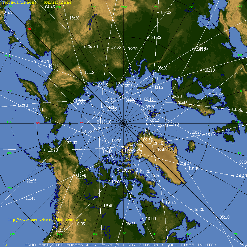
GOES-R IFR Probabilities computed using GOES-15 pixels over Alaska suffer from problems inherent in any Geostationary Data Product at high latitudes: Pixel sizes are large. In addition, ‘limb brightening’ — that is, the shift in a brightness temperature towards cooler values because the path length of photon towards the satellite travels through more of the upper (colder) troposphere (a cooling that is also dependent on wavelength being sensed) — affects the brightness temperature difference product that is used to detect water-based clouds. MODIS data from Terra and Aqua has a much higher spatial resolution and a superior view angle. It’s fairly simple to use both MODIS data to get an idea of conditions in and around Alaska, and then use GOES data to approximate the temporal change. Terra and Aqua view Alaska frequently (link) — it’s uncommon to go more than 6 hours without a view.
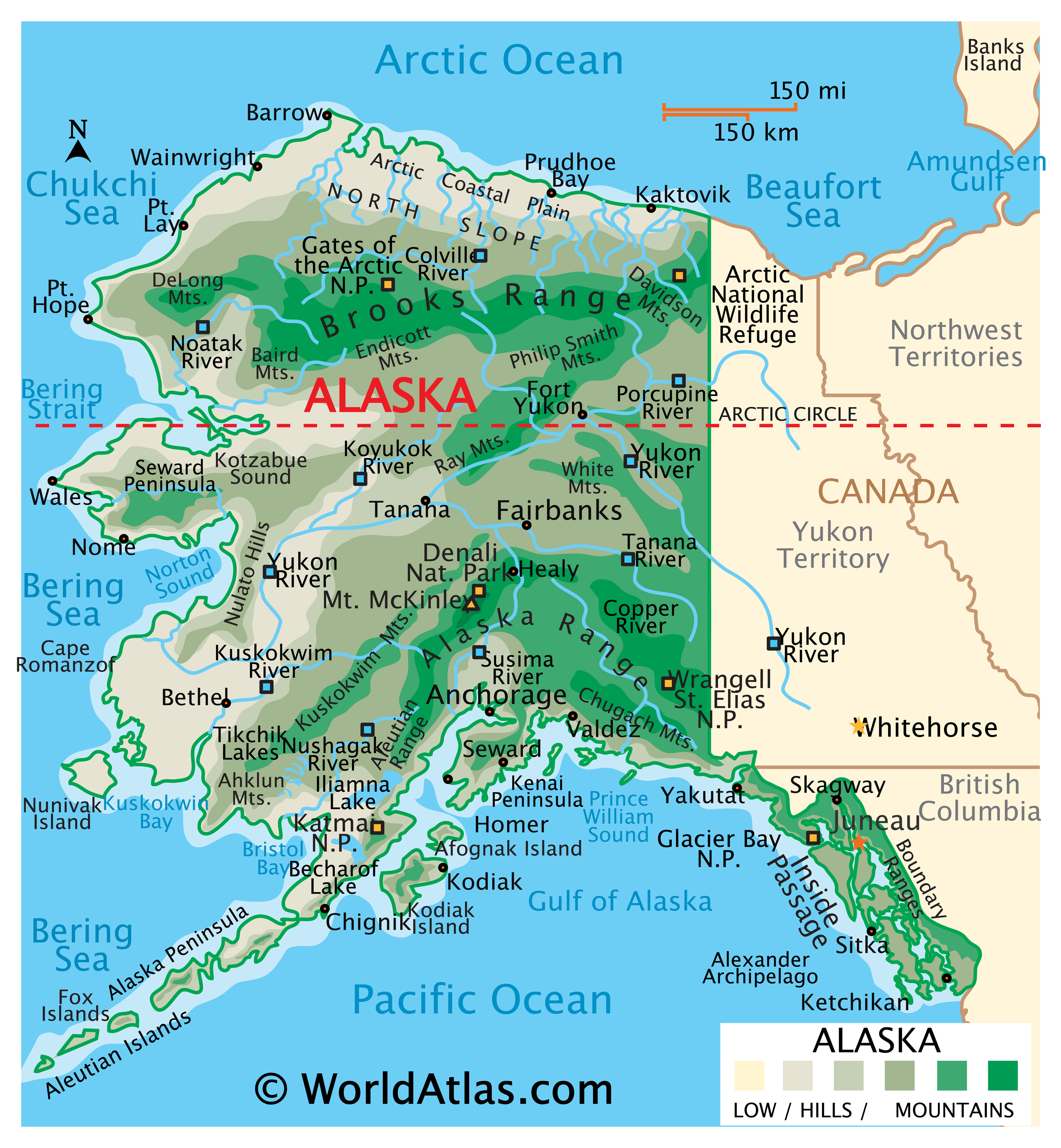
The toggles below show a series of MODIS IFR Probabilities and corresponding GOES-15 IFR Probabilities from late on 8 July 2016 through mid-day on 9 July 2016. From 2100 UTC to 1400 UTC — 17 hours — there are 7 separate MODIS views of Alaska, and they show similar features. For example, the high terrain of the Brooks Range is apparent: larger values of IFR Probabilities are noted there. The same is true over south central Alaska, over the Alaska Range in between Anchorage and Fairbanks. Interpretation of IFR Probability fields over the State require this background knowledge of Topography.
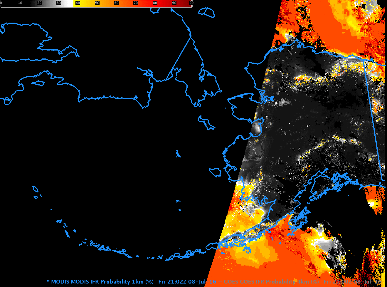
MODIS-based and GOES-15-based GOES-R IFR Probability fields, 2100 UTC on 8 July 2016 (Click to enlarge)
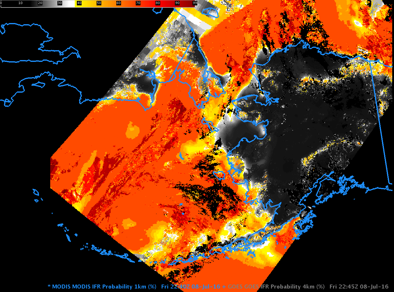
MODIS-based and GOES-15-based GOES-R IFR Probability fields, 2245 UTC on 8 July 2016 (Click to enlarge)
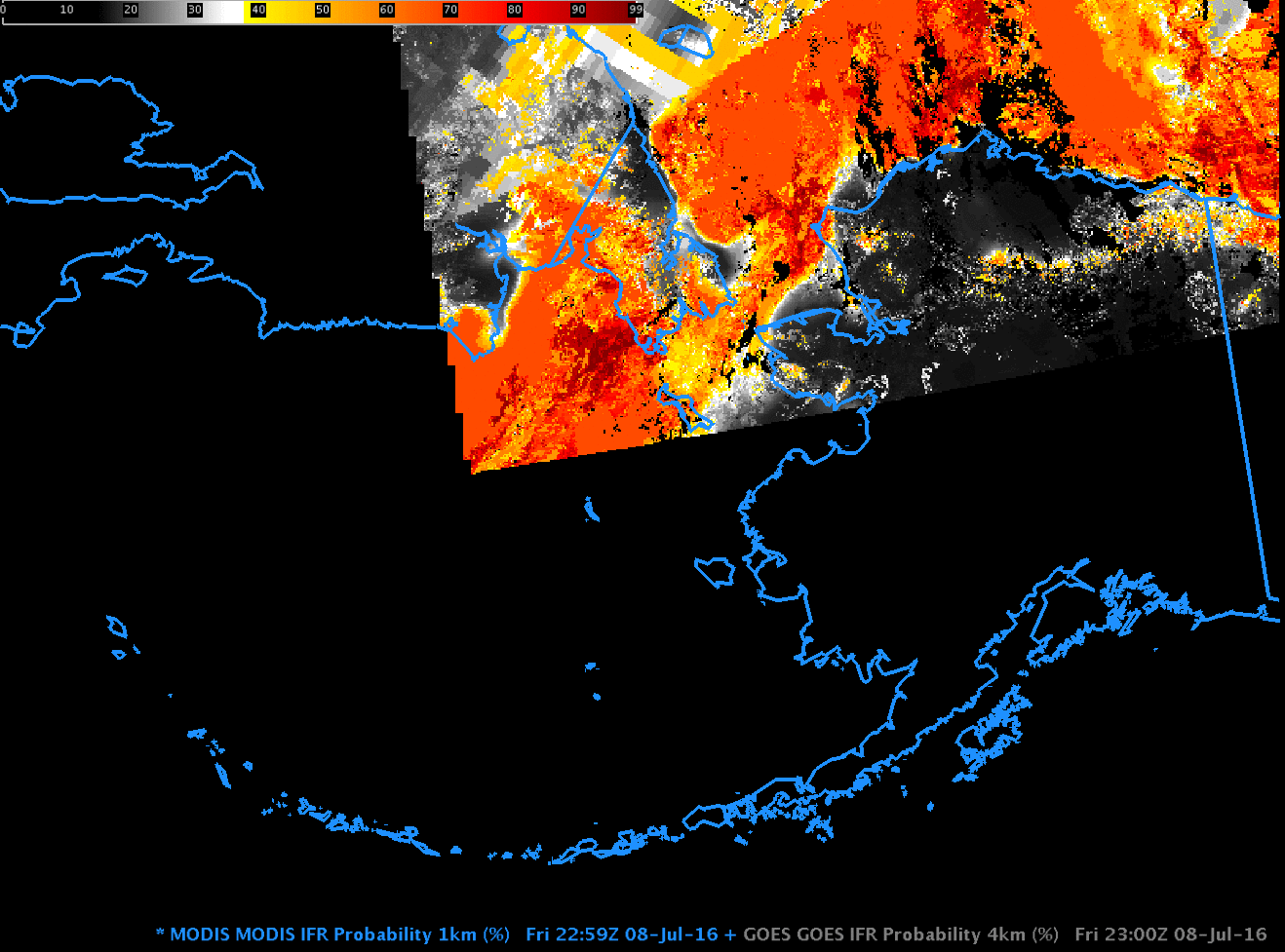
MODIS-based and GOES-15-based GOES-R IFR Probability fields, 2300 UTC on 8 July 2016 (Click to enlarge)
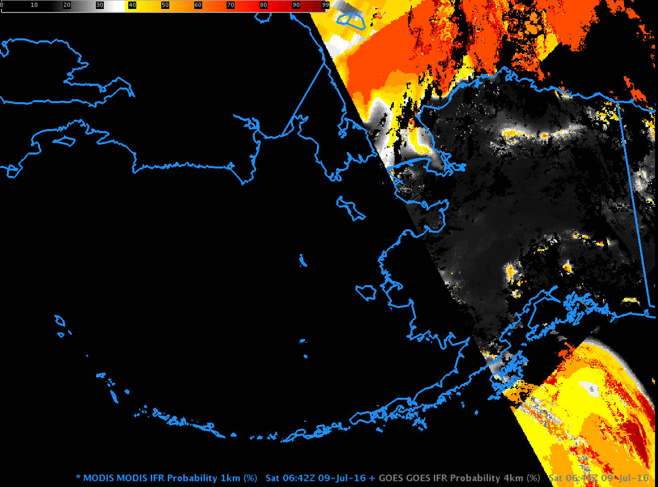
MODIS-based and GOES-15-based GOES-R IFR Probability fields, 0645 UTC on 9 July 2016 (Click to enlarge)

MODIS-based and GOES-15-based GOES-R IFR Probability fields, 0815 UTC on 9 July 2016 (Click to enlarge)
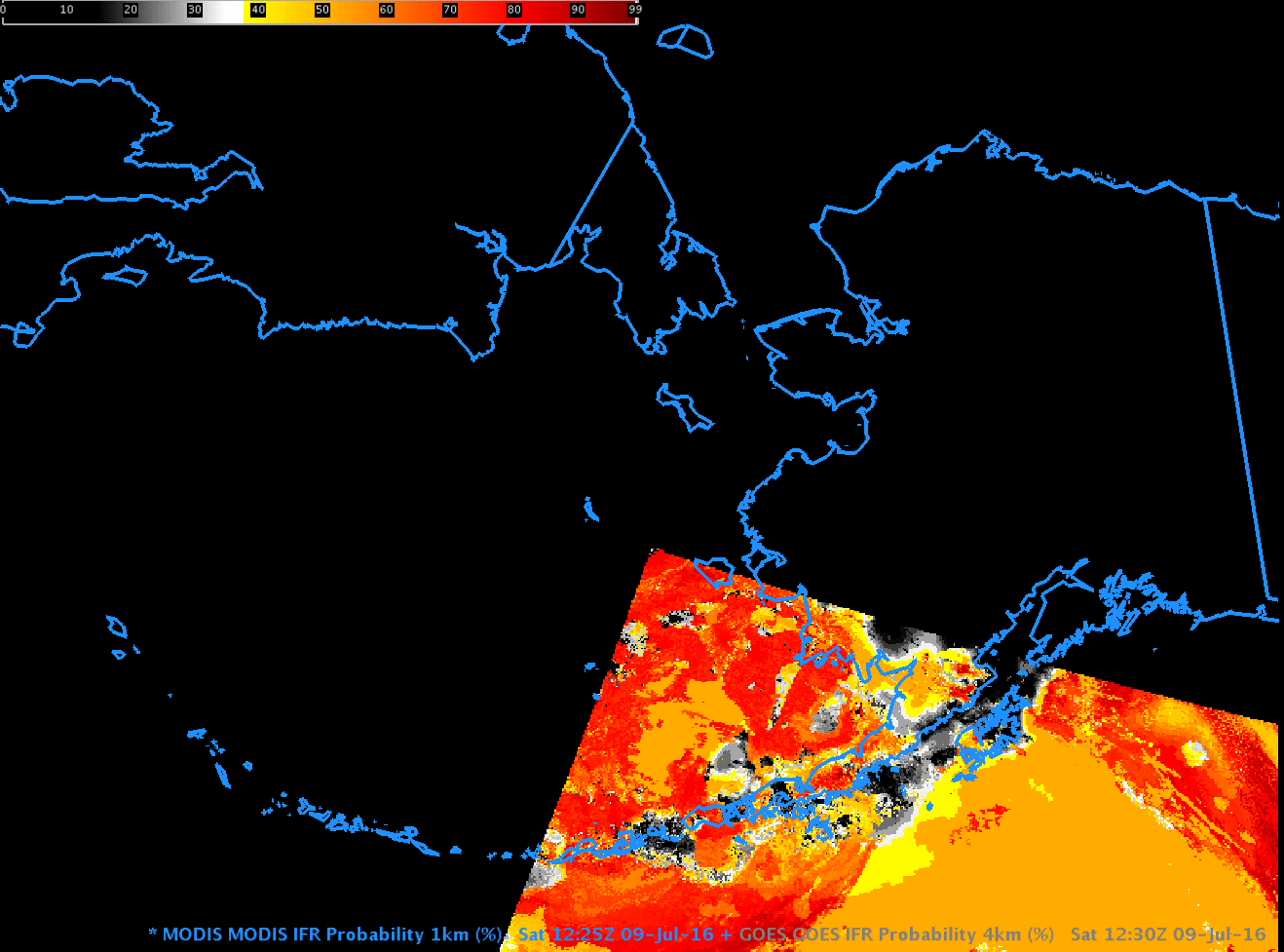
MODIS-based and GOES-15-based GOES-R IFR Probability fields, 1230 UTC on 9 July 2016 (Click to enlarge)
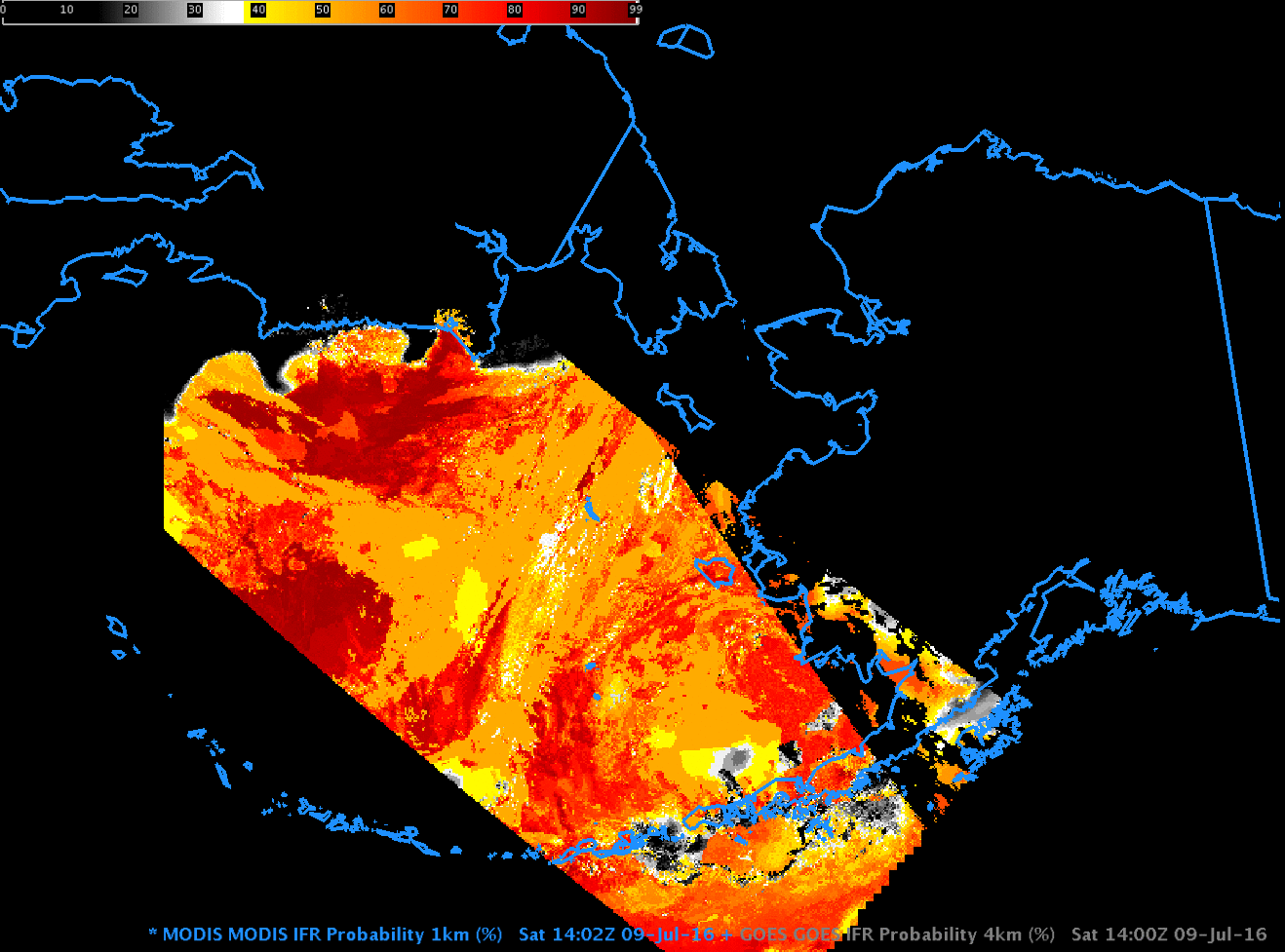
MODIS-based and GOES-15-based GOES-R IFR Probability fields, 1400 UTC on 9 July 2016 (Click to enlarge)
The scenes above suggest that most IFR Conditions near Alaska are offshore during the early morning of 9 July. On 11 July 2016, some of those regions of reduced visibility crept onshore, as shown in the plot below from this site, where surface stations are color-coded by Flight Rules: Red and Magenta denote IFR and Low IFR conditions.
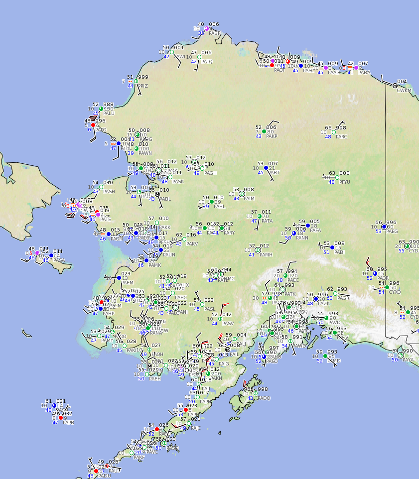
Surface METARS, 1700 UTC on 11 July 2016 (Click to enlarge)
GOES-15-based IFR Probability fields from near that time show high probabilities along the coastline of Alaska. Note that the presence of IFR Conditions can also be deduced from this set of webcams! Consider, for example, this webcam site just west of Prudhoe Bay, in a region where GOES-based IFR Probabilities are high.
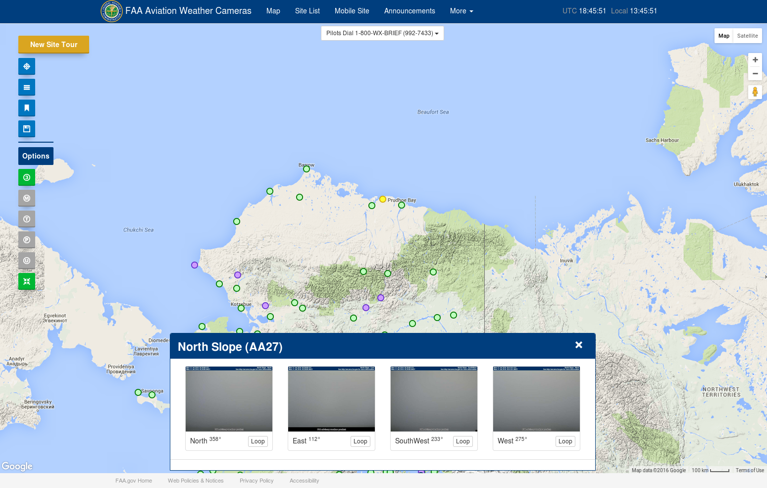
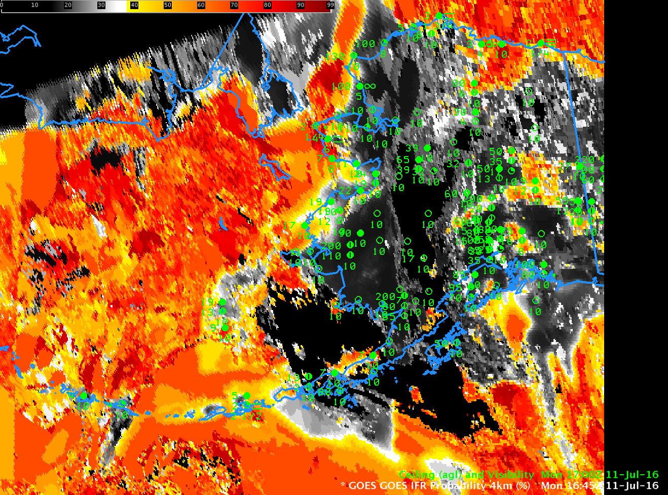
GOES-15-based GOES-R IFR probability fields, 1700 UTC on 11 July 2016, along with surface observations of ceilings and visibilities (Click to enlarge)