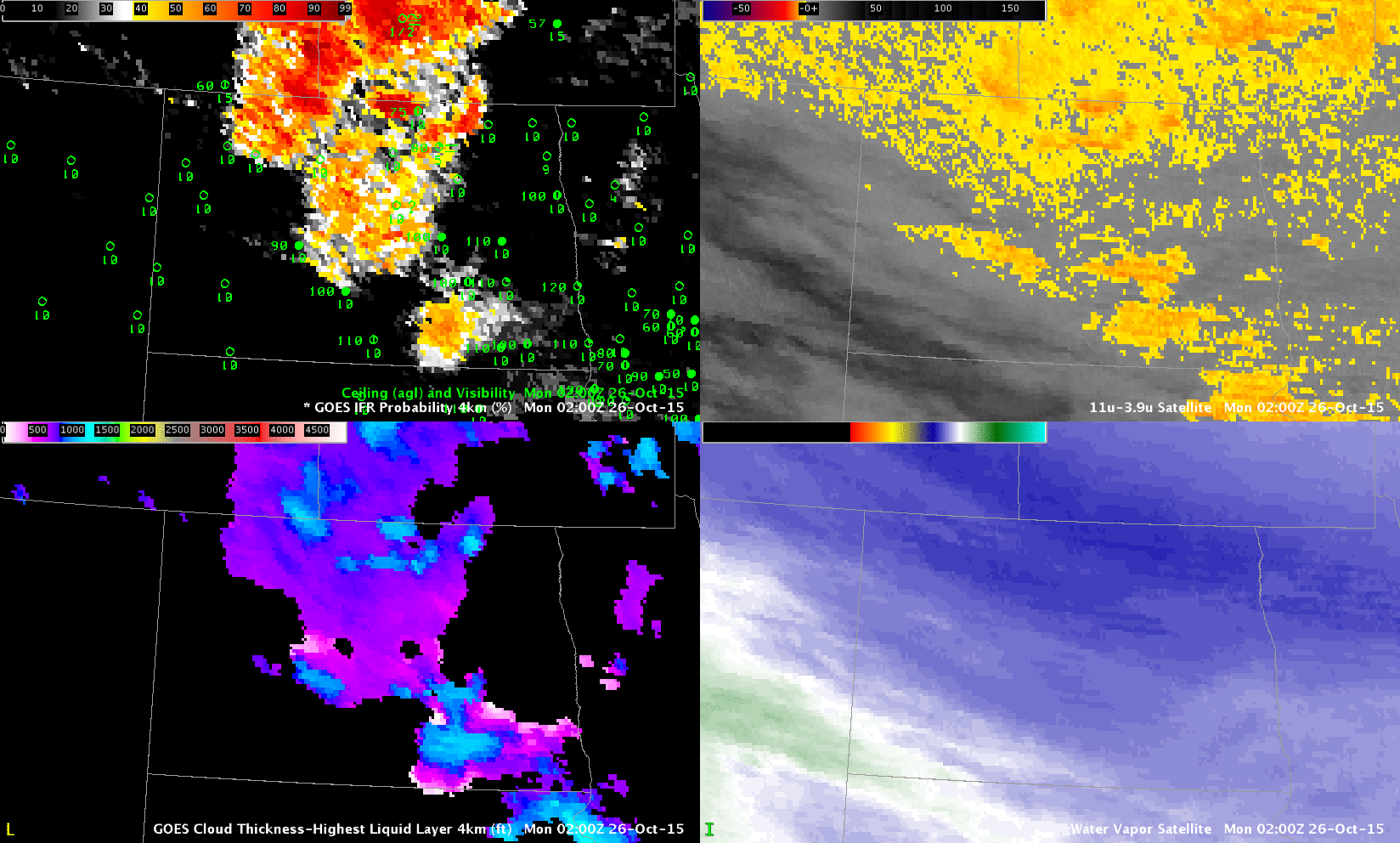
GOES-R IFR Probabilities (Upper Left), GOES-R Cloud Thickness (Lower Left), GOES-13 Brightness Temperature Difference (10.7 µm – 3.9 µm) (Upper Right), GOES-13 Water Vapor Infrared Imagery (6.5 µm) (Lower Right) (Click to enlarge)
Dense fog formed over western North Dakota early in the morning of Monday 26 October (and advisories were issued). At the same time, cirrus clouds overspread the region, making satellite detection of the low clouds problematic. This is an excellent example of the benefits of a fused product that blends surface and near-surface information from numerical models with satellite detection. When one of the products gives no information, the other can be relied upon to fill in gaps.
In the example above, dense fog develops over western North Dakota, complete with freezing drizzle. Satellite detection of the low clouds on this date was difficult because of widespread cirrus that overspread the state; these cirrus are apparent in both the water vapor (lower right) and the brightness temperature difference (upper right). When model data principally are used to compute the IFR Probability fields — in regions where high clouds prevent a satellite view of low clouds — the character of the field is flatter and less pixelated. In addition, where high clouds cannot view low clouds, the Cloud Thickness cannot be computed (as it relates 3.9µm emissivity to cloud thickness). Note that there are regions where the cirrus thins enough that low clouds can be viewed — in these regions the Cloud Thickness is computed an the IFR Probability increases (where both Cloud Predictors and Model Predictors can be used, IFR Probabilities are larger).