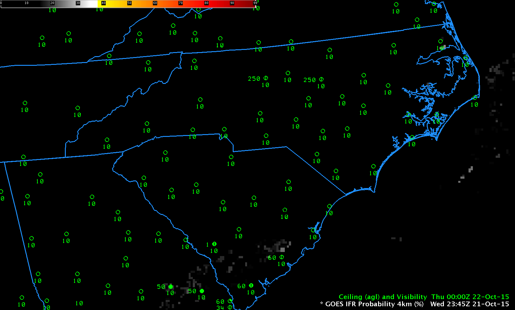
GOES-R IFR Probabilities, hourly from 0000 UTC through 1315 UTC on 22 October 2015 (Click to enlarge)
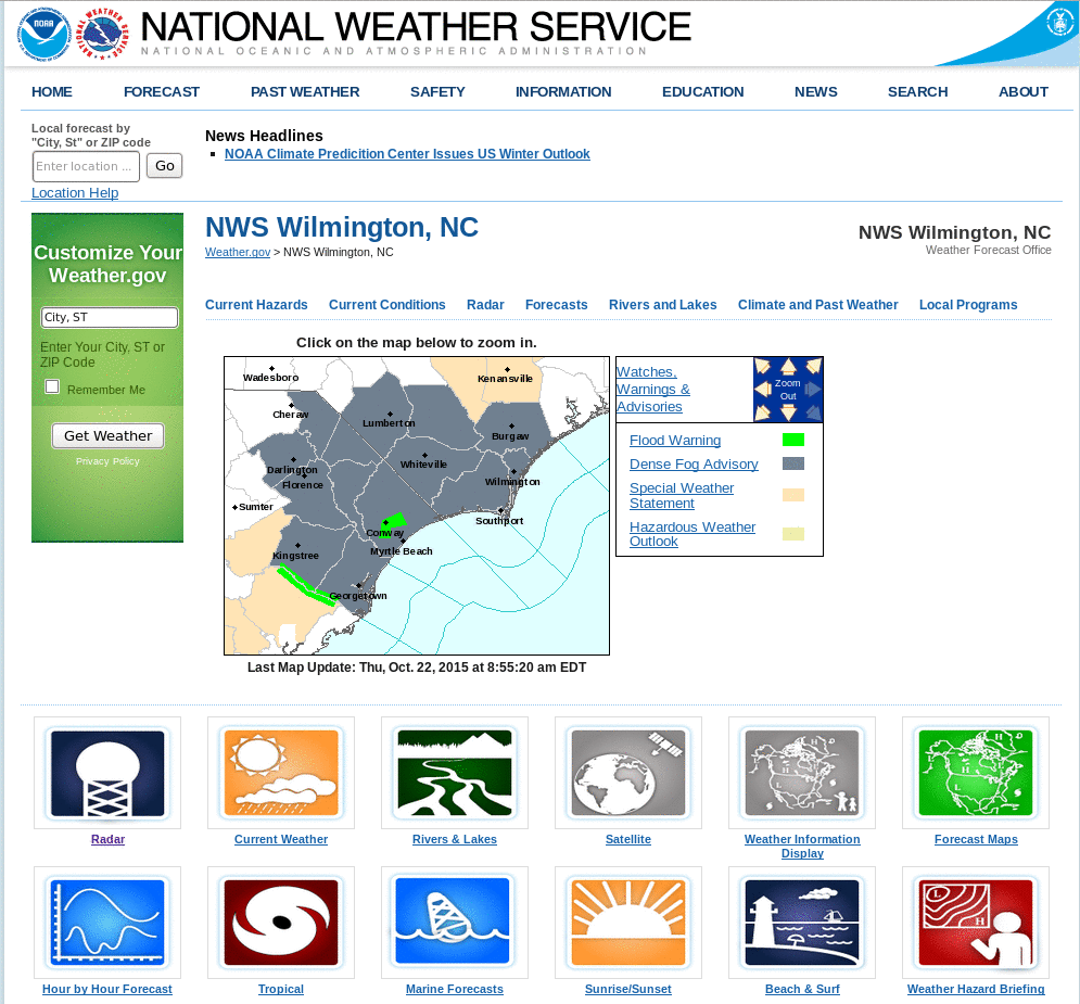
Dense fog developed over South and North Carolina on the morning of 22 October 2015, just inland from the coast (Click here for screenshot from the National Weather Service homepage from Wilmington NC). The animation, above, shows the hourly evolution of the GOES-R IFR Probability fields from just after sunset on the 21st through sunrise on the 22nd. Highest probabilities of IFR Conditions overlap the stations where IFR Conditions occur. GOES-R Cloud Thickness also gives information on where the thickest clouds are; the 1115 UTC Cloud Thickness (the final field before twilight conditions change the 3.9 µm emissivity used to diagnose Cloud Thickness) shows the thickest clouds removed from the coast; compare that region to the regions with fog remaining at 1315 UTC in the animation above. There is good overlap. The maximum cloud thickness in the just-before-sunrise image below is a bit over 1000 feet, in northeastern North Carolina; according to this scatterplot that relates pre-sunrise cloud thickness to dissipation time, fog dissipation should occur within 3 hours, that is by 1415 UTC.

GOES-R Cloud Thickness, 1115 UTC on 22 October (Click to enlarge)
IFR Probabilities have better statistics in outlining regions of dense fog. This is because fog that reduces visibility and low stratus that does not reduce visibility can look very similar to a satellite. IFR Probability fields incorporate near-surface information in the guise of Rapid Refresh model predictions of low-level saturation that better refine regions where low stratus extends down to the ground. There are regions where brightness temperature difference has a fog-like signal with high ceilings/good visibility (central South Carolina, for example). These regions have low IFR Probability values because the Rapid Refresh model does not predict low-level saturation. Fusing satellite and model data yields a better product.
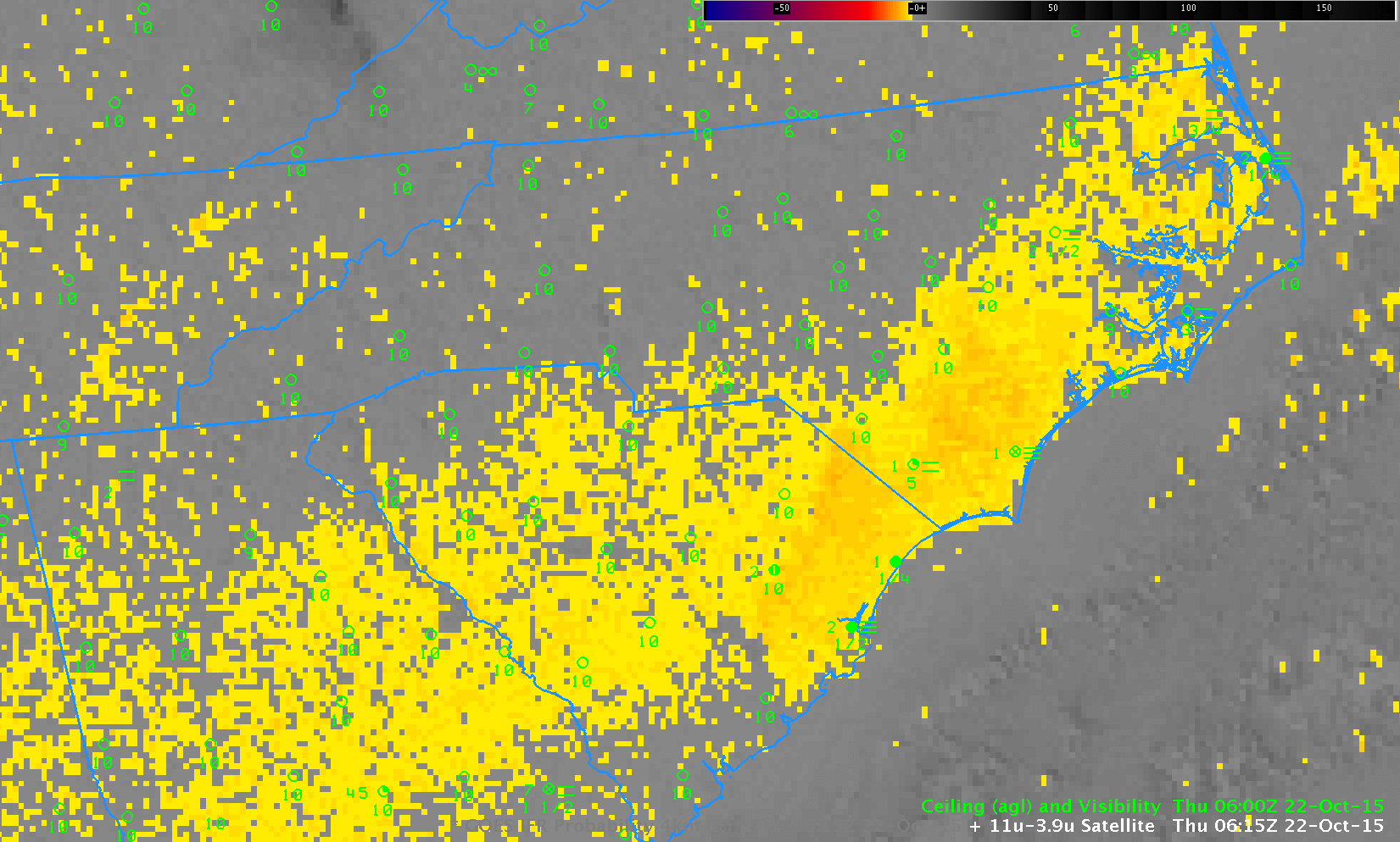
GOES-13 Brightness Temperature Difference (10.7µm – 3.9µm) and IFR Probability fields, 0615 UTC on 22 October 2015 (Click to enlarge)
The visible animation, below, shows that fog dissipated completely shortly after 1430 UTC, in accordance with expectations based on the Cloud Thickness.
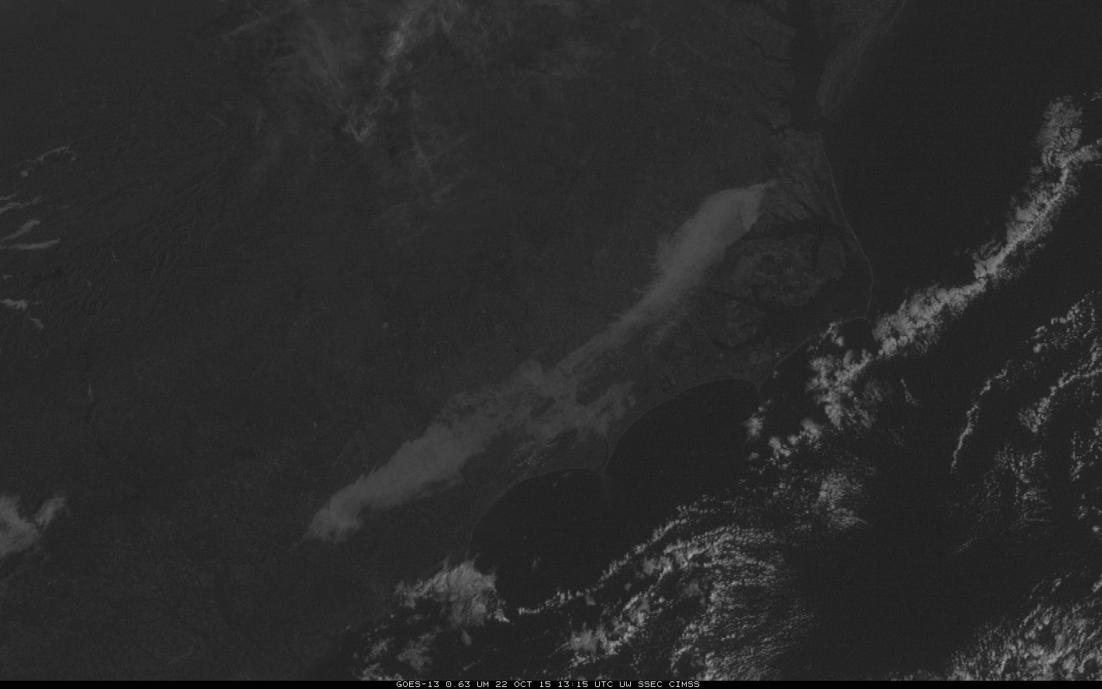
GOES-13 Visible Imagery, 1315 through 1445 UTC on 22 October (Click to enlarge)