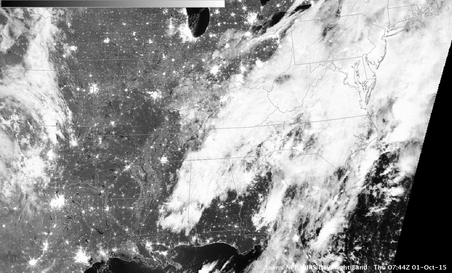
Suomi NPP Day Night Visible (0.70 µm) Image, 0744 UTC on 1 October 2015 (Click to enlarge)
When thick clouds are present, as along the East Coast of the United States early on 1 October 2015, as depicted by the Suomi NPP Day Night band (0.70 µm) image above, satellite detection of low clouds is problematic. This is why GOES-R IFR Probability fields incorporate information from model data so that useful guidance can be produced on whether IFR Conditions exist.
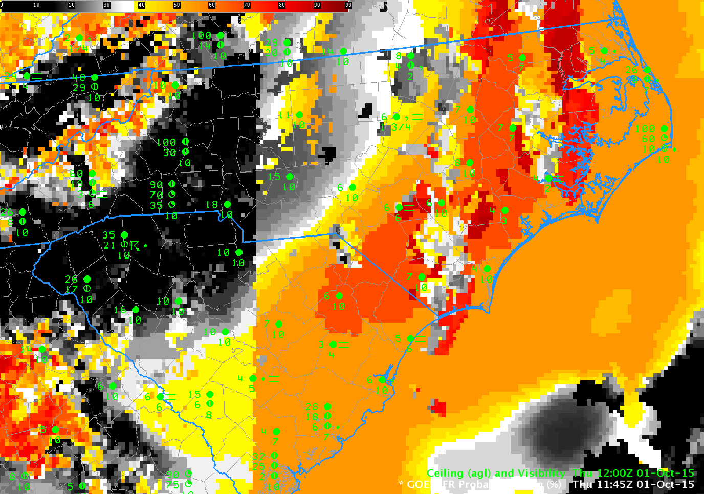
IFR Probabilities increase slowly over coastal South and North Carolina after midnight on 1 October — and the fields do a good job of outlining where IFR Conditions are occurring. In most locations, at most times, the fields are not pixelated. The smooth nature arises when model fields (which are relatively smooth) are used (and satellite data that are more pixelated are not used) to generate the IFR Probability Fields. Some holes in the extensive cloud cover occur over North Carolina during the animation: the IFR Probability field takes on a more pixelated appearance when that happens — and the Probability value increases when satellite data can also be used as a Predictor.
GOES-R IFR Probability fields created with GOES-13 Imager and Rapid Refresh model Data, 0500-1215 UTC on 1 October 2015 (Click to enlarge)
The GOES-R IFR Probability field at 1145 UTC includes a north-south oriented artifact. To the east of the obvious line, day-time predictors are used in the GOES-R IFR Probability computation; to the west, night-time predictors are used. One of the daytime predictors is Visible Imagery that is used to cloud-clear more accurately. The IFR Probability where daytime predictors are used is larger because there is more confidence that a cloud does exist.