 |
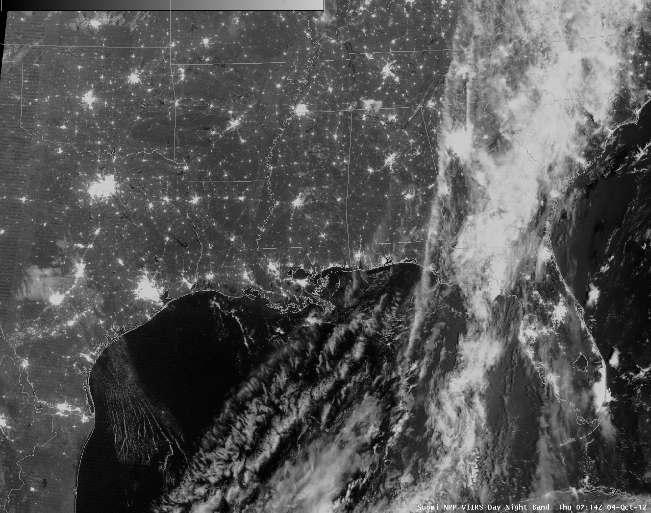
| Day/Night band from VIIRS on Suomi/NPP from 0714 UTC on 4 October 2012 |
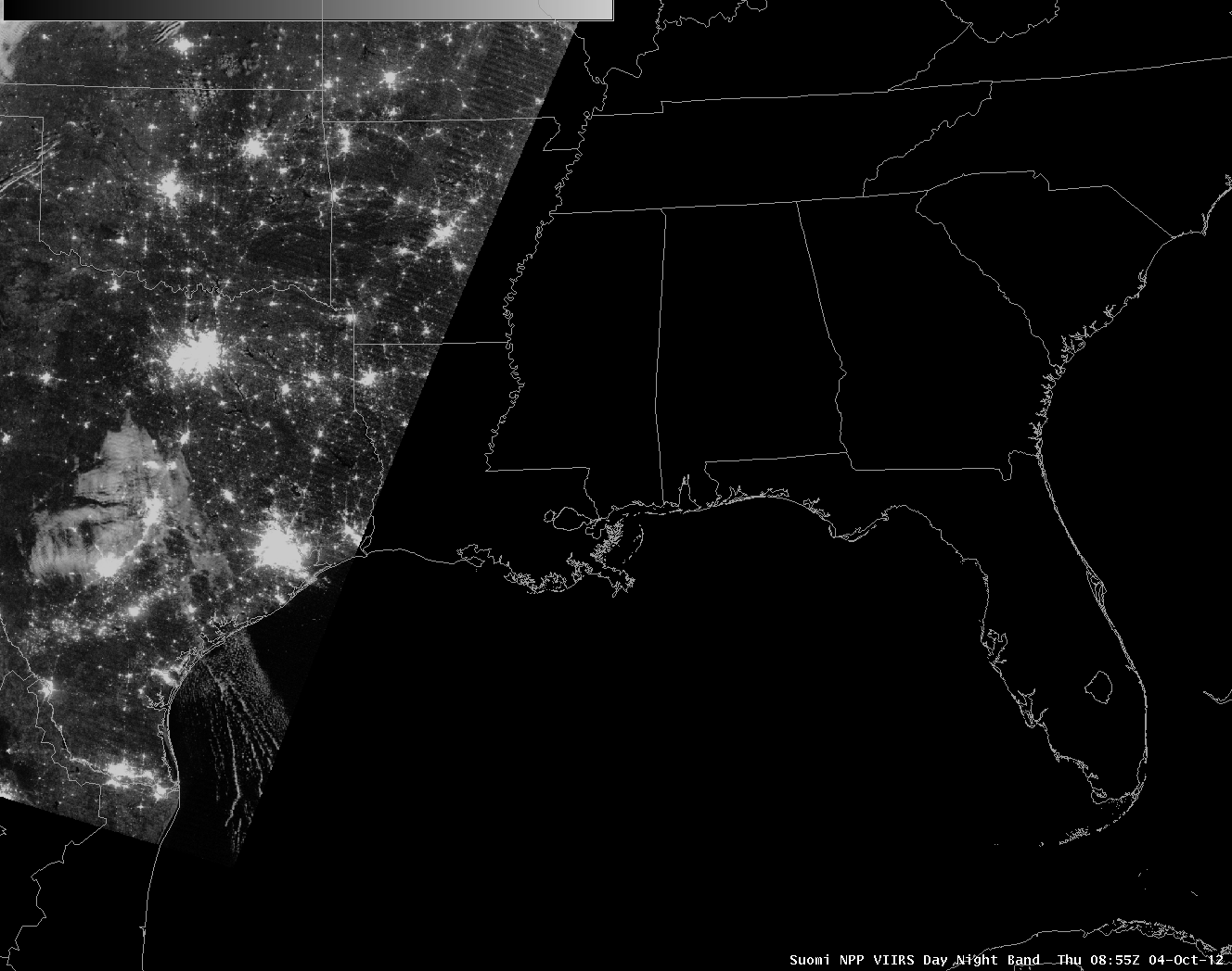
The day/night band imagery, above, shows fog/low clouds in the Hill Country west of San Antonio and Austin in south-central Texas. Additionally, there are low clouds over the Gulf of Mexico, with cloud street structures that suggest a south-southeasterly wind bringing moisture inland from the Gulf. The 0855 UTC day/night band image over the same domain, below, shows an expansion of the fog/low cloud signal.
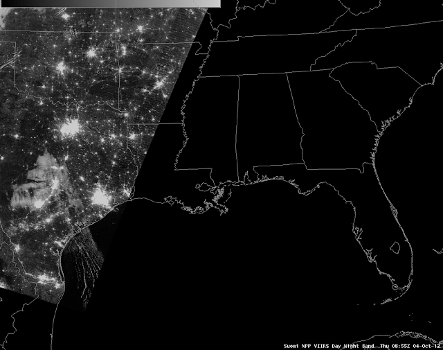 |
| Day/Night band from VIIRS on Suomi/NPP from 0855 UTC on 4 October 2012 |
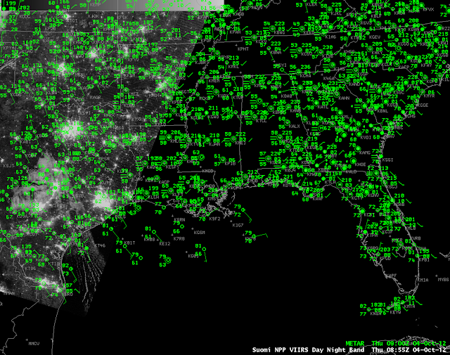 |
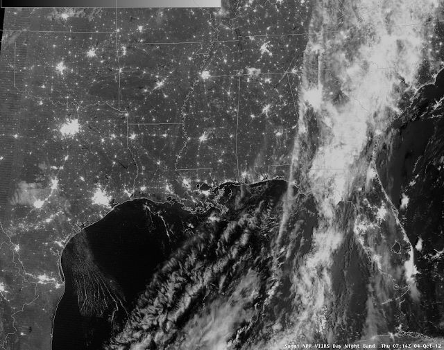
| Day/Night band from Suomi/NPP with observations overlain. |
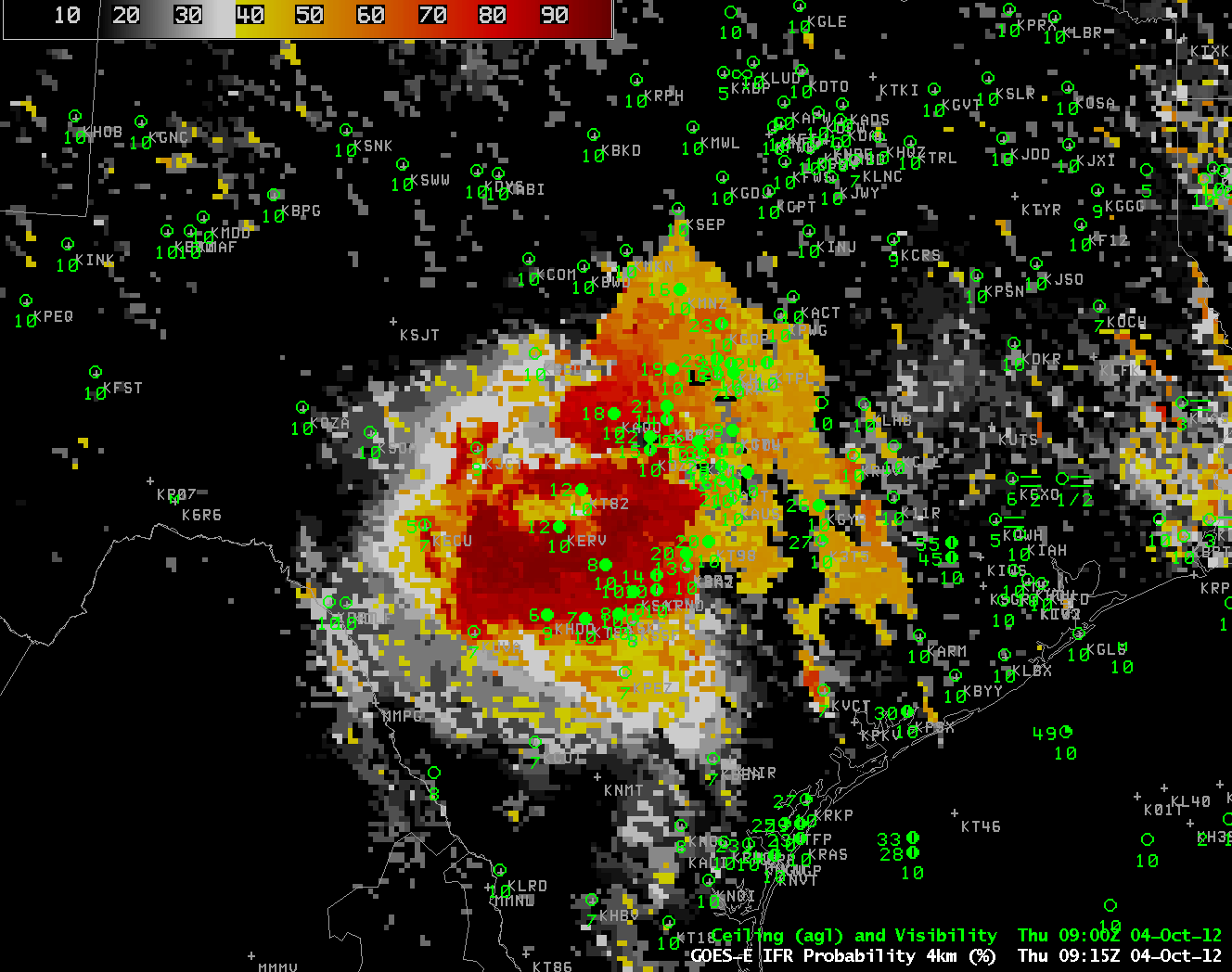
Observations suggest that the northern edge of the cloud streets over the extreme western Gulf of Mexico is the edge of a moisture gradient, and that that gradient extends inland to where the fog and low stratus are occurring. How did the GOES-R IFR Probability field perform on this day? The 0702 UTC (below) and 0915 UTC IFR probability fields show an increas in the areal extent of higher probabilities over the course of the night, consistent with the overnight cooling and the continued feed of moisture from the Gulf. By 0900 UTC, IFR observations are common in and near the region where IFR probabilities are high. This is a good example of how the Day/Night band and IFR Probabilities can be used in concert to understand the evolution of the fog/low stratus field over south Texas.