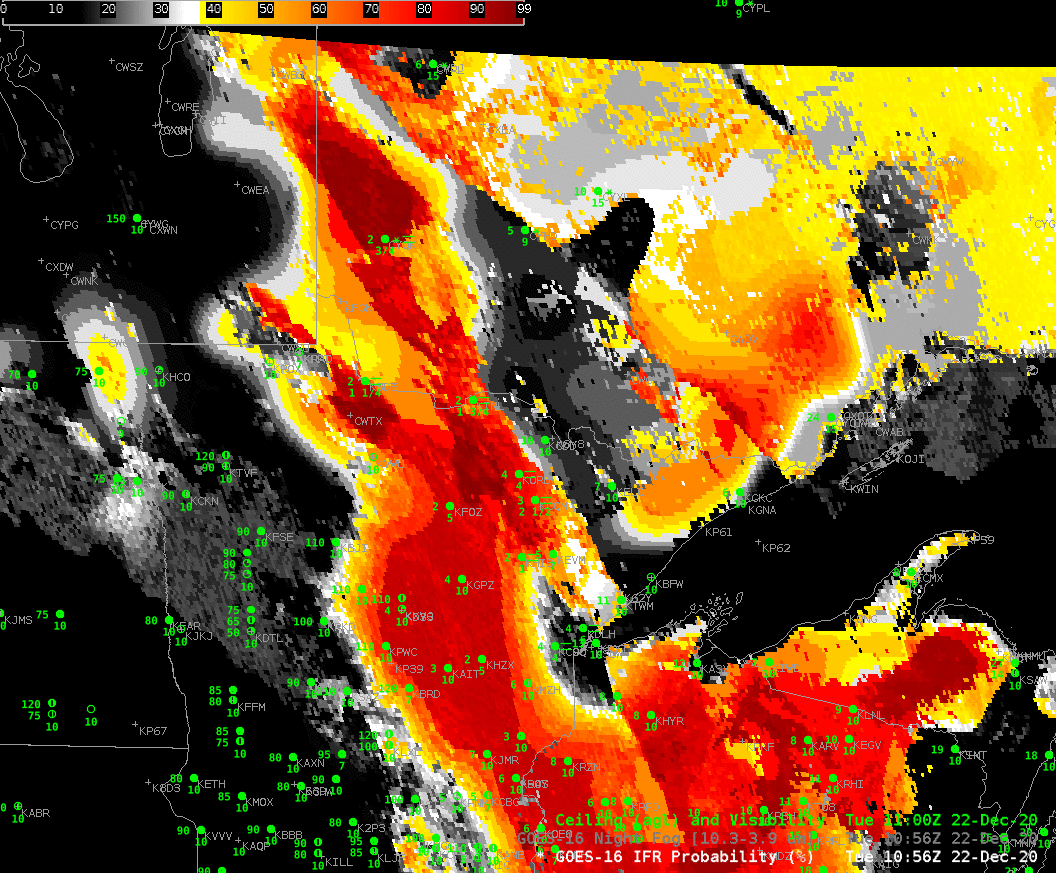
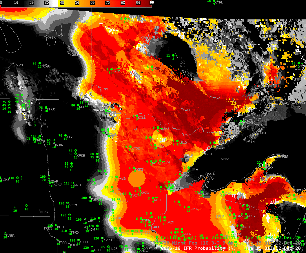
IFR Probability fields from early on 22 December 2020, above, show a region of High Probabilities over northwest Wisconsin, northeastern Minnesota and northwestern Ontario. In general, the observations of IFR conditions (ceilings between 1000 and 3000 feet, visibilities between 1 and 3 miles) match well with the highest IFR Probability. The western edge of the field has characteristics that suggest it becomes more model-defined (in this case, the Rapid Refresh model that supplies the low-level saturation information) with time: the field from western Wisconsin up through Minnesota becomes less and less pixelated with time, as satellite information is lost due to the incursion of higher clouds.
Note also: Lake Superior, warmer than the overlaying atmosphere, is diagnosed as having low probabilities of IFR conditions.
Brightness temperature Difference fields, shown below for the same times, have historically been used to detect low clouds. However, there is little correlation between the fields and the observations of IFR conditions for two principle reasons: Brightness Temperature Difference fields alone do not give information on the cloud base, and IFR conditions require low cloud bases; Higher clouds impede the detection of low-level clouds associated with IFR conditions, and high clouds are overspreading this scene.
The animation below also shows how the Brightness Temperature Difference signal is lost as increasing amounts of solar reflectance become present as the sun rises.
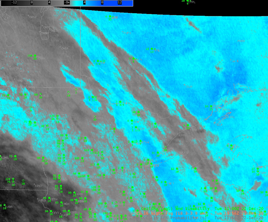
The toggle below shows GOES-16 IFR Probability and the Night Fog Brightness Temperature Difference (10.3 – 3.9) at 1301 UTC, before sunrise. There are significant regions of low clouds/fog over northeastern Minnesota that have little signal in the brightness temperature difference field — but there is a strong signal there in the IFR Probability field.
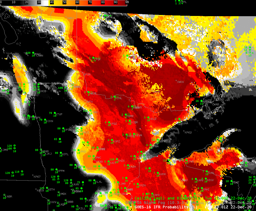
By 1501 UTC, below, when the sun is above the horizon, reflected solar radiation means that the Night Fog Brightness Temperature Difference default enhancement is no longer appropriate to detect low clouds. However, IFR Probability continues to outline regions of low clouds and fog.
GOES-R IFR Probability fields blend the strengths of satellite detection of clouds with the strengths of model detection of low-level saturation. In regions of high clouds, where the satellite cannot view low clouds (over northwest Wisconsin, for example), model data nevertheless gives a useful signal. Note also the lower IFR Probabilities over Ontario where low clouds are prevalent. Here, model data allows IFR probabilities to screen out regions of elevated stratus, which clouds are not so important as far as surface visibility restrictions go.