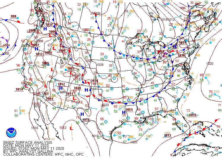
Frontal passage with extratropical cyclones will frequently be accompanied by low ceilings and reduced visibilities, that is, IFR conditions. A loop of visible imagery, above, suggests a surface cyclone (surface analyses are shown below) but it is difficult to determine from the imagery where low ceilings and reduced visibilities are present.
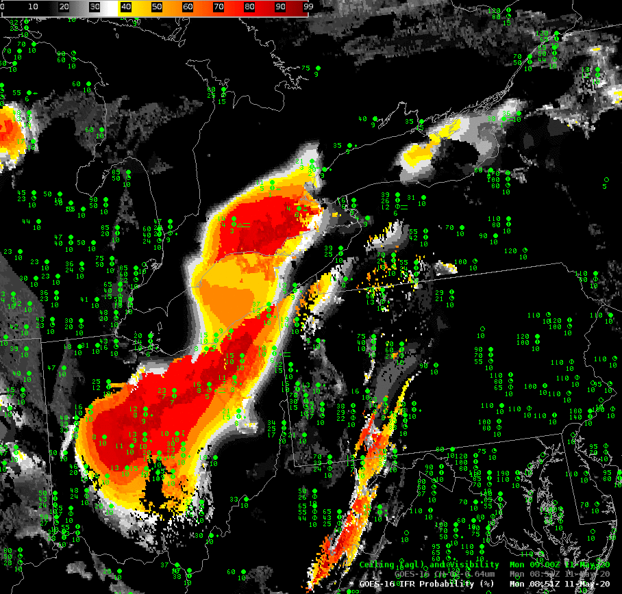
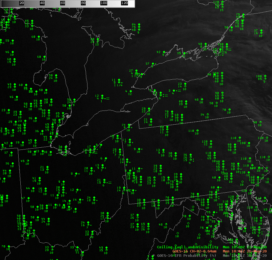
IFR Probabilities, shown below, reveal a region of higher probabilities (overlapping nicely with a region of low ceilings and reduced visibilities) initially over Ohio and then shifting northeastward in to the lakeshore counties of Erie and New York. The region gradually shrinks with time. IFR Probabilities are also enhanced over the Laurel Highlands of Pennsylvania southwestward into West Virginia, a common occurrence with westerly flow.
IFR Probabilities combine the strengths of satellite cloud detection with the Rapid Refresh model strength of low-level prediction of saturation. Where those two positive predictors align, IFR Probabilities will be elevated and can be valuable in outlining where aviation hazards might occur, more valuable than the individual satellite images.