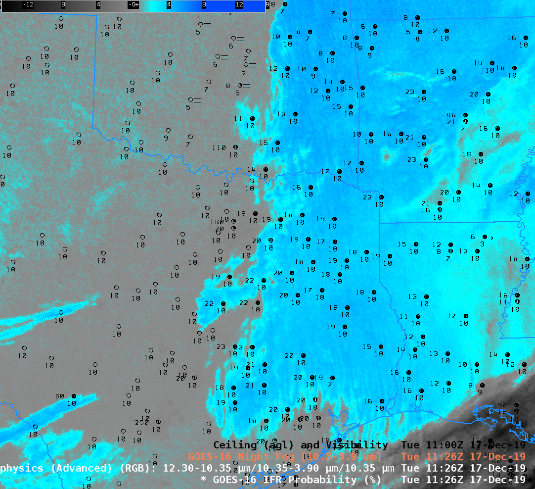
Fog and low clouds were widespread over the eastern half of the United States on 17 December 2019. In this example over ArklLaTex the Brightness Temperature Difference suggests low stratus clouds over the region, and the Nighttime Microphysics shows a signal congruent with low clouds. Note, however, that observations over much of the region do not suggest IFR conditions are present. Accordingly, IFR Probability shows fairly low probabilities in this region, with values increasing to the north where visibilities decrease. IFR Probability fields screen out regions of elevated stratus because the Rapid Refresh model in this region does not suggest low-level saturation. Over northeast Oklahoma and northwest Arkansas, however, saturation at low levels is more likely and IFR Probabilities there are larger.
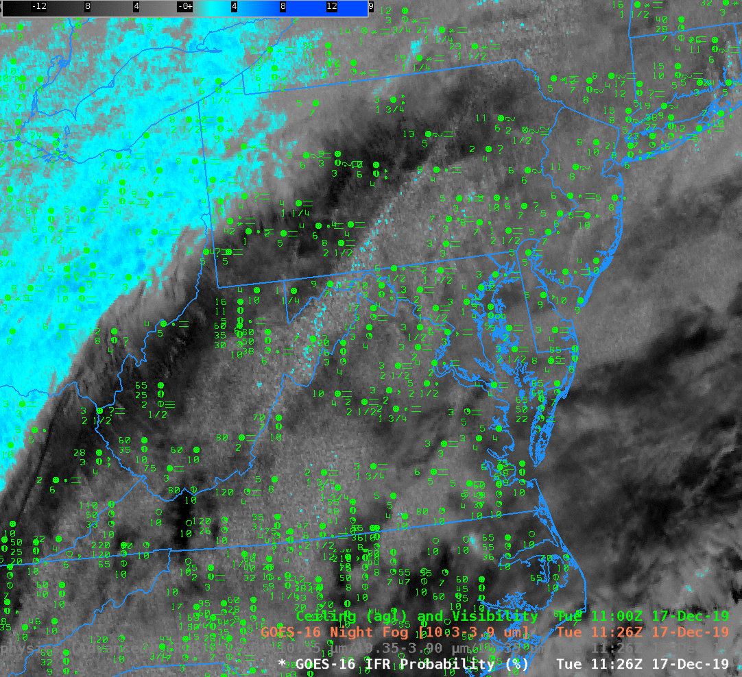
At the same time, high clouds overspread most of the east coast as a storm moved through the area. The high clouds prevent the satellite from seeing low clouds, so both the Brightness Temperature Difference and the Nighttime Microphysics RGB will not have a signal that comports with low stratus detection. However, IFR Probability includes a signal from the Rapid Refresh model if that model shows low-layer saturation in a region of multiple cloud layers; IFR Probability has a strong signal on this date over the east coast were clouds and fog are widespread. IFR Probability also shows IFR Conditions under the low clouds that the satellite does detect over eastern Ohio, and correctly notes the a region of higher ceilings over West Virginia, western Virginia and eastern Tennessee.
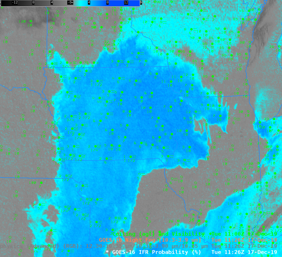
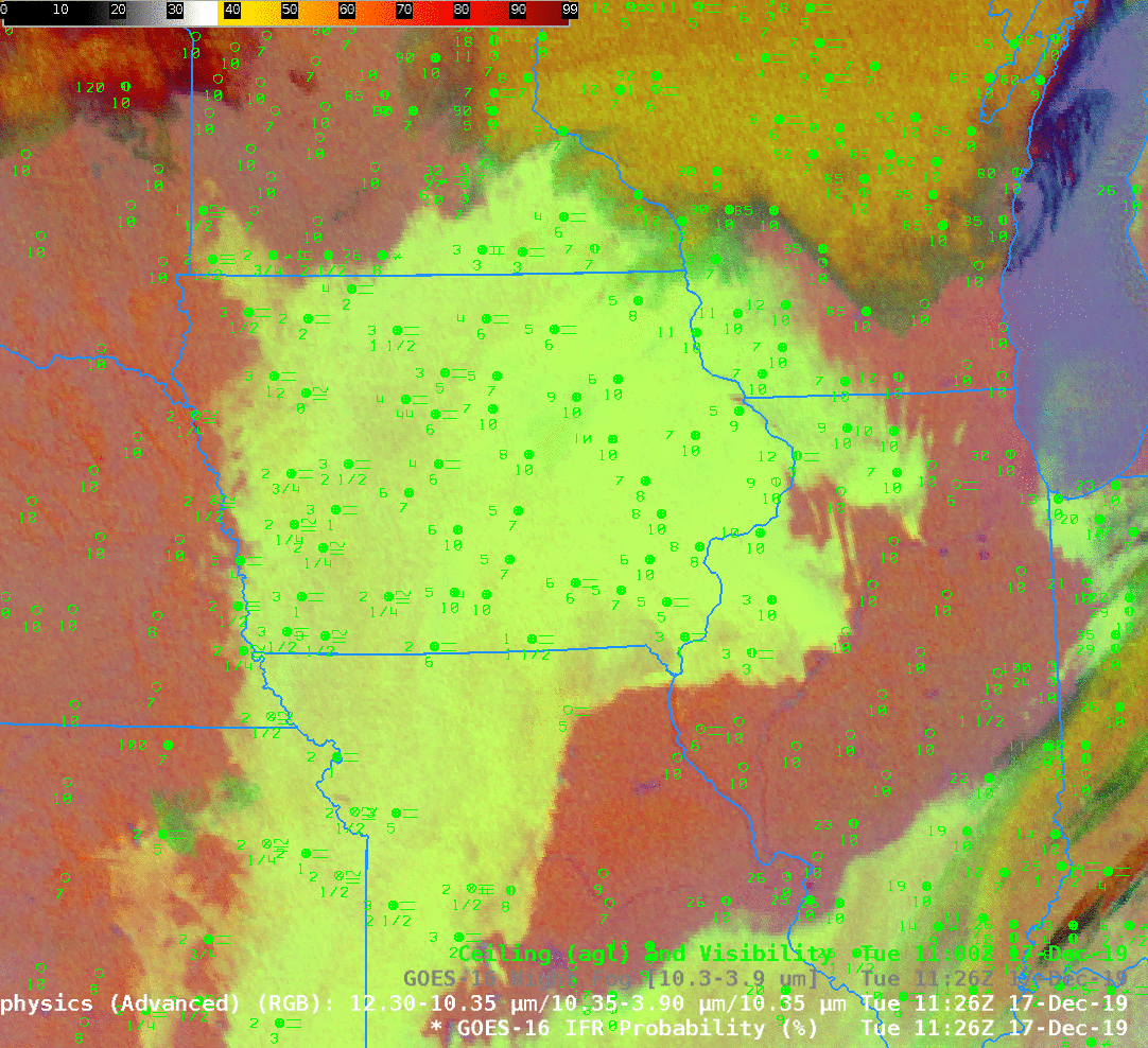
When high clouds are not present, there are different equally good ways to estimate low clouds, and that’s shown above. The Brightness Temperature Difference fields, the Nighttime RGB and the IFR Probability fields all tell a similar tale: Much of Iowa and regions to the south and northeast have low ceilings and reduced visibility.
Careful observers to the toggle note that the RGB has a different color over Wisconsin compared to Iowa. In part this is because the Brightness Temperature Field has values that are smaller over Wisconsin. A bigger driver of the color difference, however, is the 10.3 µm brightness temperature — the blue component of the Nighttime Microphysics RGB. Values are around -25º C over Wisconsin, and closer to -10º C over Iowa!