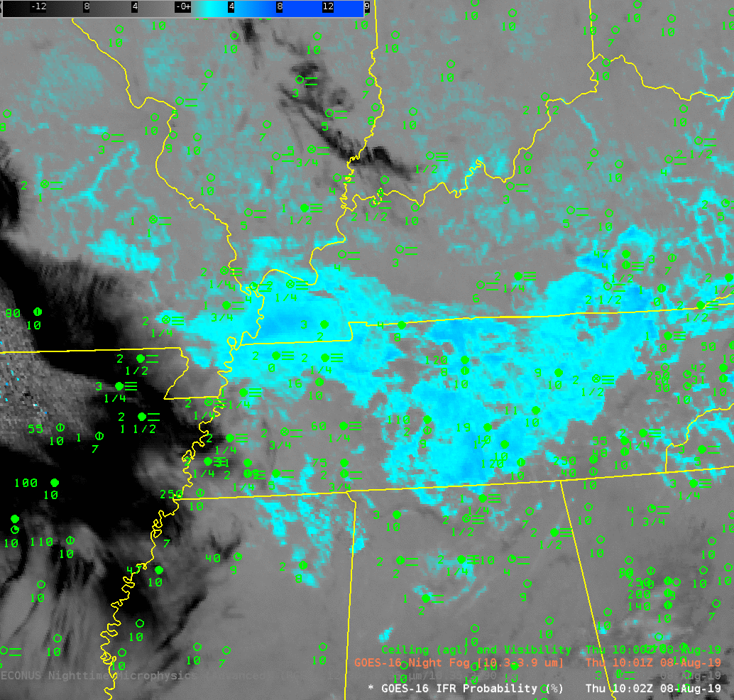
GOES-R IFR Probability, 1002 UTC on 8 August 2019, along with surface reports of ceilings and visibility (Click to enlarge)
GOES-R IFR Probability fields from 1002 UTC on 8 August 2019, above, show a region of high probabilities mostly colocated with surface observations of ceilings and visibilities. IFR conditions are widespread from north of Memphis TN to southern Illinois. IFR Probability is a fused product, using both satellite imagery to detect low clouds and Rapid Refresh model data to identify regions of low-level saturation. Where both indicators are present (for example, over extreme western Kentucky and adjacent regions of southern Illinois and northwest Tennessee), IFR Probabilities are very high and IFR conditions are observed. There are also regions where only model data can be used — because satellites are not detecting low clouds (because high clouds are blocking the view); such a case is over northwest Arkansas, where IFR Probabilities are high (albeit not as high as over western Kentucky) and the field is not pixelated like a satellite image can be. IFR Conditions are observed there as well. (Click here for a screen shot from later in the morning of the Paducah National Weather Service office front page showing Dense Fog Advisories in Tennessee, issued by the Memphis Forecast Office).
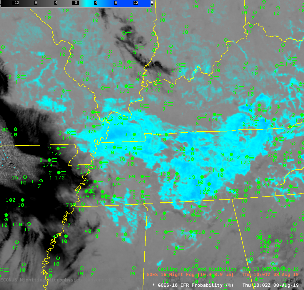
The toggle below compares the IFR Probability field with the GOES-16 ‘Night Fog’ brightness temperature difference. There is no consistent signal in the brightness temperature difference field to indicate fog on the ground. The color enhancement for the brightness temperature difference is created so that teal to blue is positive. Clouds made of liquid water droplets — such as stratus, or fog — will have a strong positive value because of the emissivity properties of small water droplets. (That is, those droplets emit 10.3 µm radiation mostly as a blackbody would, but do not emit 3.9 µm radiation as a blackbody would). Note in particular the very dark enhancement over northwest Arkansas (suggestive of cirrus there that will block any satellite view of low clouds) and the grey enhancement over west central Tennessee, north of Memphis, where mid-level clouds are similarly blocking a good view of the stratus at the surface.
GOES-16 IFR Probability and GOES-16 ‘Night Fog’ Brightness Temperature Difference field (10.3 µm – 3.9 µm) at 1002 UTC on 8 August 2019 (Click to enlarge)
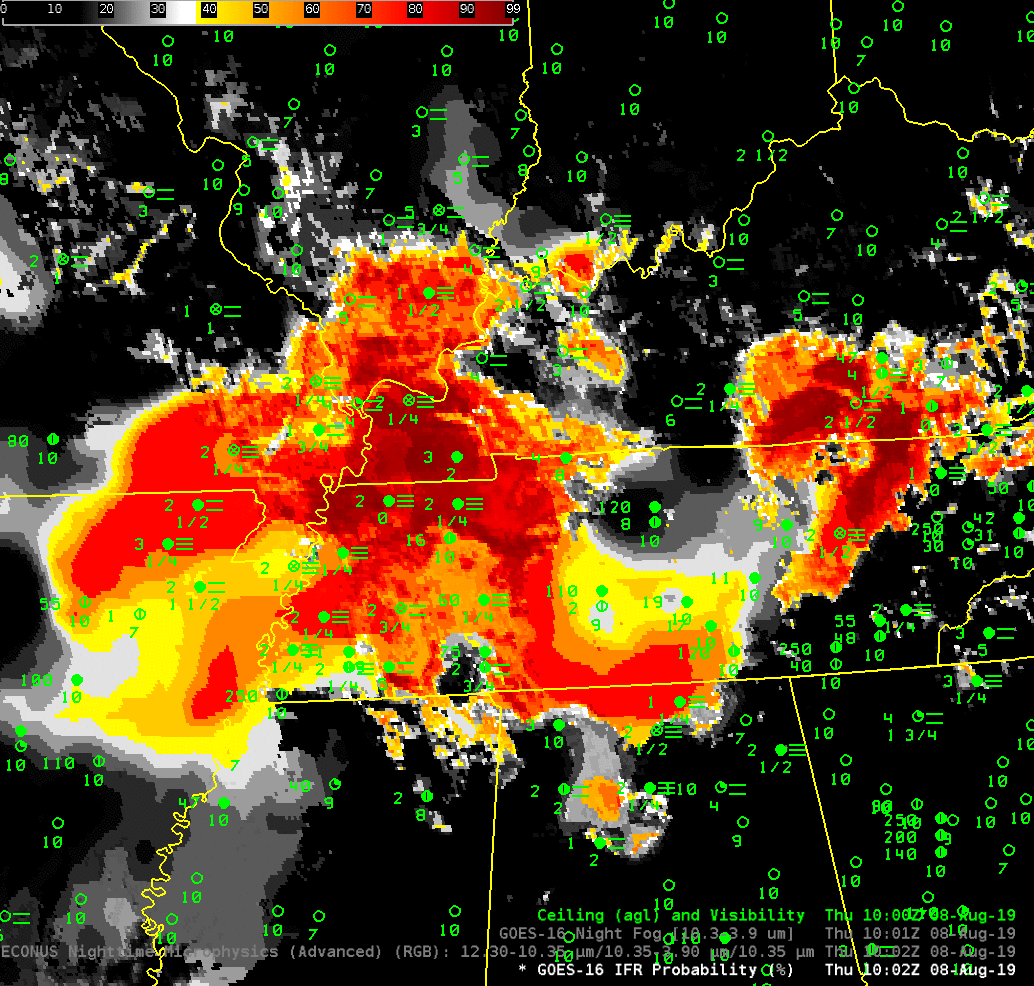
The Nighttime Microphysics RGB can also be used to alert forecasters to fog — but a main component of that detection is the Night Fog brightness temperature difference field, and where the Night Fog brightness temperature difference fails to identify fog, as above, Nighttime Microphysics will as well, as shown in the toggle below. Which color is useful for identifying fog in the RGB below? Almost all of them!