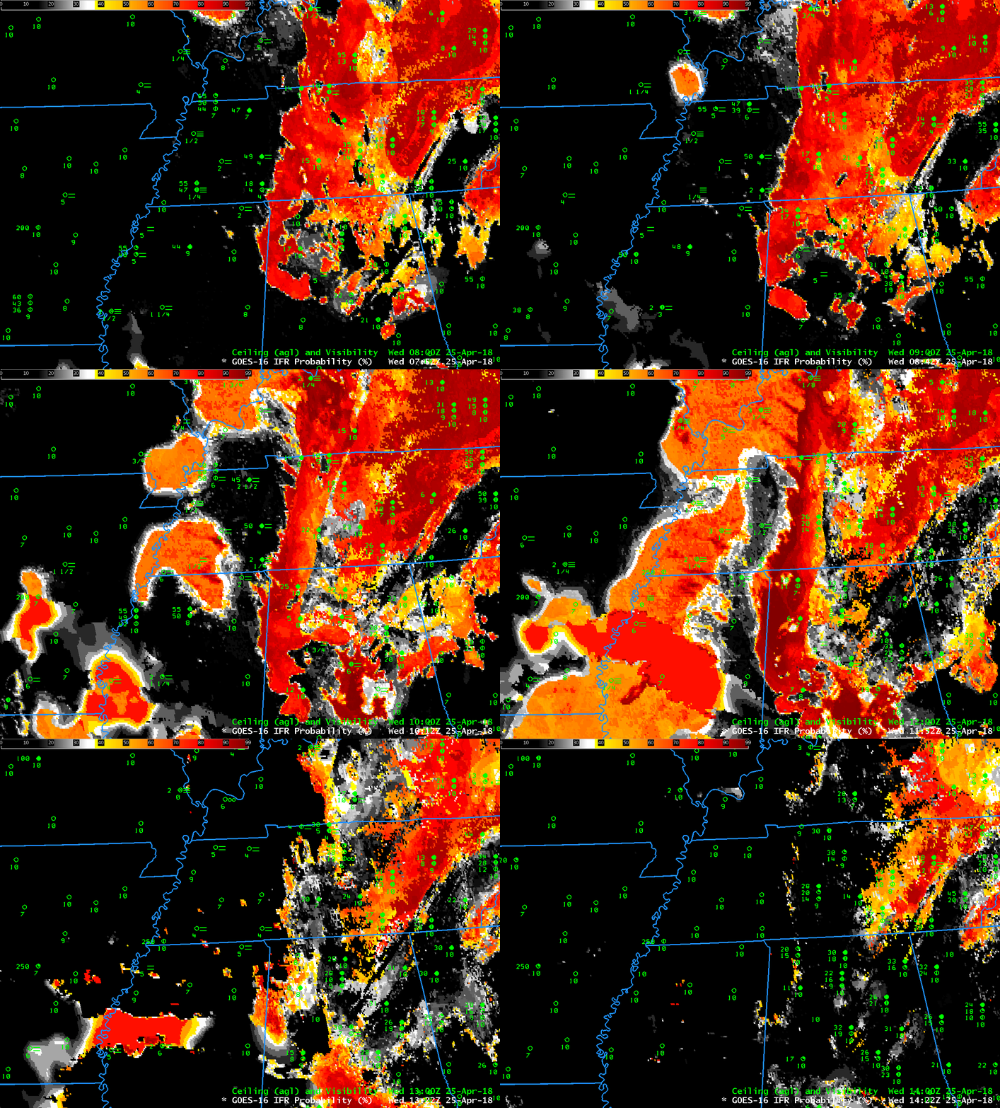
GOES-16 IFR Probability fields with a 10-minute time step from 0752-1422 UTC on 25 April 2018 (Click to enlarge)
Dense Fog developed over the mid-south on April 25th, and Dense Fog Advisories were issued by the National Weather Service Forecast Office in Memphis for portions of western Tennessee and northern Mississippi. GOES-16 IFR Probability fields above, show the development of strong signal in IFR Probability over western Tennessee starting after 0900 UTC. The satellite signal for this event was weak (see below); the sudden appearance of an IFR Probability signal at 0900 UTC suggests that the Rapid Refresh model simulation quickly changed from insufficient saturation for a strong signal to a better signal of fog when the model simulation valid at 0900 UTC was used. When IFR Probabilities suddenly change absent a big change in satellite signal, the cause is likely a change in the Rapid Refresh model output.
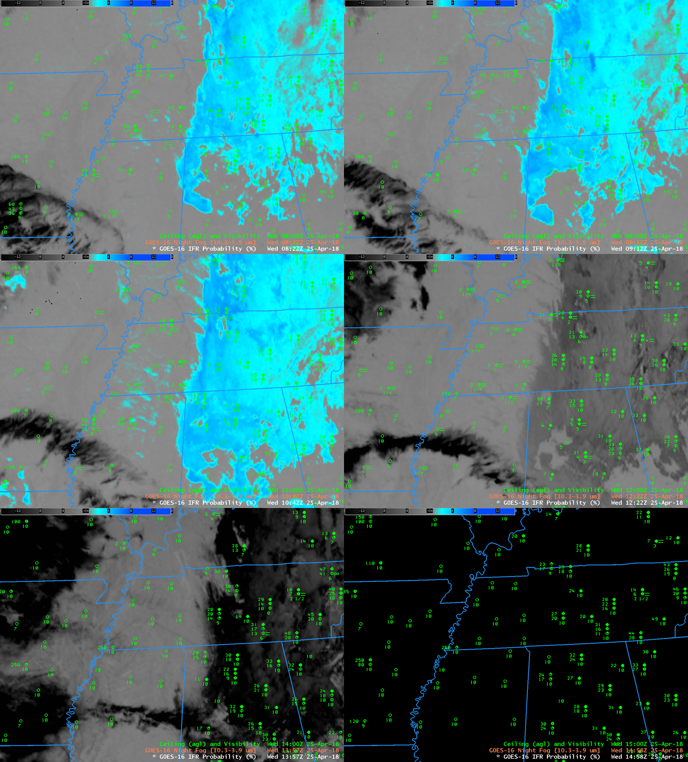
Night fog Brightness temperature difference, below, shows a weak signal over river valleys of western Tennessee and northwestern Mississippi.

GOES-16 Night Fog Brightness Temperature Difference (10.3 µm – 3.9µm) 0822-1452 UTC on 25 April 2018 (Click to enlarge)
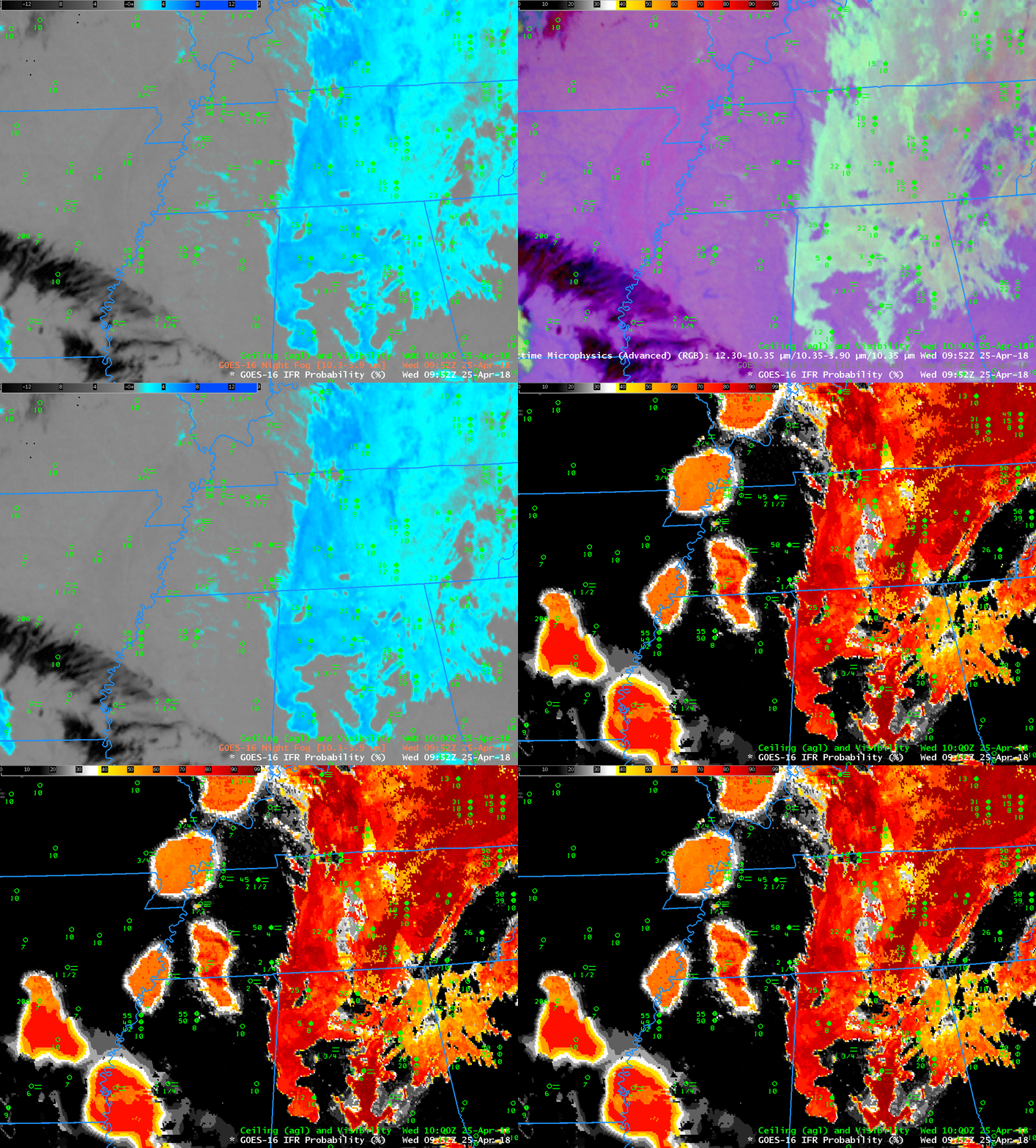
Because the signal in the brighntess temperature difference field is weak, the signal for fog in the Nighttime Microphysics RGB (which has as its green component the Night Fog Brightness Temperature Difference) is also weak. The toggle below shows the Night Fog Brightness Temperature Difference, the RGB, and the IFR Probability fields, all at 0952 UTC on 25 April.

