GOES-16 data posted on this page are preliminary, non-operational and are undergoing testing
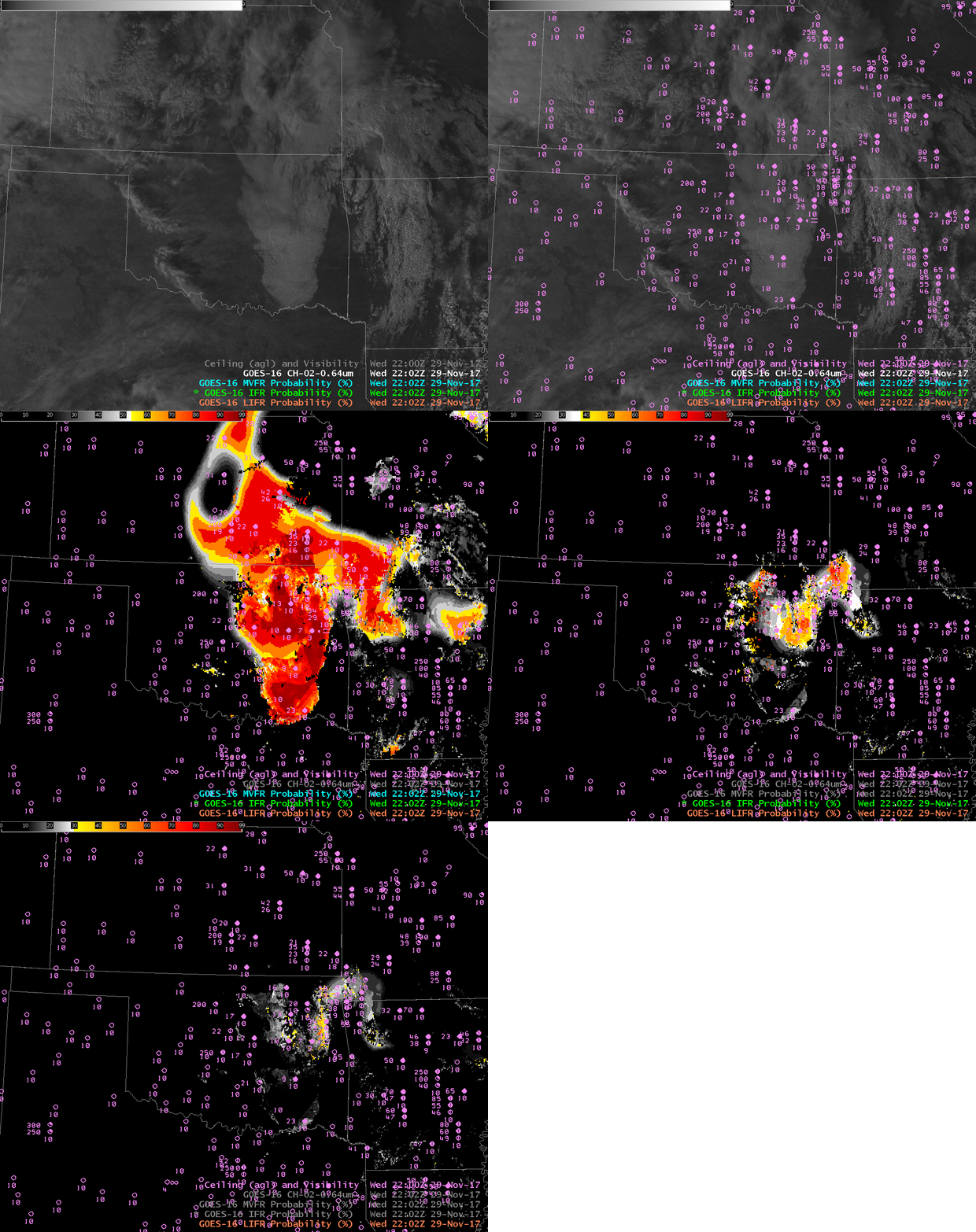
GOES-16 IFR Probabilities can now be displayed in AWIPS. This site has included the product for several months now. The imagery above, however, is from AWIPS, showing a toggle between Visible GOES-16 Imagery (with and without observations of ceiling heights and visibilities), MVFR (Marginal Visible Flight Rules) Probabilities, IFR (Instrument Flight Rules) Probabilities and LIFR (Low Instrument Flight Rules) Probabilities. GOES-16 IFR Probability fields are Bayesian and have been trained using about 2 months’ worth of GOES-16 Data. The LDM data feed will be providing data once GOES-16 Data are flowing again, sometime between 14 December and 20 December, when GOES-16 is on station at 75.2 º W Longitude.
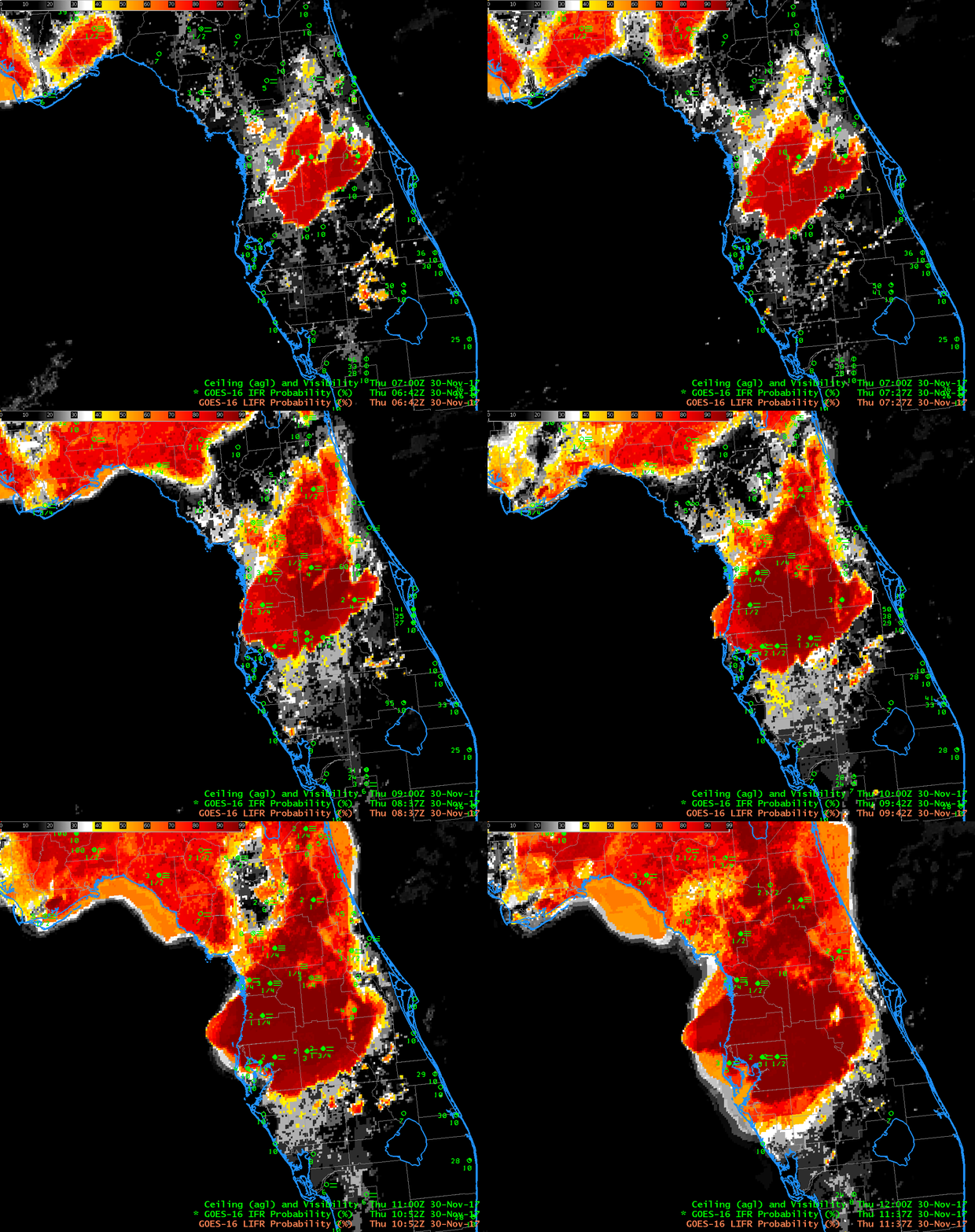
Dense Fog covered parts of Florida early on 30 November, and the animated GOES-16 IFR Probability field, above, shows the benefit of GOES-16’s routine 5-minute temporal cadence: the motion of the fog field is well-captured, and it’s straightforward to use the field to estimate the onset of IFR conditions. The Advanced Nigthtime Microphysics RGB for the same time period is shown below, and that product does not well indicate the widespread nature of the reduced ceilings and visibilities over northern Florida.
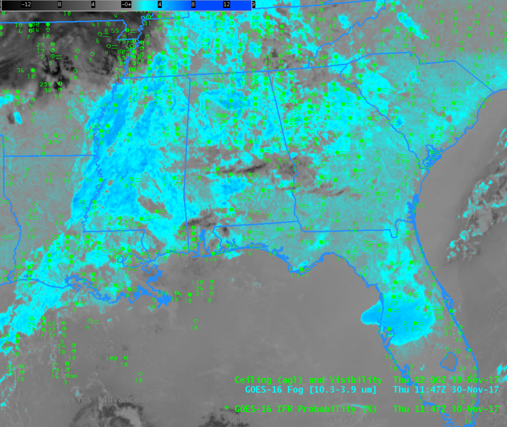
Dense Fog Advisories were widespread over the southeastern US on the morning of 30 November, as shown by the screen capture above, from 1148 UTC 30 November. The toggle below shows IFR Probabilities and the Advanced Microphysics RGB for 1147 UTC on 30 November. The 10.3 µm – 3.9 µm Brightness Temperature Difference (BTD) for the same time shown at the bottom. Evidence of multiple cloud decks is apparent in the image. Such mid- and high-level clouds result in an ambiguous signal as far as fog detection goes in both the BTD and in the RGB. IFR Probabilities give a consistent signal in those regions that relies on Rapid Refresh Model output suggesting low-level saturation is present.


