
GOES-16 IFR Probability fields, 0932-1157 UTC on 23 October 2017 (Click to animate)
GOES-16 data posted on this page are preliminary, non-operational and are undergoing testing.
Dense Fog developed over the upper Midwest on Monday morning, 23 October 2017, and Advisories were issued as shown below. GOES-R IFR Probabilities are now being created using GOES-16 data, those data are now available at this link. The uniformity of the IFR Probability fields shown above over WI suggest that high-level clouds are present, and the GOES-16 satellite could not therefore view the fog/stratus near the ground: only Rapid Refresh data were used to create GOES-R IFR Probability values.
GOES-R IFR Probability fields available to NWS Field Offices via LDM are still being computed with GOES-13 and GOES-15 data. When GOES-16 becomes operational as GOES-East at 75.2º W Longitude, planned for December, IFR Probabilities available through the LDM will be created with GOES-16 and GOES-15 data. The switchover will happen when GOES-16 becomes operational.
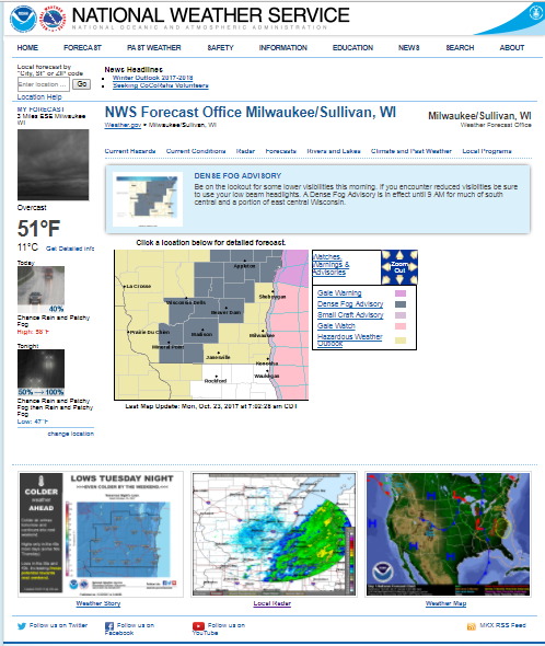
Screenshot of NWS webpage from Sullivan, WI at 1200 UTC on 23 October 2017. Dense Fog advisories are in place from SW Wisconsin to NE Wisconsin. Note also the Radar imagery showing departing showers. (Click to enlarge)