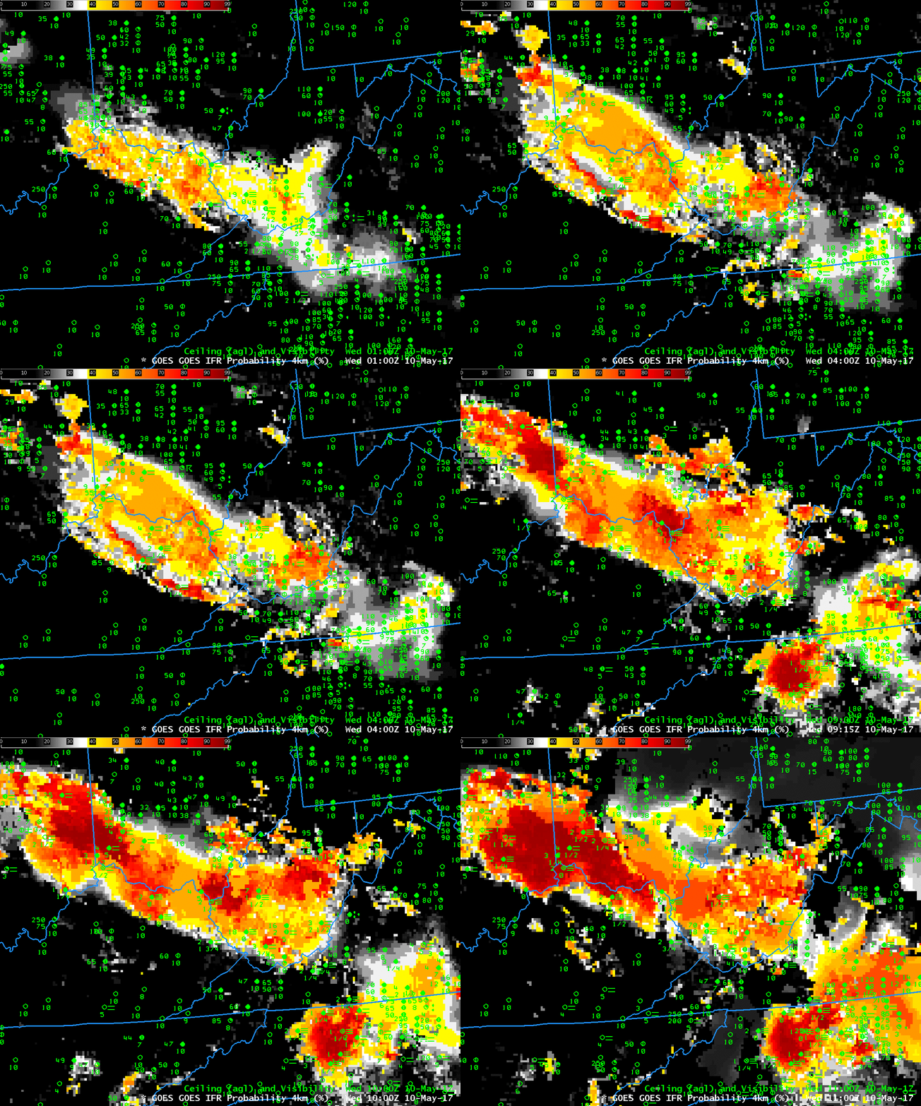
Note: GOES-R IFR Probabilities are computed using Legacy GOES (GOES-13 and GOES-15) and Rapid Refresh model information; GOES-16 data will be incorporated into the IFR Probability algorithm in late 2017.
The weather.gov website on Wednesday morning 10 May 2017 showed two dense fog advisories, one near Cincinnati, OH and one near Greensboro, NC. The aviation weather website showed an IFR Sigmet in between the two regions of dense fog. The fog formed along a stationary front that sat over the region.
How well did GOES-R IFR Probabilities and GOES-13 Brightness Temperature Difference fields capture this event? The animation of GOES-R IFR Probability, below, computed using data from GOES-13 and the Rapid Refresh Model, shows enhanced probabilities early in the evening that increased with time. The orientation of the field — from west-northwest to east-southeast — aligns well with the regions of developing fog.
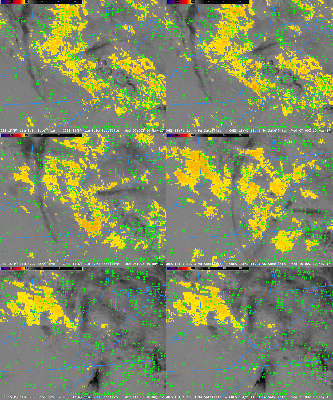
The brightness temperature difference field, below, did not perform as well in outlining the region of low ceilings/reduced visibilities because of the presence of high clouds that interfered with the ability to detect low clouds. Consequently, the highest brightness temperature differences (3.9 µm – 10.7 µm) do not align so well with the regions of developing fog. Note also that at the end of the animation — 1100 UTC — increasing amounts of reflected solar 3.9 µm radiation is changing the character of the field from negative to positive. In contrast, the IFR Probability fields (above) maintain a consistent signal through sunrise.


