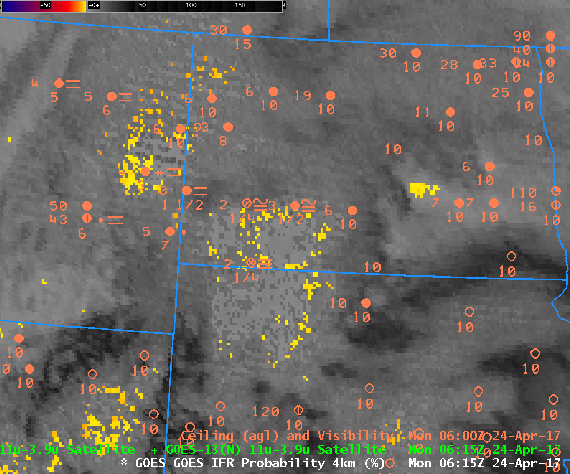
GOES-13 Brightness Temperature Difference and GOES-R IFR Probability at 0615 UTC on 24 April 2017, along with surface observations (Click to enlarge)
Note: GOES-R IFR Probabilities are computed using Legacy GOES (GOES-13 and GOES-15) and Rapid Refresh model information; GOES-16 data will be incorporated into the IFR Probability algorithm in late 2017.
A late-season snow storm was affecting North Dakota on Monday 24 April. Snow amounts were modest and IFR Conditions were widespread. The multiple clouds layers associated with the storm meant that satellite detection of low clouds/fog was difficult. The toggle above shows Brightness Temperature Difference (3.9 µm – 10.7 µm) and GOES-R IFR Probabilities. The IFR Probability field distinctly outlines the region where visibilities and ceilings are restricted by the storm. It is very difficult to discern from the Brightness Temperature Difference product where low clouds/fog exist. Because the IFR Probability field incorporates surface information (that is, low-level saturation as predicted by the Rapid Refresh Model), it is better able to alert a forecaster to the presence of IFR or near-IFR conditions.