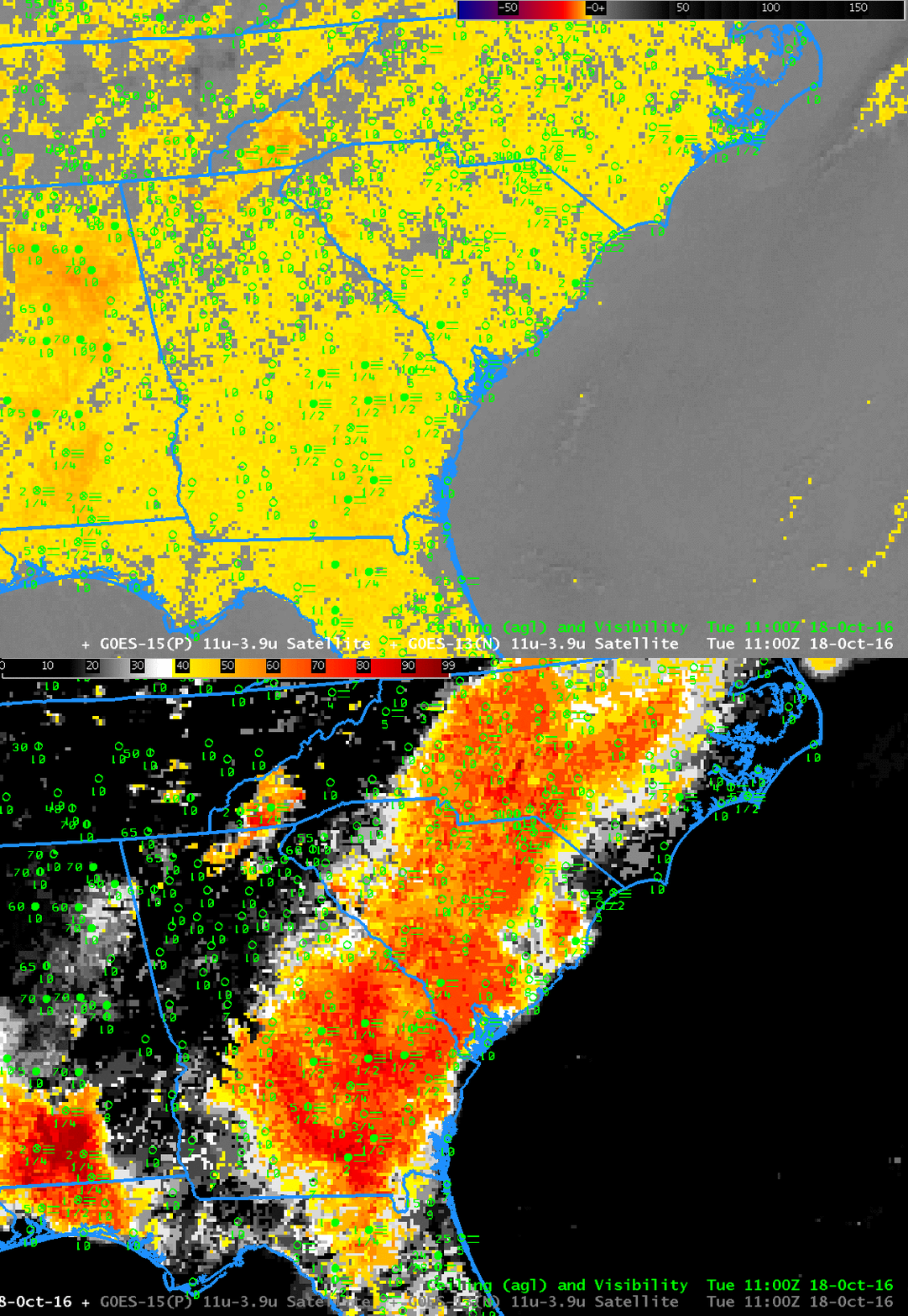
GOES-13 Brightness Temperature Difference (3.9 µm- 10.7 µm) and GOES-R IFR Probability fields computed with GOES-13 and Rapid Refresh Data, 1100 UTC 18 October. Plots of ceilings and surface visibilities are included (Click to enlarge)
GOES-R IFR Probability fields often to a better job (compared to brightness temperature difference fields) in outlining exactly where low ceilings and reduced visibilities are occurring because IFR Probability fields include information about low-level saturation from the Rapid Refresh model. That information about near-surface saturation allows the IFR Probability algorithms to screen out regions where only mid-level stratus is occurring. A low fog — a stratiform cloud of water droplets that sits on/near the surface — and a mid-level stratus deck (also a stratiform cloud of water droplets) can look very similar in a brightness temperature difference field. In the example above, consider much of northeastern Alabama and northern Georgia. There is a strong return in the brightness temperature difference field because mid-level stratus is present — but IFR Probabilities are small because the Rapid Refresh does not diagnose low-level saturation in the region. Compare Brightness Temperature Difference returns over northeast Alabama and over extreme western North Carolina — to the west of Asheville. IFR Conditions are observed over western North Carolina, and IFR Probabilities are high there. In general, the region with high IFR Probabilities in the toggle above includes stations that are reporting IFR or near-IFR conditions. Most stations outside the region of high IFR Probability are not showing IFR Conditions, even though they may be in a region with the Brightness Temperature Difference signal is large.
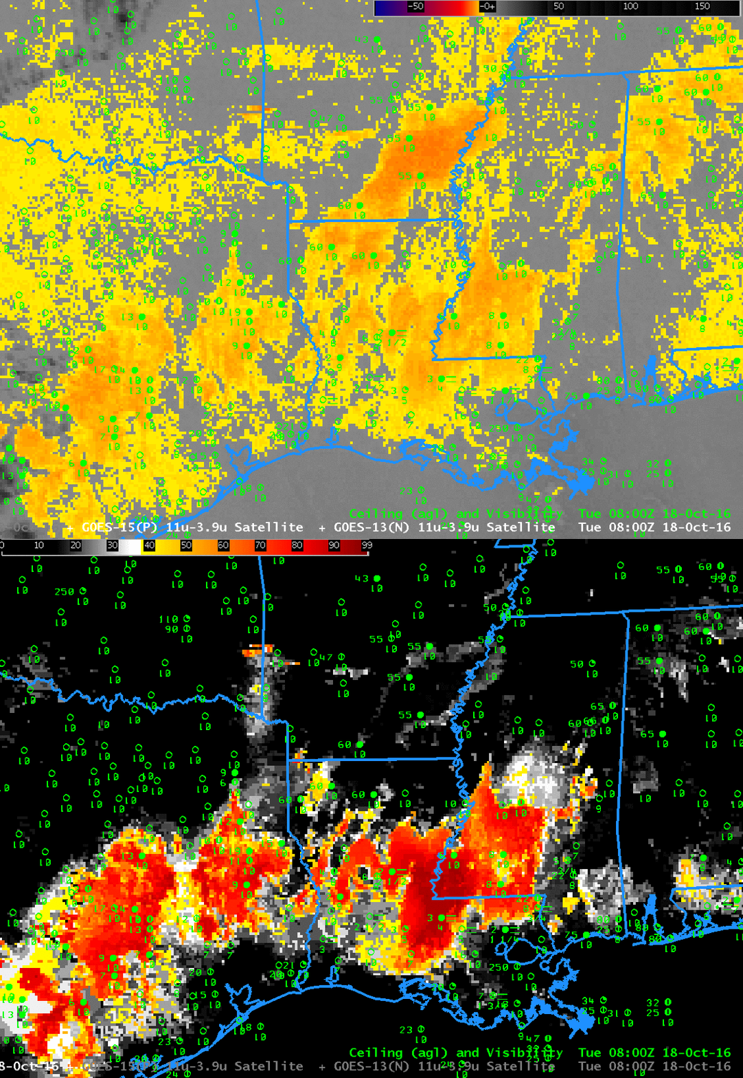
A similar story can be told farther west at 0800 UTC, shown below. Focus on the region with a strong Brightness Temperature Difference signal over southeast Arkansas. IFR Conditions are not occurring under that mid-level stratus deck, and IFR Probabilities are very low. Similarly, IFR Probabilities are small over Oklahoma and north-central Texas because the Rapid Refresh Model is not showing low-level saturation in those regions; IFR Probabilities cannot be large when low-level saturation is not indicated in the model.
Using both Satellite Data and Model Data accentuates the strengths of both. That’s the power of a fused data product.

