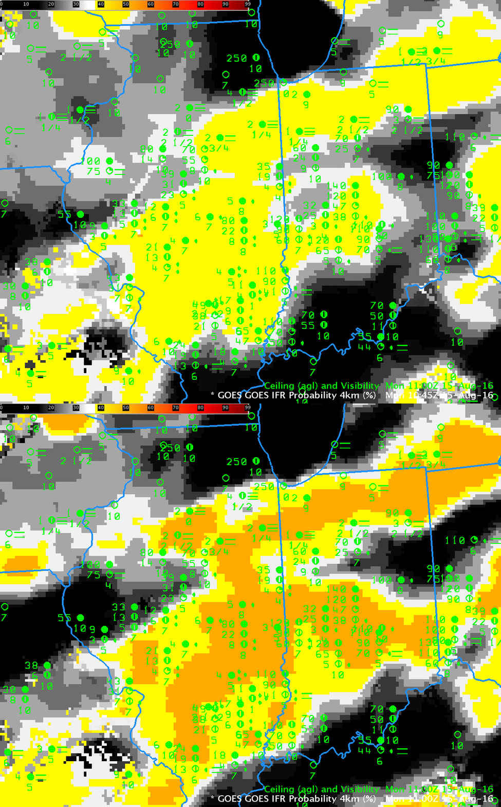
When GOES-R IFR Probability fields are governed solely by Rapid Refresh model output because of thick cloudiness (as was the case over Illinois on 15 August 2016), there can be changes in the field at the top of the hour that are related to changes in the Rapid Refresh model output — that is, changes in which hour Rapid Refresh Model is used. The toggle above shows the IFR Probability fields at 1045 UTC and 1100 UTC on 15 August. Both fields are characterized by smooth values that come with IFR Probability that is driven by Rapid Refresh model output, output that is smooth and not pixelated like satellite data. It’s pretty noticeable, however, that values increase (from ~39% to ~52%) in those 15 minutes. Why?
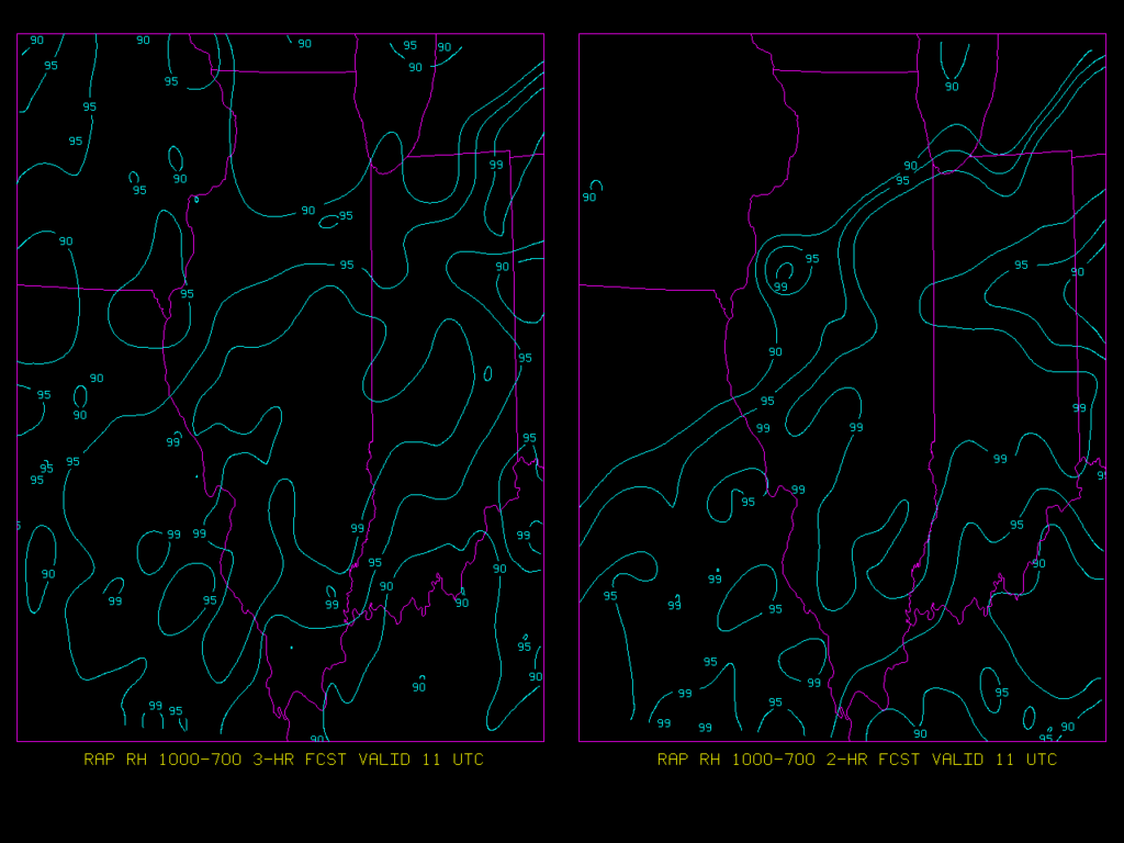
The image below shows Rapid Refresh Model Predictions of 1000-700 mb Relative Humidity at 1100 UTC from the 0800 UTC model run (that is, a 3-hour forecast, left) and from the 0900 UTC model run (that is, a 2-hour forecast, right). Relative Humidity Values from the 0800 UTC Run (interpolated to 1045) are used in the computation of IFR Probabilities at 1045 UTC; values from the 0900 UTC Run are used in the computation of IFR Probabilities at 1100 UTC. It’s not this relative humidity field (value from 1000-700 hPa) precisely that is used, but rather maximum values in the vertical. Certainly there are changes in the predicted low-level relative humidity field at 1100 UTC between the sequential model runs; it’s more likely that saturation is occurring in the later model run, and that greater likelihood of saturation is reflected in the change of IFR Probability from 1045 UTC (when 0800 UTC Rapid Refresh Model fields are used) to 1100 UTC (when 0900 UTC Rapid Refresh Model fields are used).


