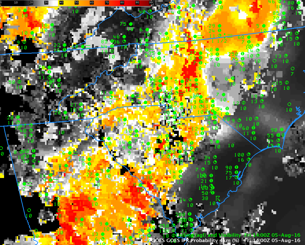
GOES-R IFR Probability, 1400 UTC on 5 August 2016, along with surface reports of ceilings and visibilities (Click to enlarge)
GOES-R IFR Probability describes regions where IFR Conditions are likely. For example, the IFR Probability field above, from 1400 UTC on 5 August 2016, shows high probabilities over part of the Piedmont from Virginia southwestward into Georgia. Observations confirm that IFR Conditions (and near-IFR conditions) exist in this region of higher probabilities.
The Aviation Weather Center maintains a website with products that dovetail nicely with IFR Probability fields. For example, the screenshot below shows stations reporting IFR Conditions (in red) and Low IFR Conditions (in magenta) ( a CWA-issued polygon on IFR conditions is included). The overall extent of the IFR Conditions in the image above and plotted below is also roughly similar. The G-AIRMET of IFR Conditions, bottom, also shows overlap with the IFR Probability field, as expected.
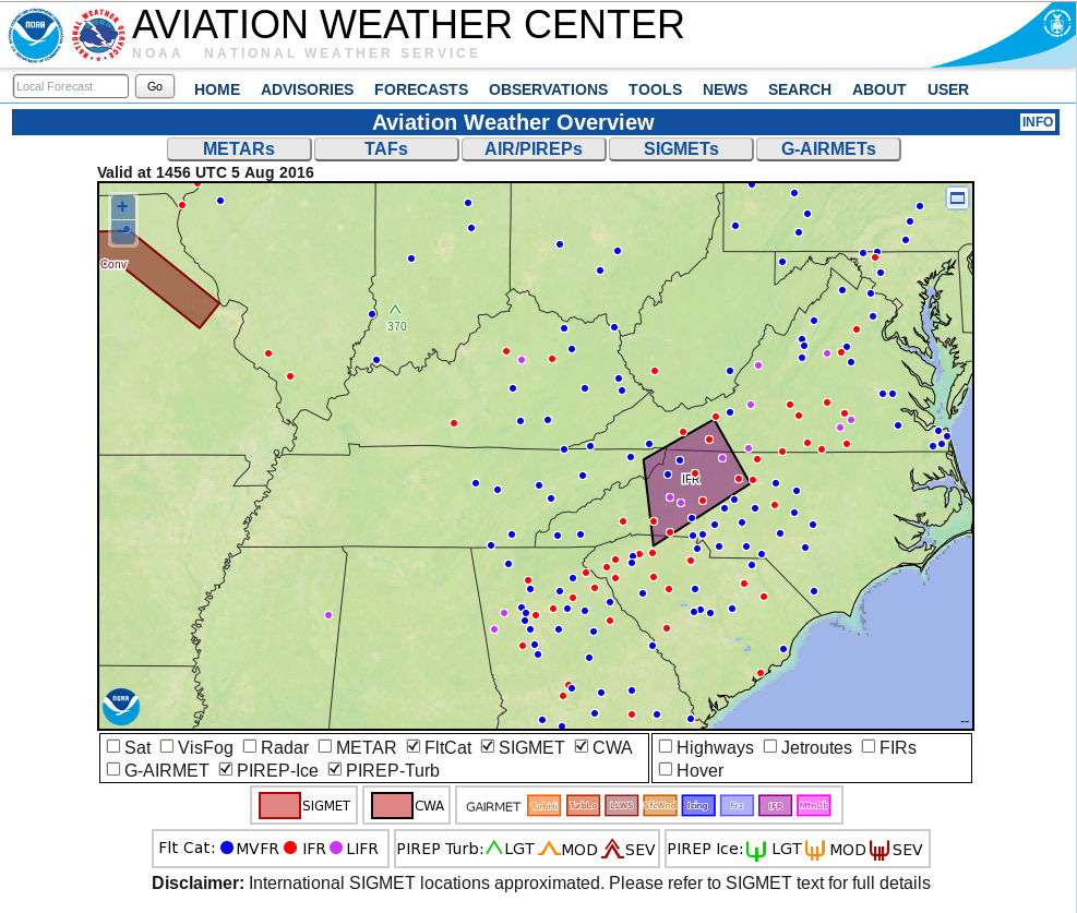
Aviation Weather Center screenshot from 1456 UTC showing region of IFR and Low IFR Probability over the southeastern and mid-atlantic states (Click to enlarge)
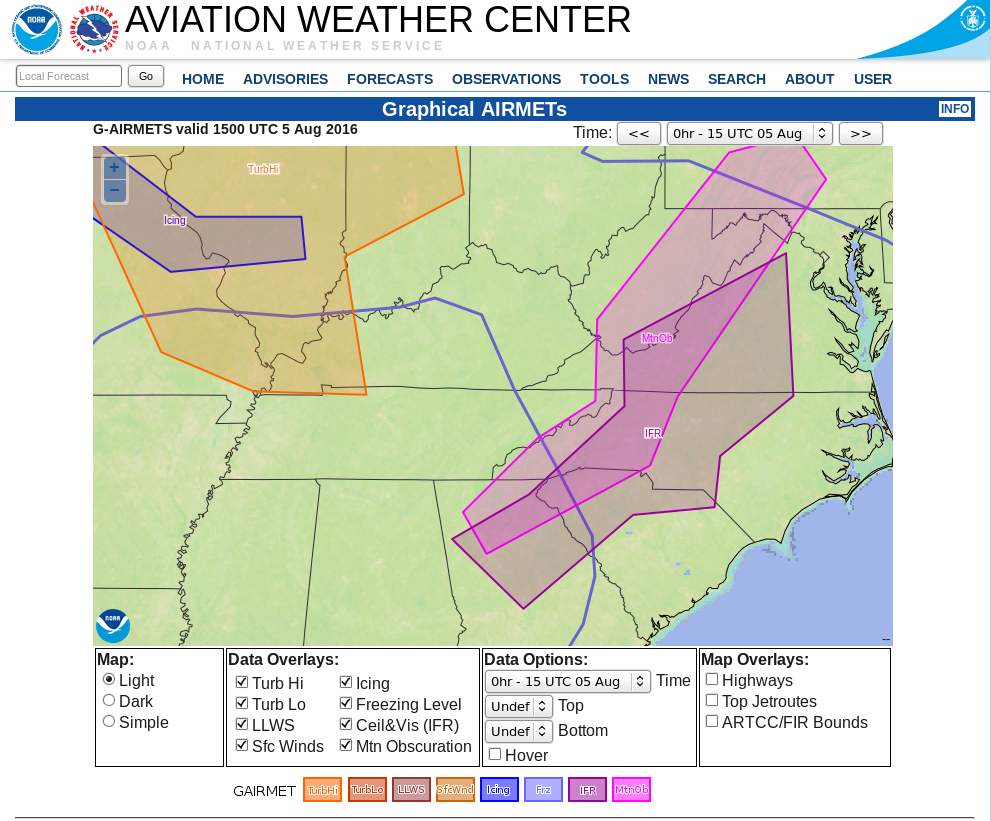
Graphical Depiction of IFR G-AIRMET and MTN OBS (Mountaintop Obscuration) G-AIRMET at 1500 UTC on 5 August 2016 (Click to enlarge)