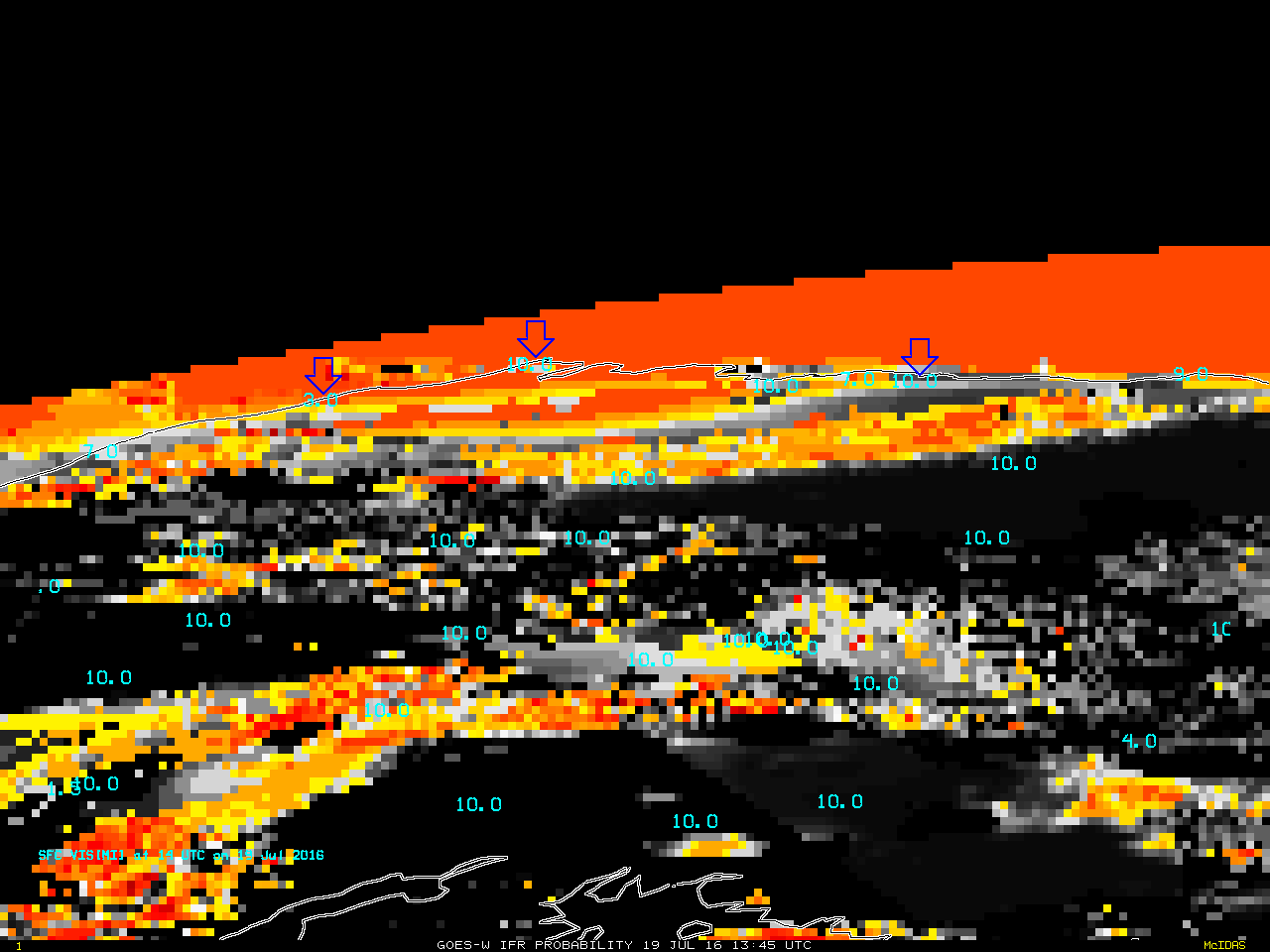
GOES-R IFR Probability, 1345 UTC on 19 July 2016, and 1400 UTC Observations of surface Visibility. Blue arrows point to, from left to right, Wainwright, Barrow, and Deadhorse Alaska (Click to enlarge)
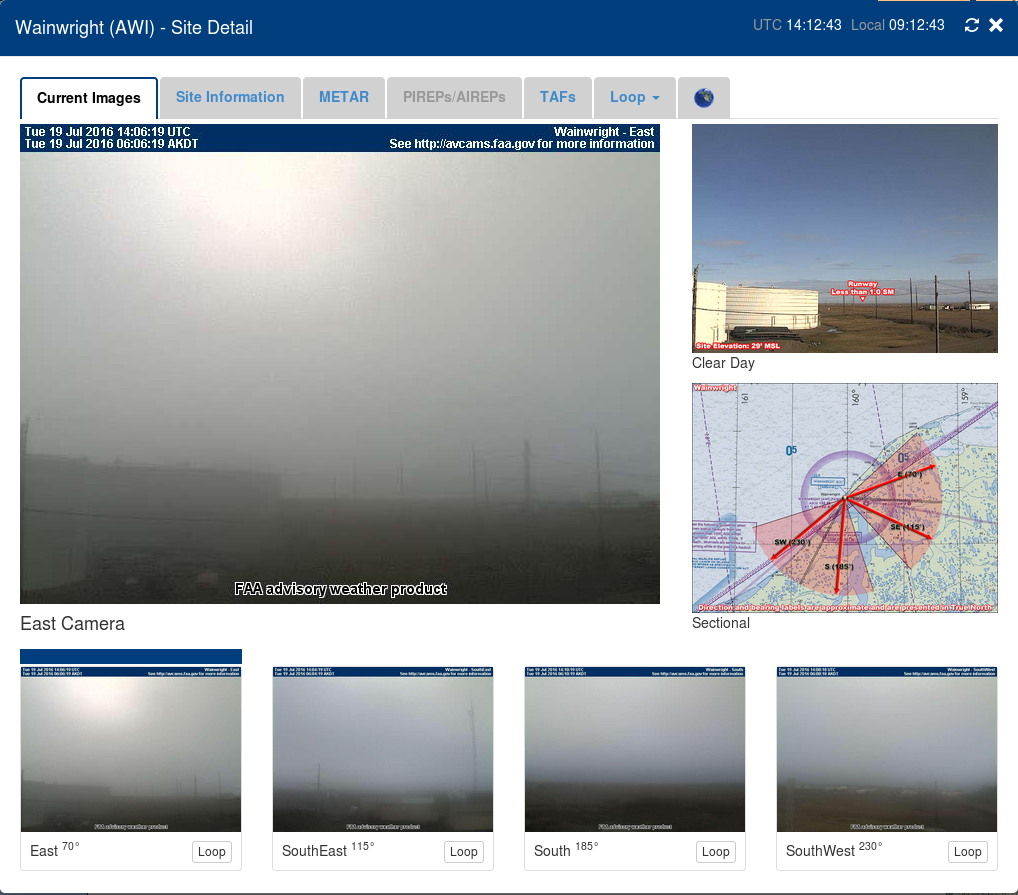
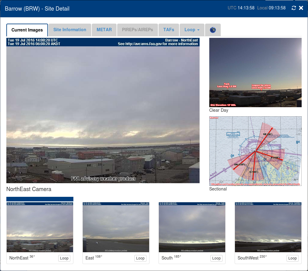
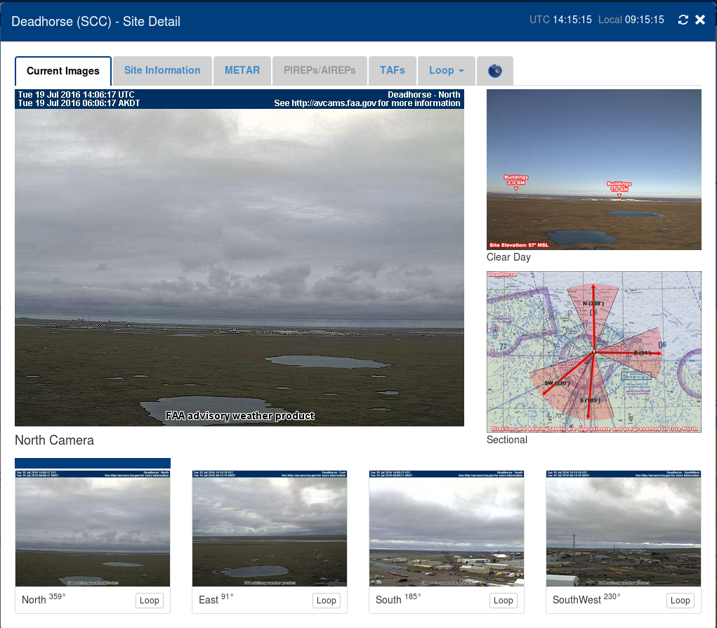
The FAA website that includes webcams over much of Alaska provides a great opportunity to match IFR Probability fields with surface observations. In the image above, Wainwright AK shows a 3-mile visibility, but Barrow and Deadhorse farther east report 10-mile visibilities. All three stations are very near high IFR Probabilities — the red/orange region has IFR Probabilities exceeding 90%. What to the webcams at the three stations show? Screen captures from the three webcams are below. Webcams from both Barrow and Deadhorse show non-IFR conditions. Wainwright shows a dense fog through which the sun is dimly visible. These webcam observations are in general agreement with the GOES-based IFR Probability fields: only Wainwright is in a region where IFR Probabilities are consistently high.
==============================================================================
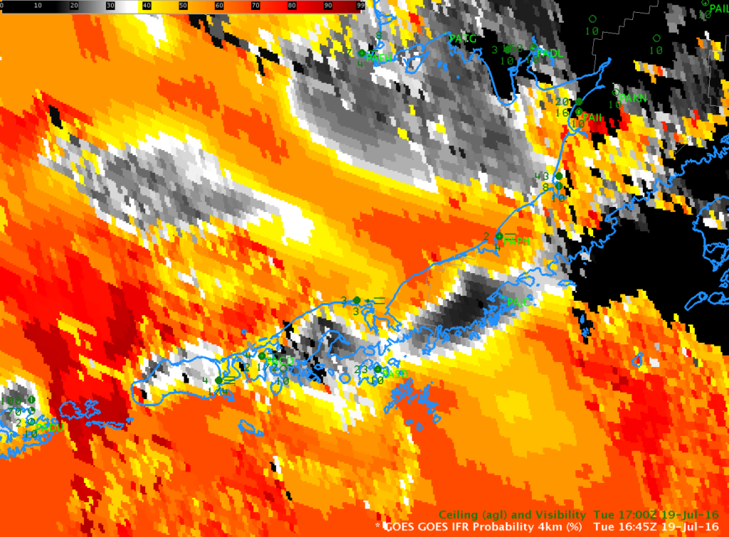
GOES-R IFR Probabilities, 1645 UTC on 19 July 2016, and 1700 UTC Observations of Ceilings/Visibilities (Click to enlarge)
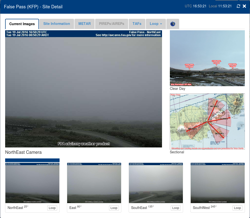
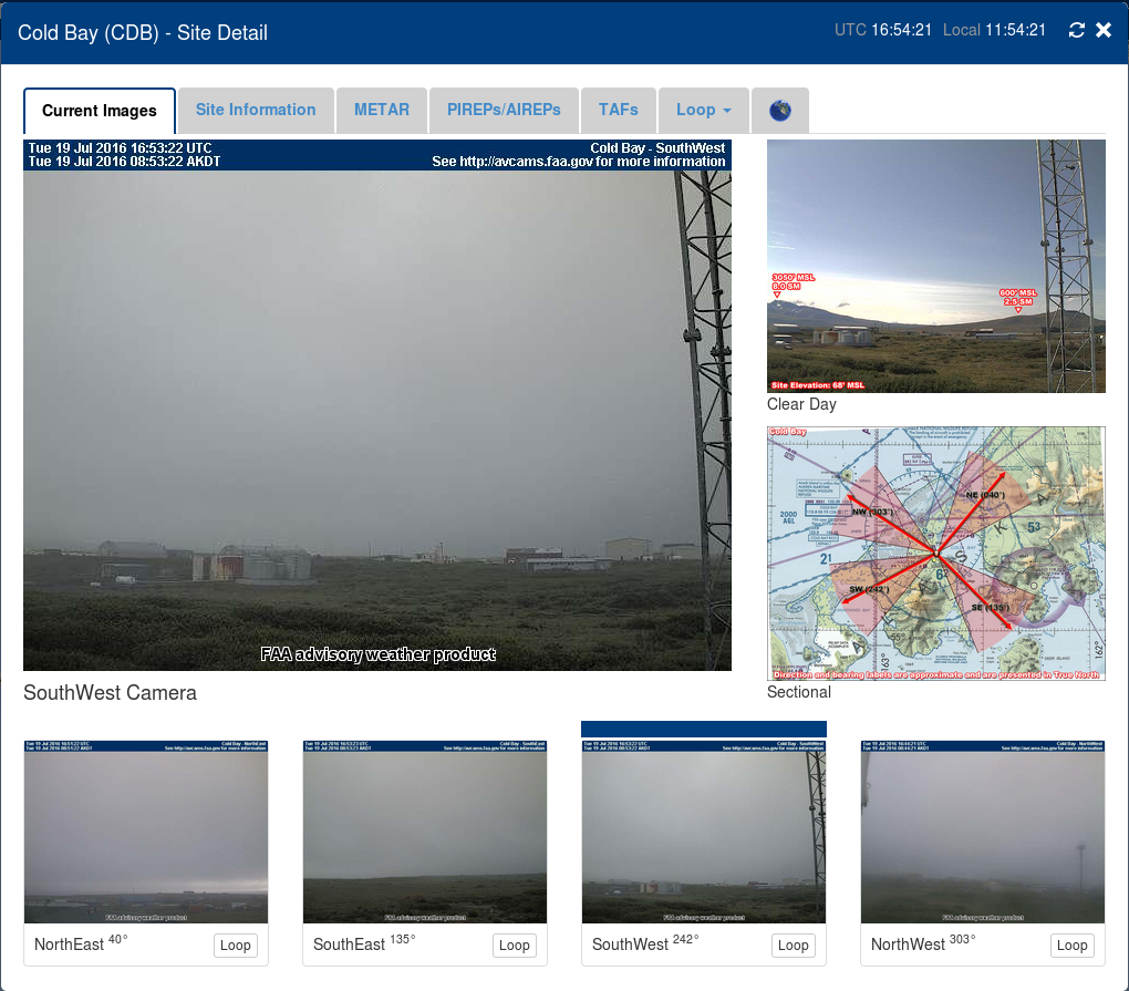
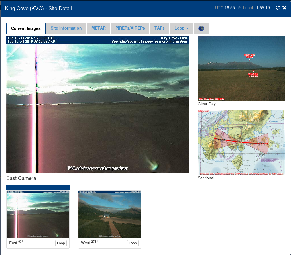
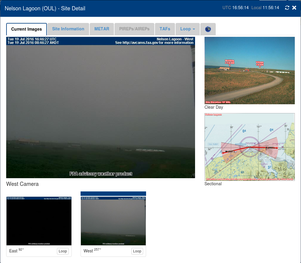
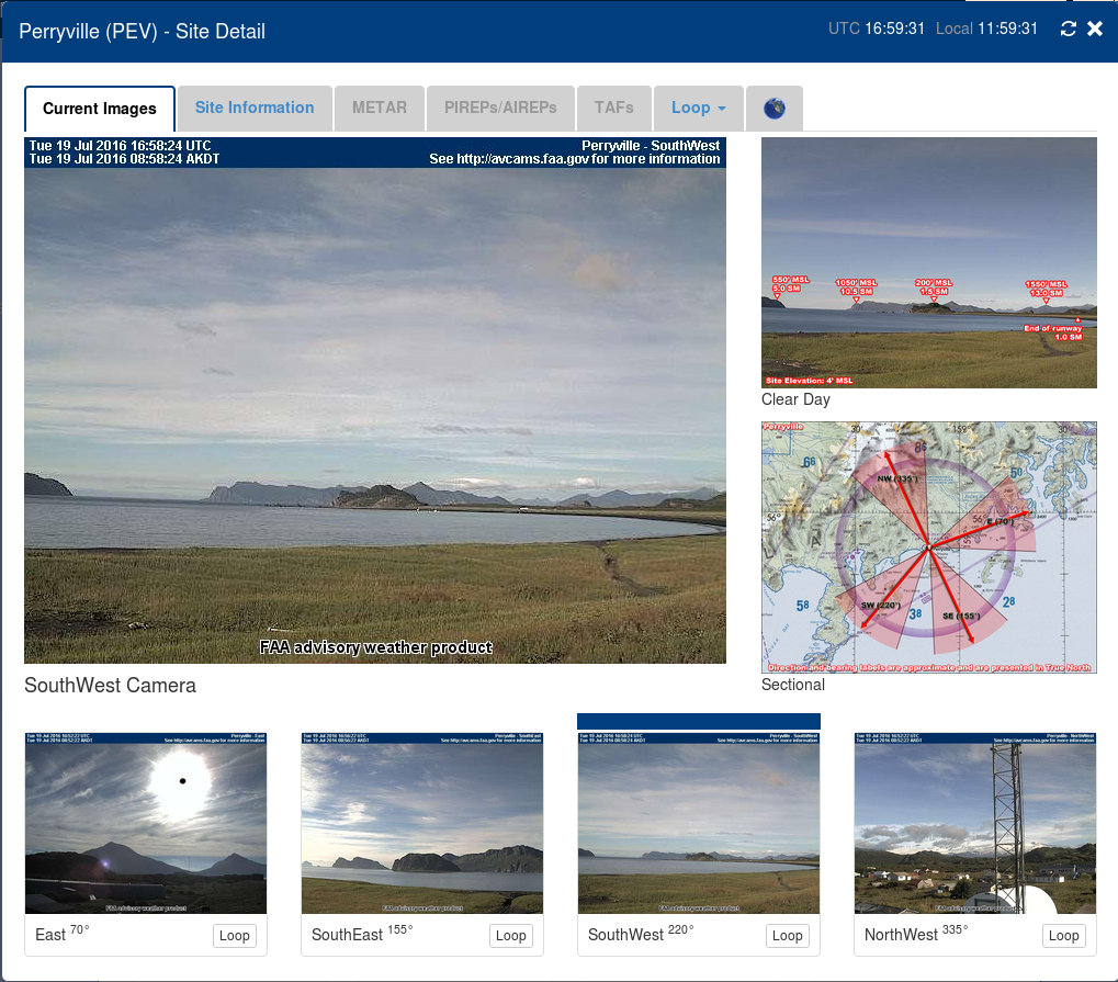
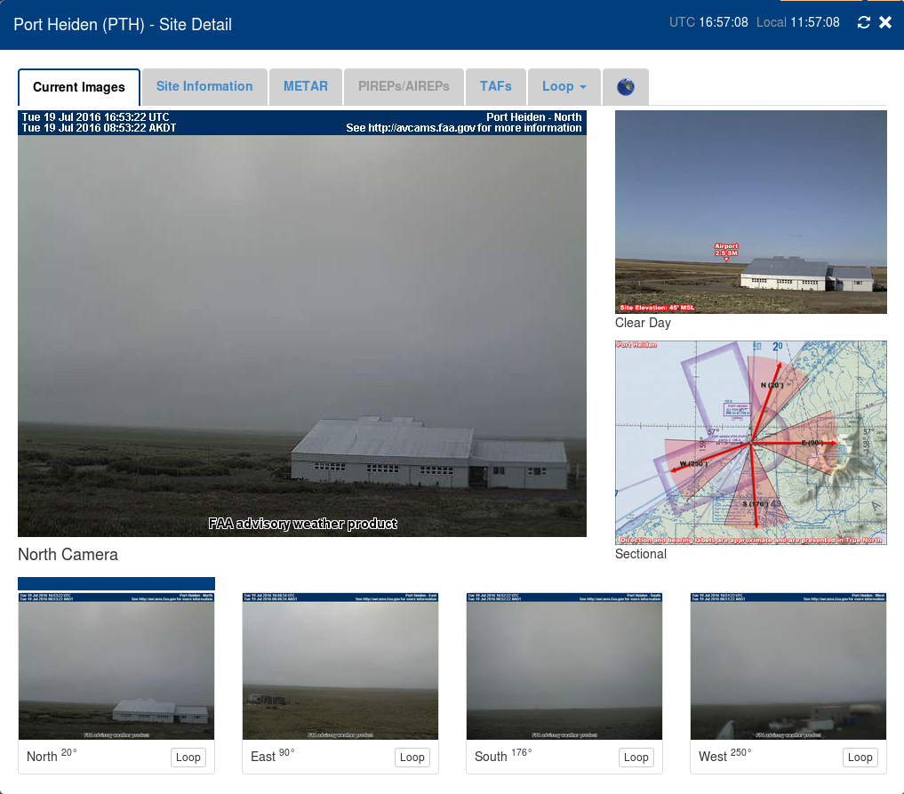
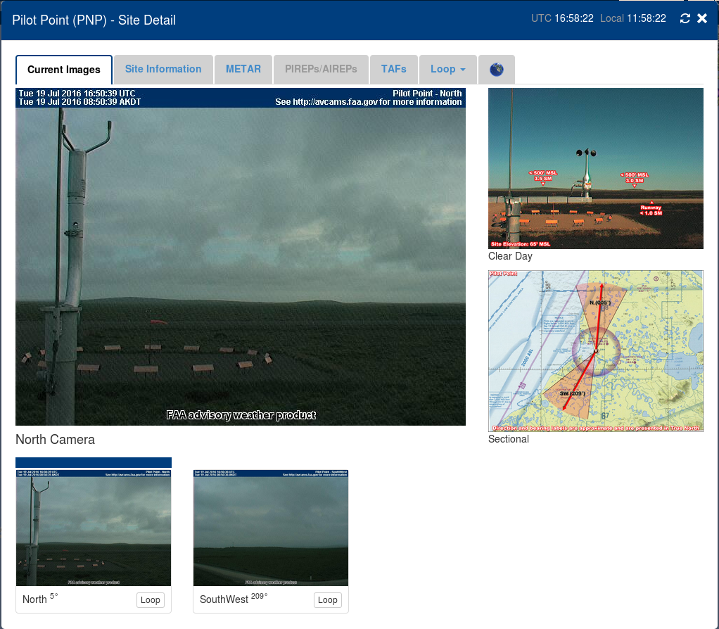
The image above is of GOES-R IFR Probabilities over the Aleutians, along with surface observations of ceilings and visibilities. In general, IFR Probabilities are a bit higher on the northern side of the Aleutians (False Pass, Cold Bay, Nelson Lagoon, Port Heiden, Pilot Point) than the southern side (Perryville, King Cove). That is confirmed with the screen captures of webcam imagery, seen below. The webcam scenes are aligned from west to east, starting at False Pass AK and ending at Pilot Point.

