Dense Fog Advisories were issued before sunrise on 5 July 2016 by the National Weather Service Offices in St Louis Missouri and Lincoln Illinois (link). This post compares GOES-R IFR Probability fields with Brightness Temperature Difference Fields for that event. At 0500 UTC, the Brightness Temperature Difference Field had a very strong signal over central/northern Illinois. This region of mid-level stratus was de-emphasized by the GOES-R IFR Probability fields because of a lack of low-level saturation in the Rapid Refresh Model Fields. At 0500 UTC, IFR Probability Fields show an increase in values over the lower Ohio River Valley.
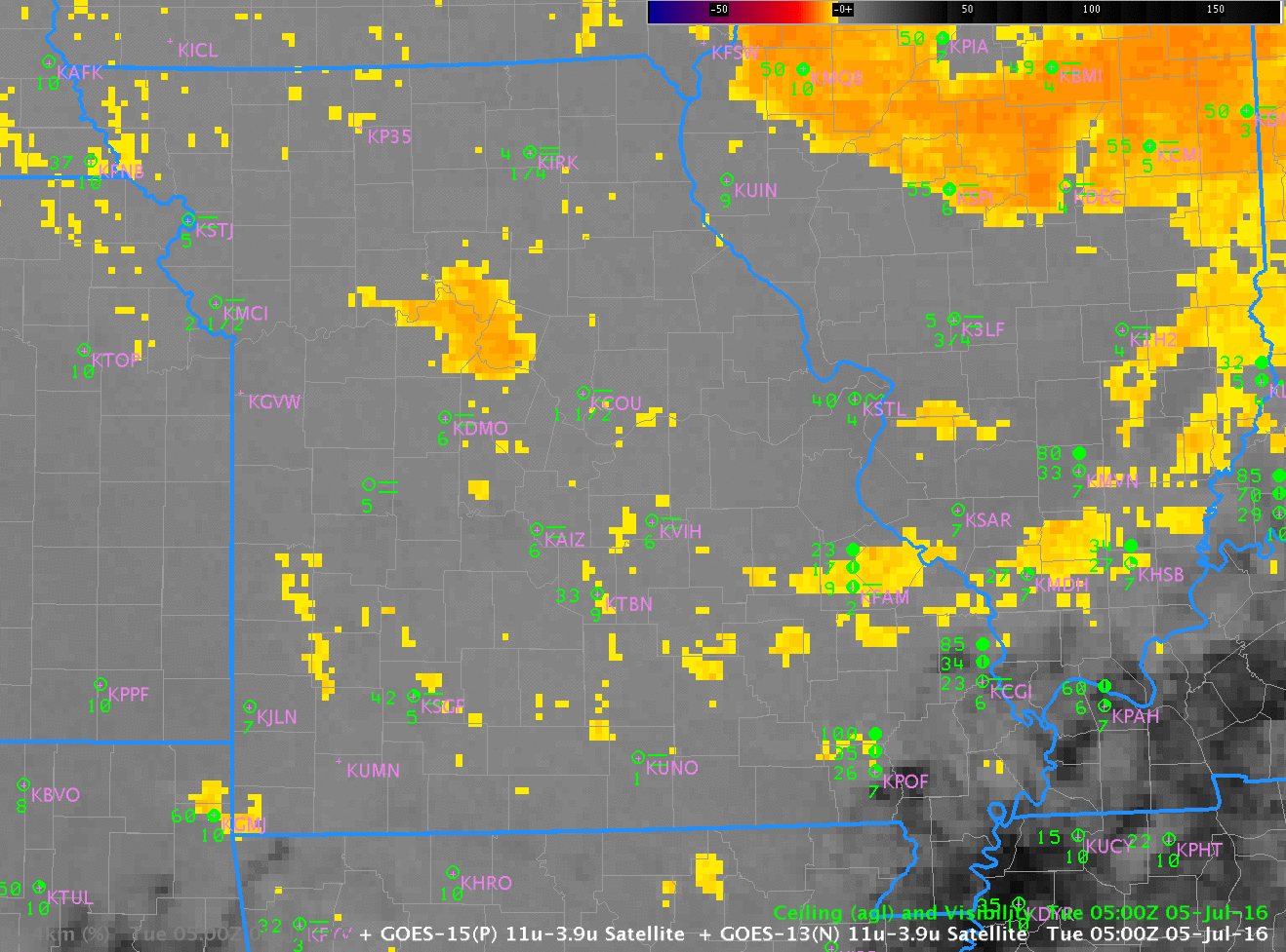
GOES-13 Brightness Temperature Difference Field (3.9 µm – 10.7 µm) and GOES-R IFR Probability Fields, 0500 UTC on 5 July 2016 (Click to enlarge)
At 0700 UTC, below, an axis of higher probabilities has developed northwest to southeast across central Missouri; in addition, IFR Probabilities are increasing slowly over central Illinois to the south of the mid-level stratus that persists over east-central parts of Illinois. IFR Conditions are present at stations over central Illinois (Springfield — KSPI — and Litchfield — K3LF, for example)
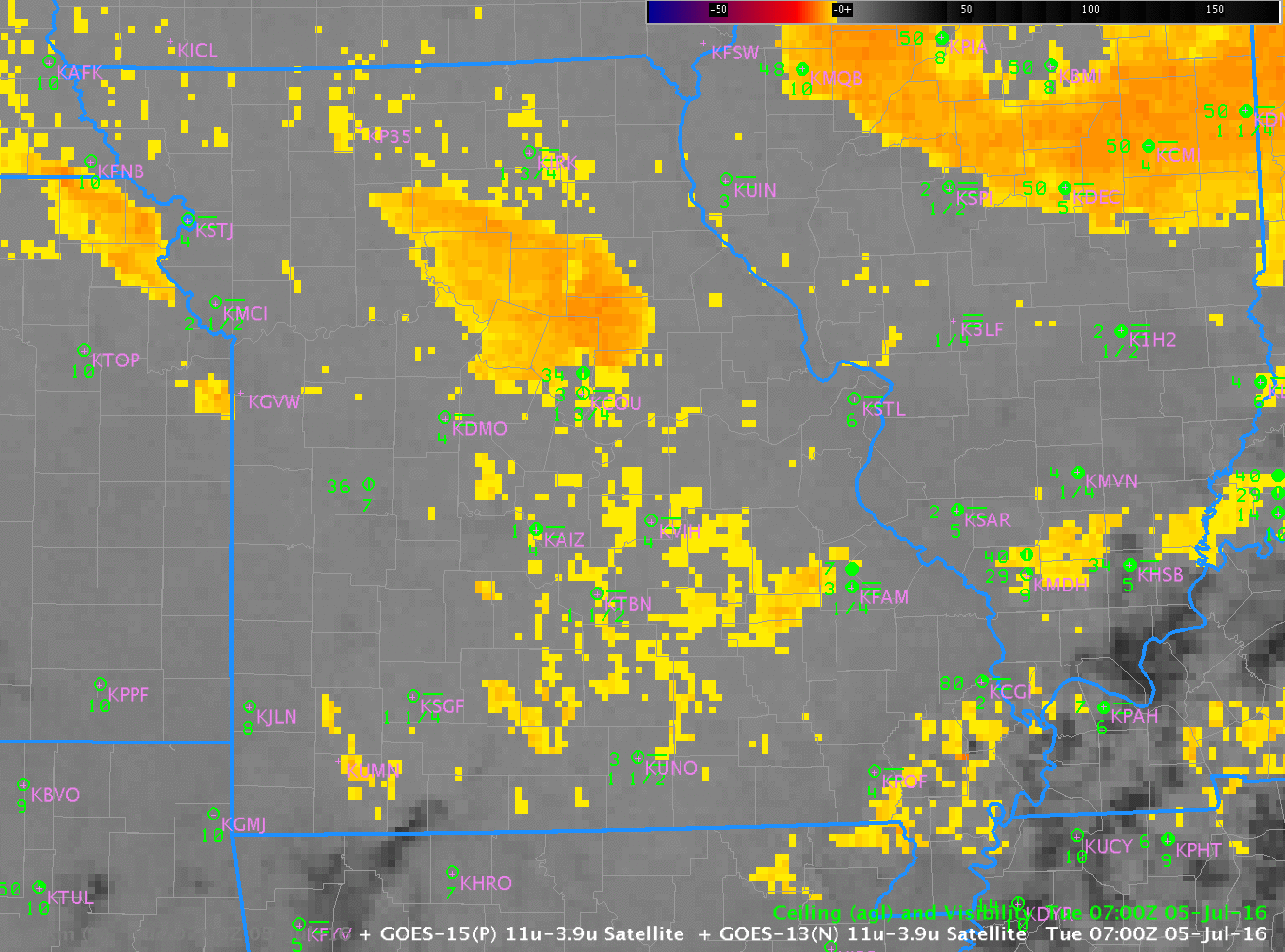
GOES-13 Brightness Temperature Difference Field (3.9 µm – 10.7 µm) and GOES-R IFR Probability Fields, 0700 UTC on 5 July 2016 (Click to enlarge)
By 1000 UTC, below, when Dense Fog Advisories have been issued, a strong brightness temperature difference signal is present over much of northern Missouri, but mid-level clouds over southeast Missouri prevent a strong signal from occurring there where fog is occurring. IFR Probability Fields’ use of Rapid Refresh information mitigates this lack of satellite observations. IFR Probability fields at 1000 UTC show a signal over much of southern Illinois where IFR Conditions are widespread.
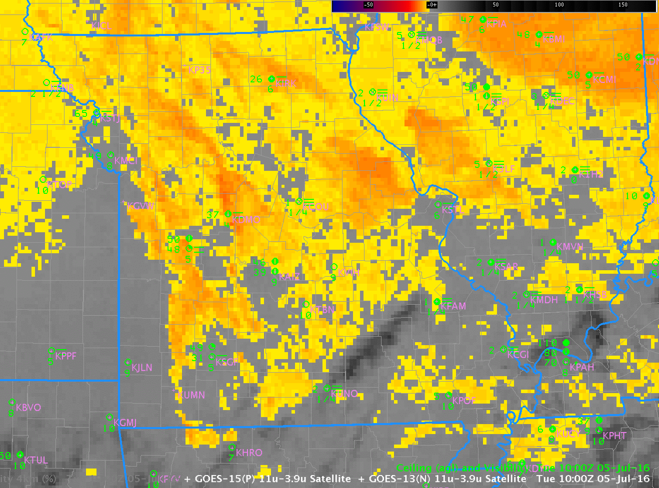
GOES-13 Brightness Temperature Difference Field (3.9 µm – 10.7 µm) and GOES-R IFR Probability Fields, 1000 UTC on 5 July 2016 (Click to enlarge)
Use IFR Probability fields as a tool to become situationally aware to the development of lowered ceilings and reduced visibilities. There are many times when Brightness Temperature Difference fields cannot tell the entire story — when multiple cloud layers exist, for example, or when mid-level stratus is present. A slow increase in GOES-R IFR Probability will often suggest lowering ceilings/reduced visibilities before Brightness Temperature Difference fields do.